mail_outline sales@mediastorehouse.com
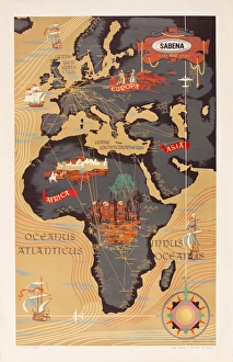
Advertisement for Sabena airlines, with a map of Europe, Africa and the Middle East. circa 1960
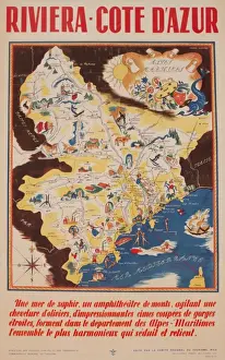
Advertisement for the French Riviera, Cote d Azur. circa 1946
Andrew Besley, photographer, Dartmoor, DevonAndrew Besley, photographer, with his camera at Cranmere Pool, Dartmoor, Devon. Date: circa 1960s
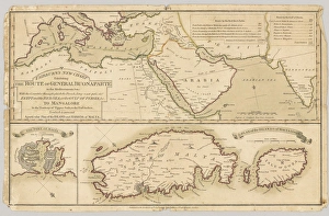
Three printed coloured maps: Fairburns New Chart Exhibiting the Route of General Buonaparte in the Mediterranean Sea; with the Countries through which the French Army must pass
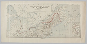
The Lake Frontier of Canada and the United States. From a collection of maps relevant to campaigns between 1794-1815. From the collection of the former Buffs Regimental Museum
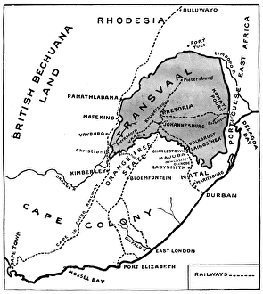
Theatre of war in South Africa - Boer War mapMap of the war in South Africa in 1899. Date: 1899
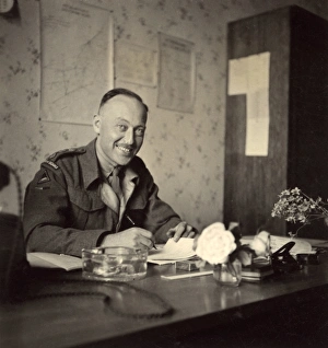
Soldier in an office, British Army of the Rhine, GermanySoldier in an office with charts and maps on the wall behind him, British Army of the Rhine, near Braunschweig (Brunswick), Lower Saxony, in postwar Germany. Date: circa 1946
Soldier in an office, British Army of the RhineSoldier in an office with charts and maps on the wall behind him, British Army of the Rhine, near Braunschweig (Brunswick), Lower Saxony, in postwar Germany. Date: circa 1946
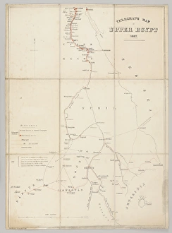
Telegraph map of Upper Egypt 1882, compiled by the Intelligence Branch, War Office; scale 1:4 000 000; one of five maps, probably belonging to Capt George Frederick Wilson, Royal Engineers
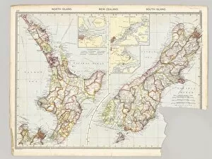
Two maps of Taranaki, New Zealand showing Middlesex Regiment operations during the Maori War, 1860-1872. From the collection of the former Middlesex Regiment Museum. Date: 1860
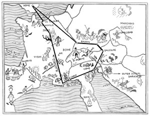
Social map of the ContinentA social map of the continent showing all the fashionable resorts during the 1930s including Biarritz, Monte Carlo, Cannes, Venice, Baden, Le Touquet, Deauville and St Mortiz. Date: 1934
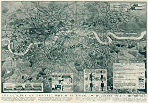
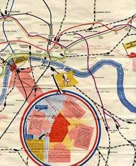
Proposed extensions of transport links into London 1919Diagram showing a map of London and the movement of commuters by different travel means from Greater to Central London, and the proposed extensions of transport links
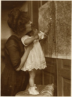
Mother and daughter with map, Bonjour Papa! WW1Mother and daughter examine a map to see where daddy is on the Western Front -- Bonjour Papa! 1917
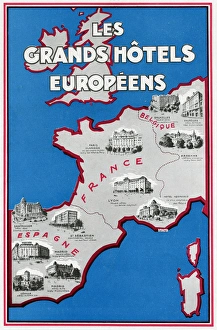
Advertisement for European hotels 1929Advertisement for European hotels in the UK, Spain, France and Belgium. 1929
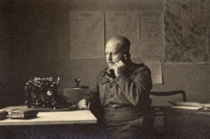
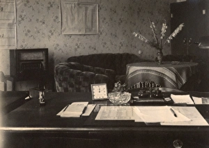
Officers desk, BAOR, Braunschweig, GermanyOfficers desk in an office with charts and maps on the wall, British Army of the Rhine, near Braunschweig (Brunswick), Lower Saxony, in postwar Germany. Date: circa 1946
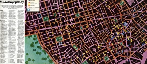
Map to the nightlife of London, 1965A handdrawn pullout map of Soho, Leicester Square and the West End as far as Hyde Park, showing theatres, cinemas and restaurants in Central London
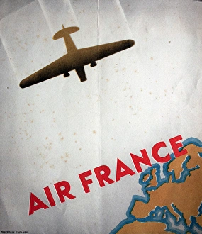
Poster, Air France. 20th century
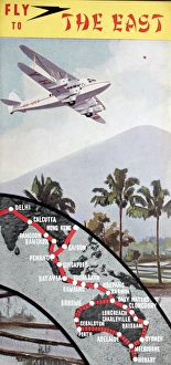
Cover design, Fly to the East, showing destinations in India, Thailand, Vietnam, China, Singapore, Australia and Tasmania. 20th century
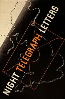
Poster, Night Telegraph Letters. 20th century
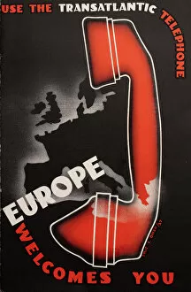
Poster, Use the Transatlantic Telephone, Europe Welcomes You, designed by Eric C Owen. 1937
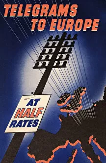
Poster, Telegrams to Europe at Half Rates. 20th century
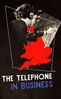
Poster, The Telephone in Business, showing a female telephone operator and a map of England. 20th century
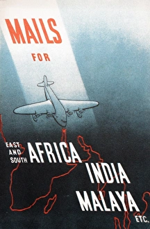
Poster, Mails for East and South Africa, India, Malaya etc. 20th century
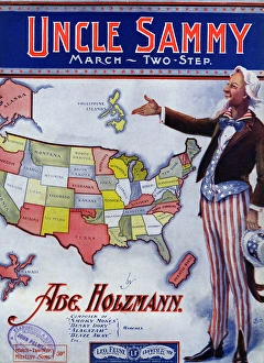
Music cover, Uncle Sammy March, Two Step, by Abe Holzmann. 1904
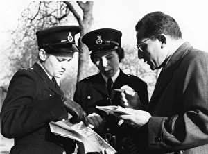
Two women police officers giving directions, LondonTwo women police officers giving directions to a man, with the aid of a map, London. Date: circa 1960s
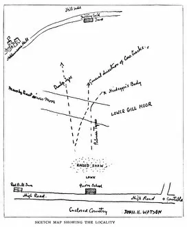
Adventure of the Priory School, Sherlock HolmesThe Return of Sherlock Holmes, the Adventure of the Priory School, a Sherlock Holmes story by Arthur Conan Doyle. Sketch map showing the locality. Date: 1904
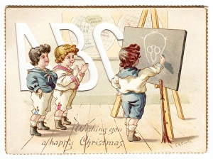
Three boys in schoolroom on a Christmas cardThree boys in sailor suits in a schoolroom on a Christmas card -- one of them is drawing their teachers face on the blackboard. Date: circa 1890s
Festival of Britain map 1951A map showing the location of the Festival of Britain. Date: 1951
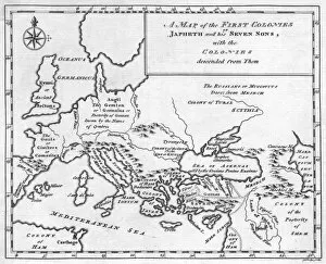
Map / Europe / Noah 1778Map showing the colonies containing descendants of Noah Date: 1778
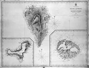
Map of Palma, Gomera and Hierro, Canary IslandsMap of Palma, Gomera and Hierro (or Ferro), Canary Islands, with soundings in fathoms. Date: 1837
Map of Naos and Arrecife, Lanzarote, Canary IslandsMap of the ports of Naos and Arrecife, Lanzarote, Canary Islands, surveyed by the Spanish Navy in 1853, with outer soundings from a survey of 1835, updated in 1880. Date: 1881
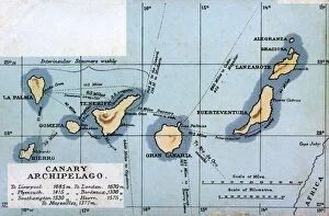
Map of the Canary Archipelago, showing the seven islands, Hierro, La Palma, Gomera, Tenerife, Gran Canaria, Fuerteventura, Lanzarote, as well as the two smaller islands, Graciosa and Alegranza
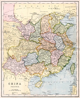
Map / Asia / China C1880China Proper showing the individual provinces, and underlining names of ports open to foreign trade Date: circa 1880
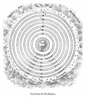
Ptolemaeus system Date: 2nd century AD
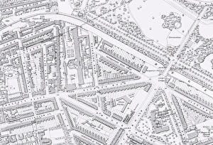
Picture No. 11792554Bethnal Green workhouse map
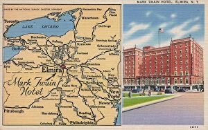
Mark Twain Hotel and map, Elmira, New York State, USA. Date: 1930s
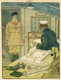
Cartoon, An easy target, WW1Cartoon, An easy target. A German sailor tells his Commandant that a merchant ship has stopped near them. The Commandant replies that in that case hes not likely to miss it. Date: 1916
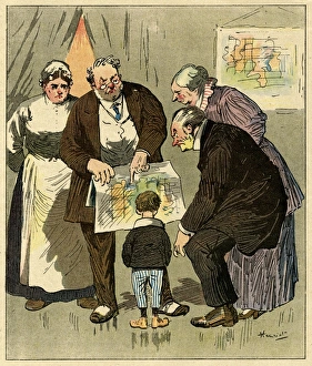
Cartoon, The interrupted conference, WW1Cartoon, The interrupted conference. A group of people look at a map, and a man says what Napoleon would have done. However, the conference has to be suspended
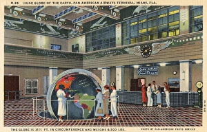
Large globe, PanAm terminal, Miami, Florida, USAPeople looking at a large globe on display in the lobby of the Pan-American Airways terminal in Miami, Florida, USA. Date: 1936
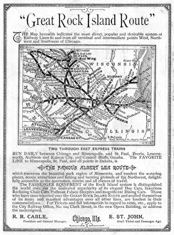
Advertisement, Great Rock Island Route, Chicago, USAAdvertisement for the Great Rock Island Route, Chicago, USA, with a map of railway routes in the Chicago area. Date: 1885
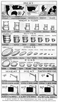
Why Englands Food is Safe, WW1Why Englands Food is Safe, showing how the majority of food supplies come from countries who are not on the side of the enemy during the First World War. Date: 1914
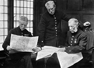
Chelsea pensioners discuss the war, WW1Chelsea veterans discussing the position of the opposing armies in August 1914. Date: 1914
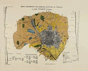
VILANOVA i PIERA, Joan (1821-1893). Agronomic map of Madrid municipal area. SPAIN. MADRID (AUTONOMOUS COMMUNITY). Madrid. Instituto Geol o y Minero de Espa
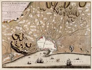
French map of the city of Barcelona (1706). SPAIN. CATALONIA. Barcelona. Barcelona City History Museum
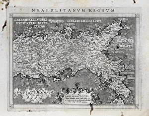
Map of the Kingdom of Naples. 1597-1568. Illustration from the work Geografia, cio鬠 Descrittione universale de la terra, edited in Venice by Giovanni Battista and Giorgio Galignani. SPAIN
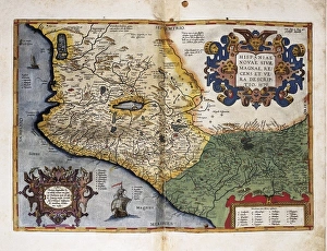
Theatrum Orbis Terrarum. New Spain (Mexico)ORTELIUS, Abraham (1527-1598). Theatrum Orbis Terrarum. 1570. It is considered to be the first modern atlas. Map of New Spain (Mexico), 1579. Printed in Antwerp by Christophe Plantin (1588). Etching
Portrait of Magalhaes. Spanish anonymousMAGELLAND, Ferdinand (1480-1521). Portuguese navigator and discoverer. Oil on canvas
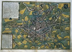
Civitatis Orbis Terrarum. GhentBRAUN, George (1541-1622). Civitatis Orbis Terrarum (Theatrum orbis terrarum). 1572-1617. Ghent (1572). Etching. SPAIN. CASTILE AND LEON. Salamanca. Salamanca University Library