mail_outline sales@mediastorehouse.com
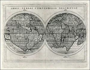
World Map 1587Mercators projection, with parallel latitudinals, mentioning recent navigations such as Magellan
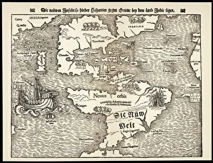
Maps / Americas 1540Map showing the discoveries by explorers during the first half-century after Columbus : note the confusion of India, Japan (Zipangri) and China (Cathay), & the Hesperides
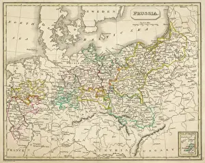
Map / Europe / Germany 1827Map of Germany (Prussia) showing the various nation states
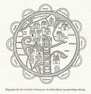
14th century World Map according to the Grandes Chroniques de Saint-Denis
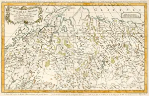
MAP / RUSSIA / SIBERIA C1760Siberia and adjacent regions : St Petersburg and Moscow are on the far left, Irkutsk centre low right Date: circa 1760
Schoolboys and teacher on a Christmas cardMisbehaving schoolboys surprised by their teacher on a Christmas card. Date: circa 1890s
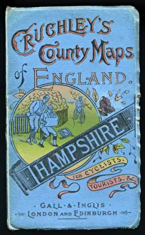
Cover design, county map of Hampshire for cyclists and tourists, in a series entitled Cruchleys County Maps of England, published by Gall & Inglis of London and Edinburgh. Date: early 20th century
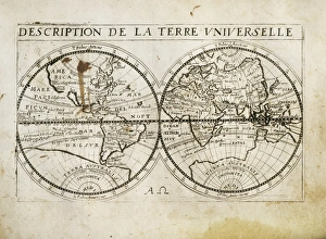
Description de la Terre Universelle (1667). Map. Engraving
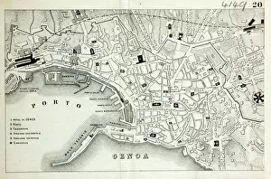
Map of GenoaMap of the city of Genoa, Italy Date: 19th century
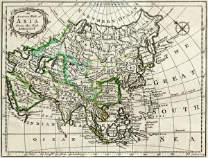
MAP / ASIA 1763Map of Asia Date: 1763
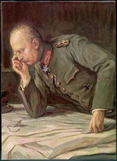
Ludendorff and MapsGENERAL EFW VON LUDENDORFF Der Feldherr Ludendorff studies plans of the battlefield
Whittaker Star Map 24Including Orion and Lepus
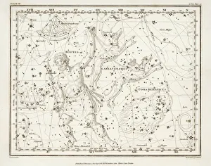
Whittaker Star Maps 7Including Bootes
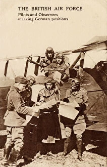
WW1 - Royal Air Force - Pilots and Observers mark targetsWW1 - Royal Air Force - Pilots and Observers mark enemy german targets and positions. Date: circa 1918
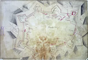
Map of OlivenzaOlivenza, fortress and defence works, Spain c. 1801 Date: c. 1801
Regents ParkPlan of the Regents Park Estate, London 1820 Date: 1820
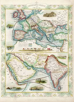
World Map / Overland IndiaThe overland routes from England to India, compared with sea routes
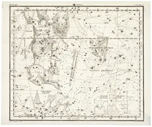
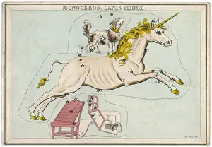
Canis Minor Star MapThe constellation of the Unicorn and Canis Minor
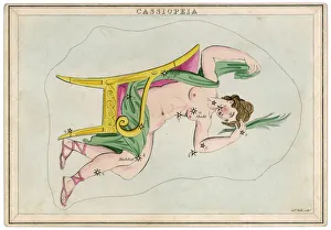
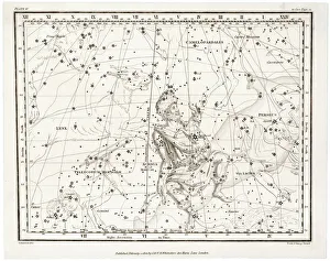
Cassiopeia Star MapThe constellation of Cassiopeia, wife of Cepheus, king of Ethiopia, and mother of Andromeda
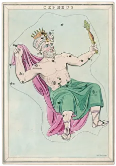
Cepheus Star MapThe northern constellation of Cepheus, king of Ethiopia, husband of Cassiopeia and father of Andromeda
Map / N America / CanadaThe east coast of North America from New York to Newfoundland, showing habitats of Eskimaux, native American peoples, and the French colonies of Acadie, etc
Map / Asia / Jerusalem 14CMap of Jerusalem during Ibn Batutas travels
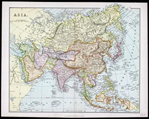
MAP / ASIA C1877Map of Asia
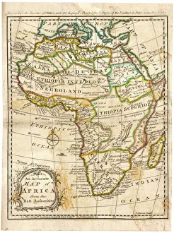
MAP / AFRICA 1763Map of Africa
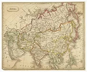
MAP / ASIA 1827Map of Asia
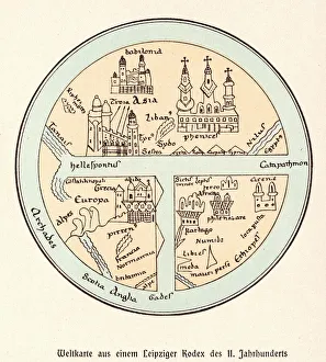
World Map / Leipzig CodexA German map of the world, showing various cities, rivers and seas
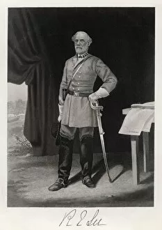
Robert E Lee / T NastROBERT EDWARD LEE American Confederate general
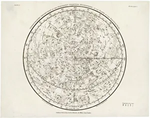
Whittaker Star Map 28The Southern Hemisphere, with its Zodiac signs
Whittaker Star Maps 4Including Auriga
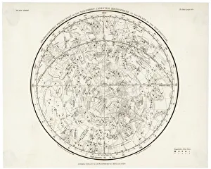
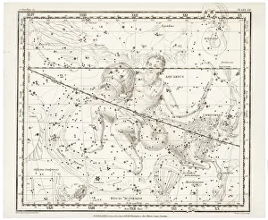
Whittaker / Star Map 1The Northern hemisphere, including the signs of the Zodiac
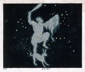
BLUNT / ORION / 52 / 1849The constellation of Orion, one of the most brilliant in the heavens
MAPS / WORLD / 1827World map
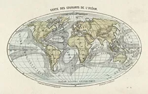
Maps / World / CurrentsWorld map of the ocean currents
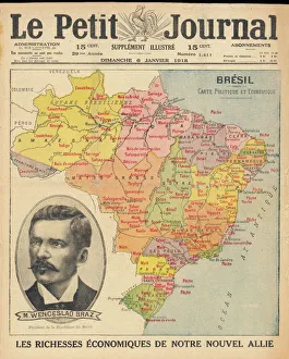
Brazil & Bras PortraitA map of Brazil with a portrait of its then president Venceslau Bras. Brazil had declared war on Germany in 1917 during World War One
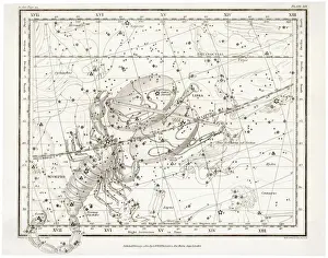
Whittaker / Scorpio / LibraIncluding the signs of Scorpio and Libra
Whittaker / Aquarius / CapriIncluding the signs of Aquarius and Capricorn
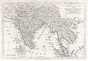
Map / Asia / East IndiesIndia and its neighbours : note that Burma is named India beyond the Ganges
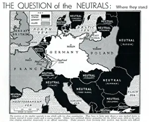
Map of Europe showing WW2 alliances, September 1939A map of Europe, colour-coded to represent the different alliances between nations shortly after the outbreak of war, September 1939
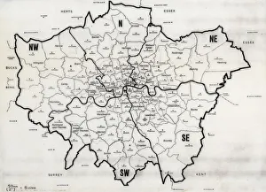
Map of the Greater London area with council areas marked. Date: mid-20th century
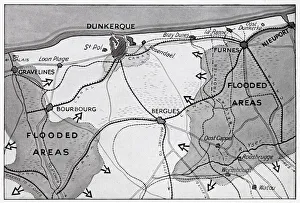
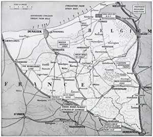
Map of Dunkirk area during the evacuation, WW2Map of the Dunkirk area in northern France during the evacuation, showing two flooded areas of low-lying meadow land which assisted in the Allied retreat. Date: 1940
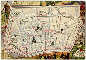
Map of the Butte Montmartre, Paris, FranceMap of the Butte Montmartre, 18th arrondissement, Paris, France. Date: circa 1900s
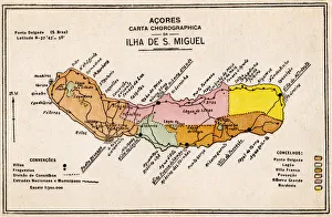
Map of Sao Miguel Island, Azores, Atlantic Ocean. Date: circa 1920
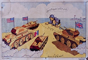
Cartoon with British and American tanks, WW2Cartoon, political map of Libya with British and American tanks during the Second World War. circa 1942
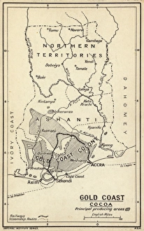
Map, Gold Coast Colony, Ghana, West Africa, with the main cocoa producing areas shaded, a railway line and steamship routes. Also a gold mining area. Date: circa 1920
Map of France and Belgium, evacuation from Dunkirk, WW2Map of the northern French and Belgian coast, showing the evacuation from Dunkirk and other points, and the evacuation triangle through which the Allied army retreated
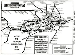
Map of London Underground railway, for HarrodsMap of the London Underground railway, How to Reach Harrods by Tube. Date: circa 1909
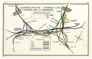
Railway map, Clapham Junction area, LondonRailway map, Clapham Junction, Stewarts Lane, Lavender Hill and Longhedge, SW London, with colour coding of the various railway companies. Date: 1912
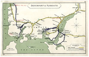
Railway map, Devonport & Plymouth, showing the Great Western and London & South Western railways. Date: 1909