mail_outline sales@mediastorehouse.com
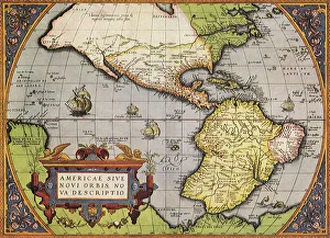
Early Map of Americas 1570 Date: 1570
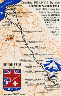
Hotels on the route of the London-Geneva Pass RoadRecommended Hotels on the route of the London-Geneva Pass Road - selected for quietness, good food and reasonable prices. This particulr card was from the Grand Hotel Ripotot at Champagnole
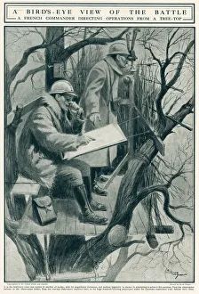
French Commander directing operations from tree top 1917Birds-eye view of the battle behind the lines, showing two French Commanders with periscope and map, directing operations and sending their strategy back to the front lines. Date: 1917
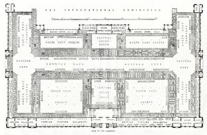
Plans International Exhibition 1862Plans of galleries at The International of 1862, or Great London Exposition, held at South Kensington, London. Date: 1862
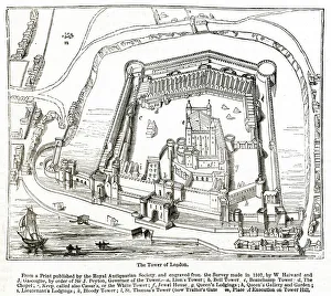
Tower of London and surrounding area 1597From a print published by the Royal Antiquarian Society and engraved from the survey made in 1597. Date: 1597
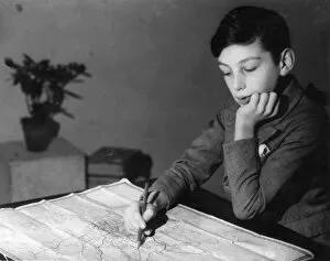
READING A ROAD MAPTo the adventurous schoolboy there is high romance in following the line of a road, even on paper and the mature motorist delights in following the route correctly. Date: 1940s
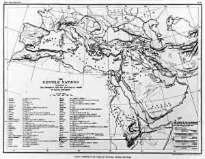
MAP / GENTILE NATIONSA map of the Gentile Nations, as mentioned in the Prophets and historical books of the Old Testament. Date: BC
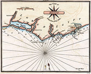
MAP / AFRICA / EGYPT / COASTMap of Egypt: the coastline near Alexandria, at the time of the Battle of the Nile (1 August 1798) Date: 1798
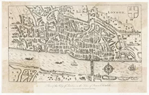
MAP / LONDON / CITY LATE 16CMap of the City of London in the time of Queen Elizabeth Date: late 16th century
MAP / USA / BOSTON 1775-6Map of Boston and its environs Date: 1775-6
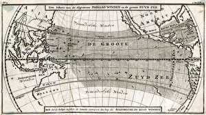
MAP / PACIFIC OCEAN 1700Map of the South Pacific or Great South Sea Date: 1700
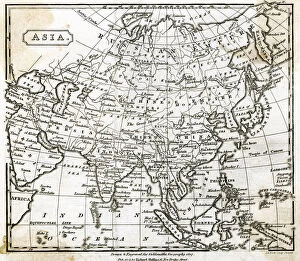
MAP / ASIA 1797Map of Asia Date: 1797
MAP / ASIA 1807Map of Asia Date: 1807
MAP / ASIA 1812Map of Asia Date: 1812
MAP / ASIA MINOR 1553Map of Asia Minor Date: 1553
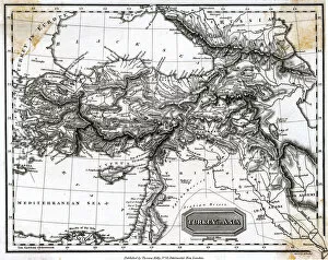
MAP / TURKEY 1817Map of Turkey Date: 1817
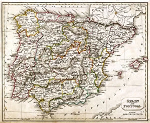
MAP / SPAIN / PORTUGAL 1827Map of Spain and Portugal Date: 1827
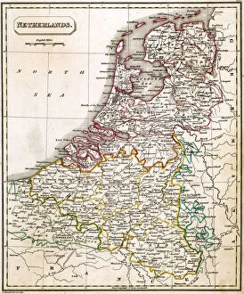
MAP / NETHERLANDS 1827Map of the Netherlands Date: 1827
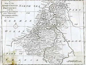
MAP / NETHERLANDS 1788Map of the Seven United Provinces, with the Dutch, Austrian and French Netherlands Date: 1788
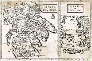
MAP / EUROPE / GREECE / HOMERMap of Ancient Greece, Phrygia and Crete at the time of Homer Date: BC
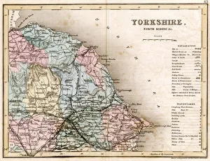
MAP / YORKSHIRE / NORTH 1857Map of Yorkshire: North Riding, showing the east coast Date: circa 1857
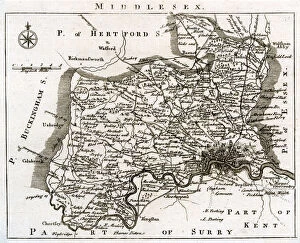
MAP / MIDDLESEX MID-18CMap of Middlesex Date: mid-18th century
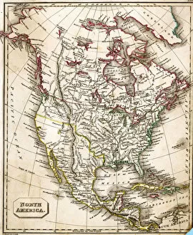
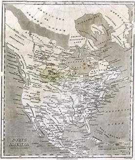
MAP / NORTH AMERICA 1827Map of North America Date: 1827
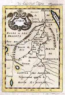
MAP / AFRICA / SAHARA 1719Map of the Sahara Desert with Nubia, part of Egypt and part of Abyssinia Date: 1719
MAP / BERKSHIRE 18CMap of Berkshire Date: 18th century
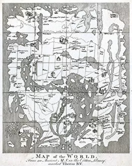
WORLD MAP / STRUTT 10CAn ancient world map: note the buildings in some of the important cities Date: 10th century
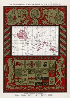
WORLD MAP / BRIT EMPIREWorld map, showing the British Empire Date: 1902
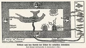
WORLD MAP / MOSAIC 6A world map with Greek and Latin inscriptions, showing various rivers and seas, and the four winds blowing Date: 6th century
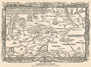
MAP / EUROPE / RUSSIA 1549A map of Russia, concentrating on the areas surrounding Moscow. Date: 1549
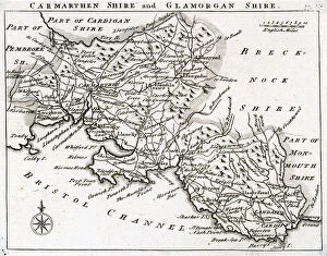
MAP / BRITAIN / WALES 18CMap of Carmarthen and Glamorgan Shires Date: mid 18th century
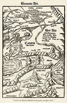
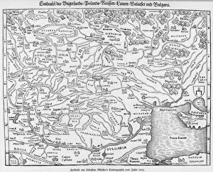
MAP / EASTERN EUROPE 1550A detailed map of Eastern Europe, showing the major regions, cities, rivers and lakes. The map stretches from Constantinople in the East to Strasbourg in the West. Date: 1550
MAP / AFRICA / MADAGASCARMost of the interior of the island is described as unexplored Date: mid 19th century
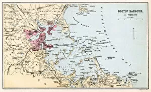
MAP / USA / BOSTON HARBOURBOSTON HARBOUR AND VICINITY Date: circa 1860
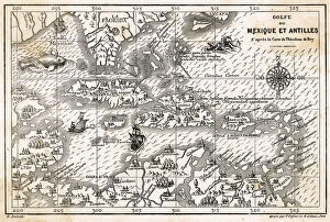
MAPS / AMERICAS / W. INDIESAn illustrated map of the West Indies and the islands of the Antilles. Date: 1590s
NORTHERN NAVIGATIONThe Navigation of the Northern Seas showing Spitzbergen and the coasts of Scandinavia and Russia Date: circa 1700
London Map - Roman PeriodMap showing Roman London (Londinium) with its grid of straight roads
MAP / NORTH AMERICA C1800A fascinating map of North America, from the Russian settlements in the NW via the territory of the Long-Hair Indians to New Albion and Tecas (sic) Date: circa 1800
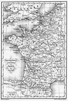
MAP / EUROPE / FRANCE 12CMap of France showing English possessions between 1165 and 1453. Date: 12th-15th century
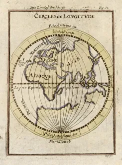
PARALLELS OF LONGITUDEParallels of longitude, relative to the Equator Date: circa 1690
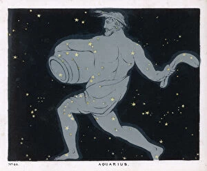
BLUNT / AQUARIUS / PLATE 48The constellation of Aquarius, a figure of a man carrying a jar of water. Date: 1849
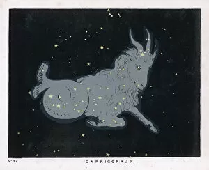
BLUNT / CAPRICORN / 47 / 1849The constellation of Capricorn, this version has the head, shoulders and fore- legs of a goat and the hind body and tail of a fish. Date: 1849
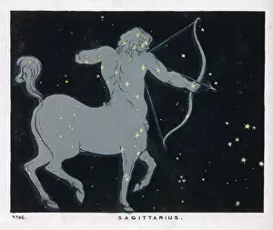
BLUNT / SAGITTARIUS / PL 46The constellation of Sagittarius, half man and half horse with a bow and arrow. Date: 1849
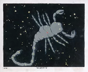
BLUNT / SCORPIO / 45 / 1849The constellation of Scorpio, the scorpion. Date: 1849
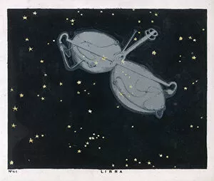
BLUNT / LIBRA / 44 / 1849The constellation of Libra, the scales. Date: 1849
BLUNT / VIRGO / 43 / 1849The constellation of Virgo. Date: 1849
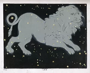
BLUNT / LEO / PLATE 42The constellation of Leo, the lion. Date: 1849
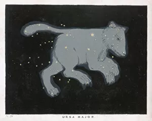
BLUNT / URSA MAJOR / PL 24Ursa Major : the constellation is composed, at first sight, of seven conspicuous stars, four of which are in a rectangular figure and form Date: 1849
MAP / EUROPE / GREECE 323BCTHE EMPIRE OF ALEXANDER Date: 323 BC