mail_outline sales@mediastorehouse.com
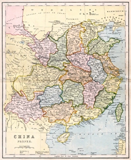
Map / Asia / China C1880China Proper showing the individual provinces, and underlining names of ports open to foreign trade Date: circa 1880
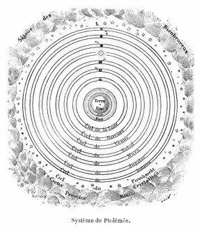
Ptolemaeus system Date: 2nd century AD
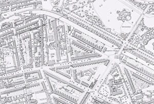
Picture No. 11792554Bethnal Green workhouse map
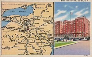
Mark Twain Hotel and map, Elmira, New York State, USA. Date: 1930s
Cartoon, An easy target, WW1Cartoon, An easy target. A German sailor tells his Commandant that a merchant ship has stopped near them. The Commandant replies that in that case hes not likely to miss it. Date: 1916
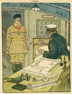
Cartoon, The interrupted conference, WW1Cartoon, The interrupted conference. A group of people look at a map, and a man says what Napoleon would have done. However, the conference has to be suspended
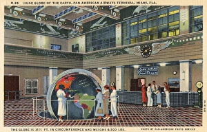
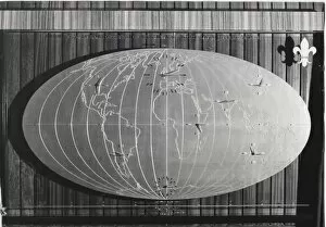
Large globe, PanAm terminal, Miami, Florida, USAPeople looking at a large globe on display in the lobby of the Pan-American Airways terminal in Miami, Florida, USA. Date: 1936
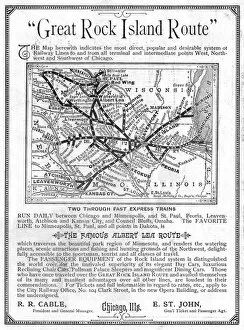
Advertisement, Great Rock Island Route, Chicago, USAAdvertisement for the Great Rock Island Route, Chicago, USA, with a map of railway routes in the Chicago area. Date: 1885
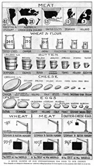
Why Englands Food is Safe, WW1Why Englands Food is Safe, showing how the majority of food supplies come from countries who are not on the side of the enemy during the First World War. Date: 1914
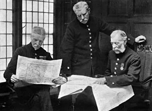
Chelsea pensioners discuss the war, WW1Chelsea veterans discussing the position of the opposing armies in August 1914. Date: 1914
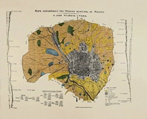
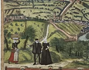
VILANOVA i PIERA, Joan (1821-1893). Agronomic map of Madrid municipal area. SPAIN. MADRID (AUTONOMOUS COMMUNITY). Madrid. Instituto Geol o y Minero de Espa
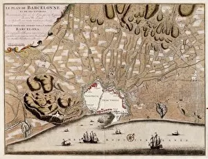
French map of the city of Barcelona (1706). SPAIN. CATALONIA. Barcelona. Barcelona City History Museum
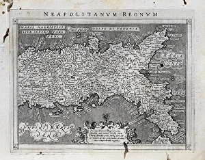
Map of the Kingdom of Naples. 1597-1568. Illustration from the work Geografia, cio鬠 Descrittione universale de la terra, edited in Venice by Giovanni Battista and Giorgio Galignani. SPAIN
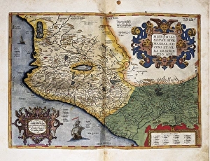
Theatrum Orbis Terrarum. New Spain (Mexico)ORTELIUS, Abraham (1527-1598). Theatrum Orbis Terrarum. 1570. It is considered to be the first modern atlas. Map of New Spain (Mexico), 1579. Printed in Antwerp by Christophe Plantin (1588). Etching
Portrait of Magalhaes. Spanish anonymousMAGELLAND, Ferdinand (1480-1521). Portuguese navigator and discoverer. Oil on canvas
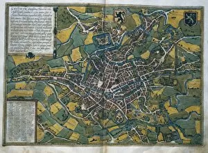
Civitatis Orbis Terrarum. GhentBRAUN, George (1541-1622). Civitatis Orbis Terrarum (Theatrum orbis terrarum). 1572-1617. Ghent (1572). Etching. SPAIN. CASTILE AND LEON. Salamanca. Salamanca University Library
Civitatis Orbis Terrarum. EcijaBRAUN, George (1541-1622). Civitatis Orbis Terrarum (Theatrum orbis terrarum). 1572-1617. Ecija (1567). Etching. SPAIN. CASTILE AND LEON. Salamanca. Salamanca University Library
Civitatis Orbis Terrarum. LondonBRAUN, George (1541-1622). Civitatis Orbis Terrarum (Theatrum orbis terrarum). 1572-1617. London. Detail. Etching. SPAIN. CASTILE AND LEON. Salamanca. Salamanca University Library
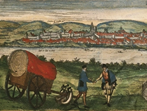
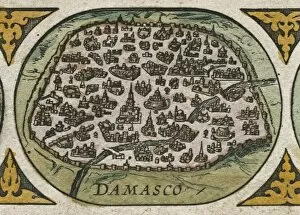
Atlas Novus. Asia, 17th c DamascusBLAEU, Jan (1596-1673). Atlas Novus or Atlas Maior. 1635 - 1665. Asia noviter delineata. Map of Asia printed in Amsterdam ca. 1635. Detail with view of the city of Damasco. Etching. SPAIN. CATALONIA
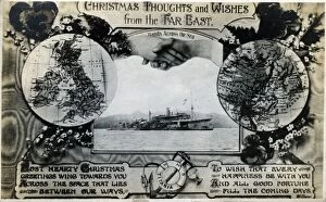
HMS Titania, British ship, Christmas card from Far EastHMS Titania, British ship, Christmas card from the Far East, with hands across the sea. Date: circa 1910s
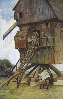
British observation post in a windmill, WW1A Flanders windmill taken over by the British Army as an observation post. Staff officers are seen busy with maps and field glasses while the small son of the miller stands watching with eyes fixed
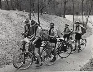
Dutch scouts on a cycling trek, Netherlands, checking their map
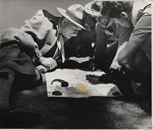
Boy scouts studying a map, Athens, Greece. They are on their first wood badge course. Date: 1947
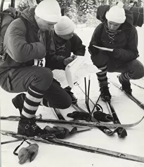
Boy scouts on skiing activity in FinlandBoy scouts on a skiing activity in Finland
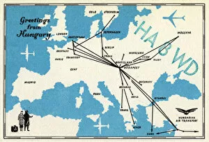
Postcard, Greetings from HungaryPostcard with map of Europe and airline routes to and from Budapest, Greetings from Hungary (Hungarian Air Transport). Date: circa 1960s
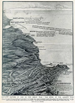
Map of the East Coast Bombardments, WW1A map of the North East coast of Britain, showing Hartlepool, Whitby and Scarborough, the scene of shelling by German battle cruisers in December 1914
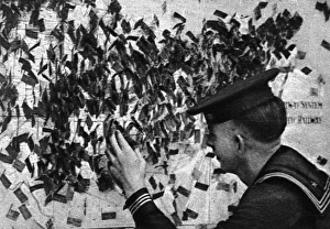
Flagging his home town at the Eagle Hut, WW1An American sailor sticks a flag into a huge map adorning the wall of the Eagle Hut in Aldwych, London, in order so he may meet other American soldiers and sailors from the same area
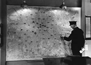
Map of London with fire stations marked, Lambeth HQMap of London with all the fire stations marked, in the control room at Lambeth HQ
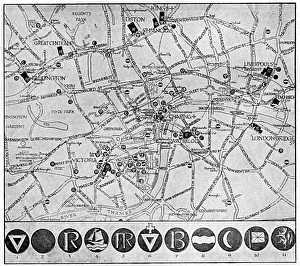
Map of YMCA shelters around London during WW1A map showing the various YMCA huts available for soldiers and sailors in the capital on leave during the First World War, though The Graphic magazine, who published this picture
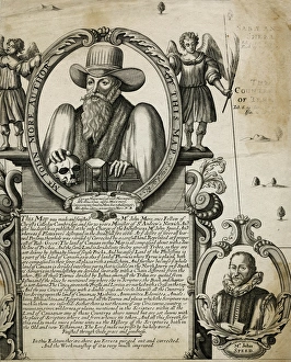
John More, clergyman and cartographerJohn More (?-1592), Fellow of Christs College, Cambridge, minister of St Andrews Church, Norwich, and cartographer. He worked for many years on a map of Canaan, based on biblical research
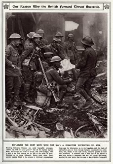
Battalion commander explaining the next moveBattalion commander and his soldiers having a temporary rest in a derelict building while being instructed where their next move will be using a field map of the district. Date: 1917
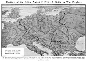
Bystander magazine competition, When Will the War End?Picture 2 of 2 (see 10731631 for 1st). Map of Europe to accompany the Bystander magazines war forecast competition, run in August 1915, with a closing date of 30 September that year
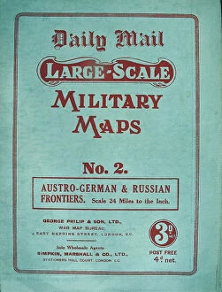
Two foldout Daily Mail Military Maps Numbers - WWI eraTwo foldout Daily Mail Military Maps Numbers 1 and 2. No. 1 - The Franco-Belgian & German Frontiers, Scale 12 Miles to the Inch. No. 2 - Austro-German & Russian Frontiers, Scale 24 Miles to the Inch
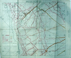
Trench maps belonging to Sergeant Ernest BlaikleyTrench maps belonging to 2903 Sergeant ERNEST BLAIKLEY, 28th Battalion London Regiment (Artists Rifles) (1885-1965). Attached S.O. & S
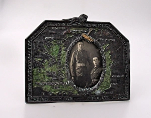
WWI photo frame showing the Eastern FrontFirst World War photo frame showing the Eastern Front with names of Generals and Allied Powers (1914-18) around the edge. Includes maps of Bulgaria, Greece, Asia Minor, Syria and Egypt.. Trench Art
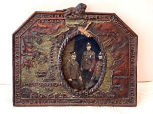
Eastern Front photo frame, WW1First World War photo frame showing the Eastern Front with names of Generals and Allied Powers (1914-1918) around the edge. Includes maps of Bulgaria, Greece, Asia Minor, Syria and Egypt. Trench Art
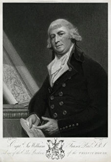
Capt Sir William Fraser, Bar F.R.S, (d.1818), one of the Elder Brethren of Trinity House, (1737 - 1818) on left a rolled chart of Papua New Guinea
Scouts in London for the CoronationBoy Scouts and Sea Scouts with maps in Westminster, Central London, at the time of the Coronation of Queen Elizabeth II on 2 June 1953. Date: 1953
Map with clocks at Baden Powell House, LondonA modern map with clocks showing the time in different parts of the globe at Baden Powell House, South Kensington, London. Above it are the words: From All Corners of the Earth You Have Journeyed
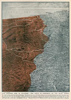
The Fighting Line in Flanders, 1915Areas of possession between the German and Allied armies on the Western front by the autumn of 1915. Despite the advances made by the Germans at Ypres
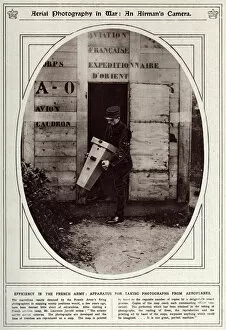
An airmans camera 1917Efficiency in the French Army: Apparatus for taking photographs from an aeroplanes. The French Armys camera takes aerial photographs of the enemies trenches, they are developed and put on maps
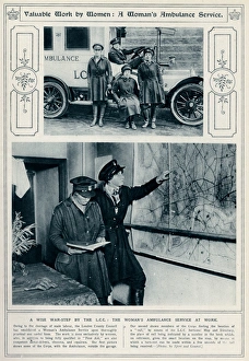
Womens home front ambulance service 1917Owing to the shorage of male labour, the London County Council established a Womens ambulance service, quailfied in first aid and competent motor drivers
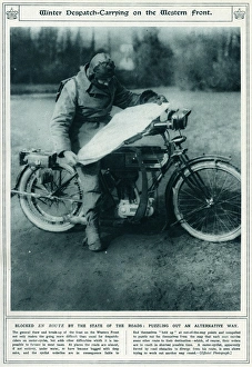
Winter dispatch carrying on the Western Front 1917Corporal Newsham, a British Press despatch rider, studying a map on his motorcycle at Rollancourt in northern France during the First World War
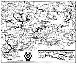
British roads damaged by military traffic, WW1A map of the Southern counties of Britain prepared by the Automobile Association and the Motor Union to indicate the stretches of road extensively damaged by the passage of military traffic
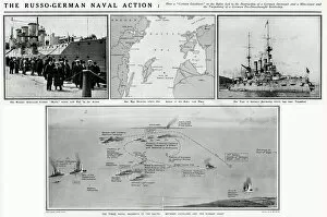
Russo-German naval action in the Baltic, WW1Russo-German naval action in the Baltic during the First World War which led to the destruction of a German destroyer and mine layer and the torpedoing of a German pre-dreadnought battleship
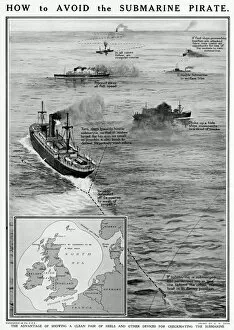
How to avoid the submarine pirate by G. H. DavisHow to avoid the submarine pirate during the First World War. The advantage of showing a clean pair of heels and other devices for checkmating the submarine. Date: 1915
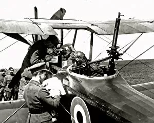
RAF personnel marking German positions, WW1RAF pilots and observers marking German positions in preparation for a raid, on the Western Front in France during World War One. Date: circa 1918
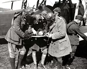
Pilot and observer about to set out, Western Front, WW1A British pilot and his observer getting instructions through their CO via photographs and maps before setting out for the German lines on the Western Front in France during World War One