mail_outline sales@mediastorehouse.com
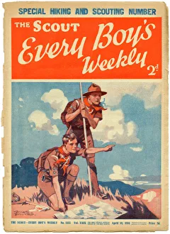
The Scout, Every Boys Weekly front coverFront cover of The Scout magazine, the " only weekly official organ of the boy scouts" featuring two enthusiastic and earnest looking boy scouts reading a map while out on a hike
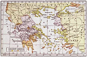
Map of Ancient GreeceA map showing the extent of the Greek Empire and the surrounding territories
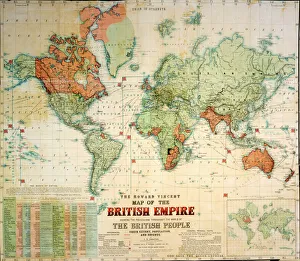
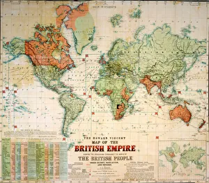
Map of the British EmpireThe Howard Vincent map of the British Empire, 1897 Date: 1897
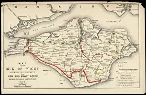
Map of Isle of WightA Map of the Isle of Wight, showing the internal railway system and the new & short route between the island and the Hampshire coast
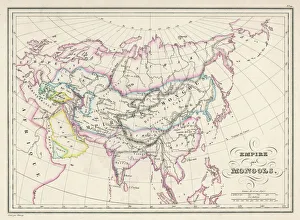
Map / Asia / Mongol EmpireThe Mongol Empire at its greatest extent : commenced by Genghis Khan in the 13th century, it was enlarged by Kublai Khan but broke up after about 1380
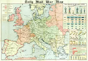
Daily Mail War Map, WW1A fold out war map issued by the Daily Mail in the early weeks of the First World War. The map offers statistics regarding the manpower strength of each of the warring nations
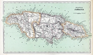
Maps / JamaicaMaps/Jamaica
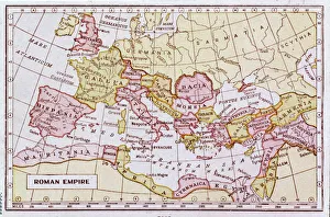
Map of the Roman EmpireA map showing the extent of the Roman Empire
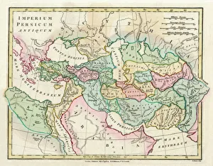
Map of the Ancient Persian Empire, encompassing Greece to the north west, Arabia to the south east, Egypt and Libya to the south west and deep in the Caucasus in the north east. Date: 1798
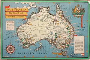
Map of Australia, showing her natural and industrial resources. 20th century
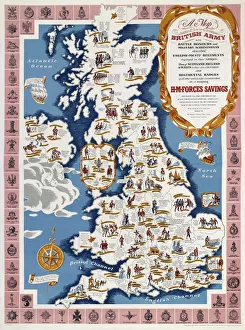
WW2 Poster -- Map of the British ArmyA Map of the British Army with Battle Honours, Military Achievements and Regimental Badges, first published in 1944 by HM Forces Savings Committee
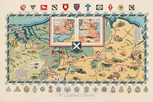
WW2 poster, activities of 52 (Lowland) DivisionScreen-print poster, published circa 1950, showing the activities of the 52nd Lowland Division during the Second World War, with a map of Northern Europe, and unit badges along the top and bottom
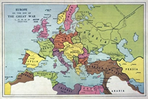
Europe Map C1914The map of Europe on the eve of World War One
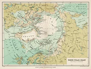
Map / Arctic Circle 1895Map of the Arctic Circle and surrounding areas
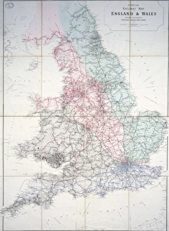
Railway map of Britain1920 Historical map
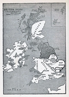
Viking Britain MapA map of the British Isles (including Ireland) during the time of the Vikings
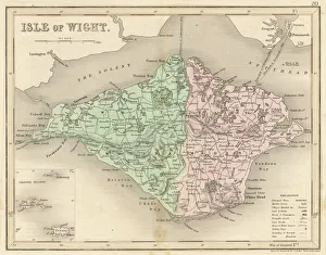
Map / Isle of Wight C1857Map of the Isle of Wight (County series)
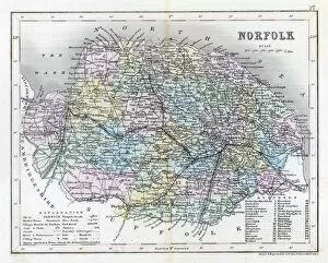
Map / Norfolk C1857Map of Norfolk
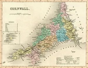
Map / Cornwall C1857Map of Cornwall Date: circa 1857
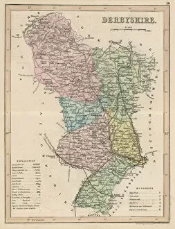
Map / Derbyshire C1857Map of Derbyshire
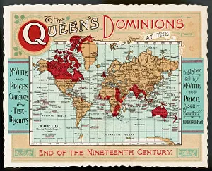
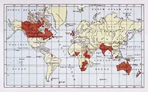
World Map Empire McVitieA map of the world, showing the British Empire coloured in red at the end of the nineteenth century
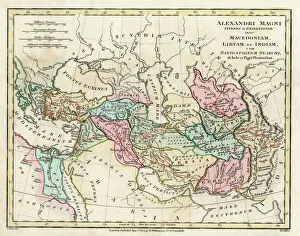
Map of the Empire of King Alexander the Great (Alexander III of Macedon 356323 BC), from Greece in the west to India in the east. Date: 1807
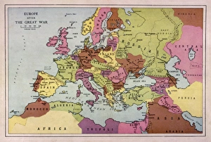
Europe Map C1918The map of Europe after World War One
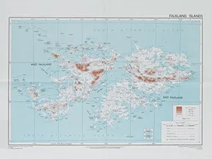
Falklands War - 1982Directorate of Overseas Surveys map of the Falklands Islands, 1983 (c). One of four maps of the Falkland Islands, 1982 (c)-1984 (c)
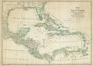
Map of CaribbeanThe Caribbean, with the West Indies, and the coasts of the United States and the Spanish possessions which later became Texas and Mexico, and the northern coast of S. America
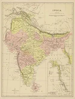
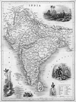
Map / Asia / India C1870India, showing the various Presidencies under British rule
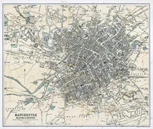
Map / Manchester 1878Map of Manchester and its environs
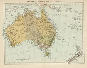
Maps / Australia / New ZeaMap showing Australia, Tasmania, New Zealand and neighbouring islands
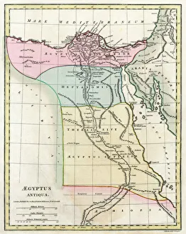
Map of Ancient Egypt. Date: 1814
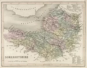
Map / Somerset C1857Map of Somerset
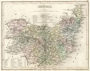
Map / Suffolk C1857Map of Suffolk
British Empire Map 1880Map showing the extent of the British Empire circa 1880
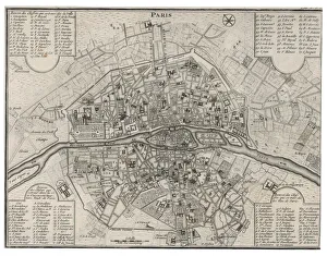
Map / Paris 18CDetailed map of Paris, showing the many churches
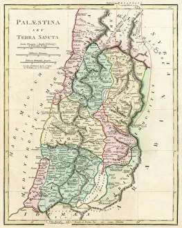
Map of Palestine and the Holy Land - all places named in their Latin form. Date: 1806
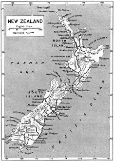
Maps / New ZealandA map of New Zealand Date: 1908
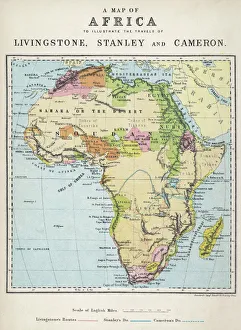
Map of Africa illustrating travels of explorersA map of Africa which illustrates the travels of the explorers Livingstone, Stanley and Cameron
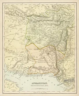
Map / Afghanistan C1860SMap of Afghanistan and Beluchistan (note camel routes are measured in days, not miles)
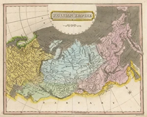
Map / Europe / Russia EmpireMap of the Russian Empire
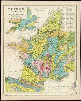
Map / France / Belgium / NetheMap of France, Belgium and the Netherlands
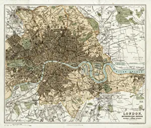
MAP / LONDON 1878Map of London and its suburbs
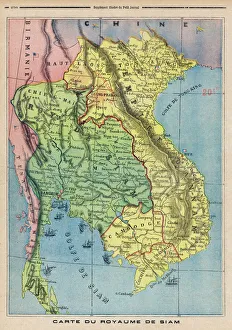
Map Siam / Thailand 1893Map showing the Kingdom of Siam, now Thailand
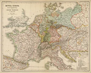
Map / Europe / Germany 1871Imperial Germany after the Franco- Prussian War, showing Alsace and Lorraine as part of the country, not to mention huge chunks of Poland in East Prussia
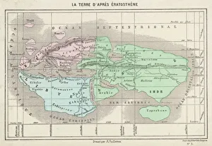
Maps / World / EratosthenesThe world as known to Eratosthenes
Map / Asia / India C1850India under British rule, about the time of the Mutiny
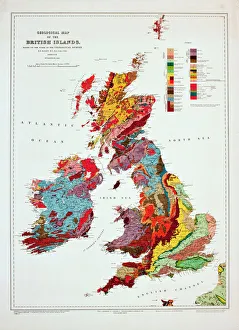
Geological map of the British Islands. 1941
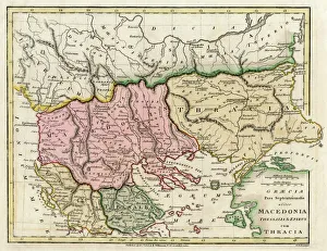
Map of the Macedonian and Thracian Empire. Date: 1808
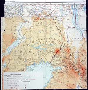
Map of Kenya and UgandaMap of Kenya Uganda boundary, 1926 Date: 1926