mail_outline sales@mediastorehouse.com
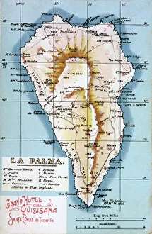
Map of La Palma, Canary Islands. Date: circa 1908
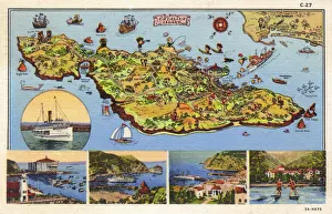
Map, Santa Catalina Island, California, USAMap of Santa Catalina Island, off the coast of California, USA, with inset scenes. 1935
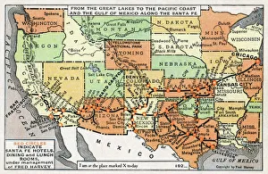
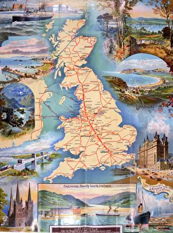
Map, route of Santa Fe Railroad, USAMap showing the route of the Santa Fe Railroad, USA, from the Great Lakes in the east, to the Gulf of Mexico in the south, and the Pacific coast in the west
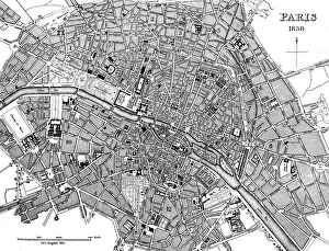
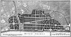
Paris, France - City Map Date: 1830
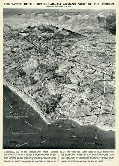
Nettuno-Anzio Front, Italy, by G. H. DavisThe battle of the beachhead -- an airmans view of the terrain. A pictorial map of the Nettuno-Anzio Front, showing roads, with the Alban Hills in the background
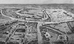
Birds-eye view of the Social London, 1914An aerial view of the two prestigious, social areas of London - Mayfair and Belgravia. In the foreground is Belgravia with its eastern frontier running down from Grosvenor Place
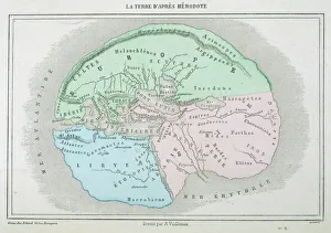
Maps / World / HerodotusThe world as known to Herodotus
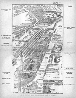
Map of the Pall Mall area of LondonMap of the Charing Cross, Pall Mall and Pimlico area of central London showing, the famous thoroughfare of Pall Mall with its numerous club houses
Maps Wrens LondonChristopher Wren seizes the opportunity of the Great Fire to draw up plans for a brave new London - which alas will be only partially realised. Date: 1666
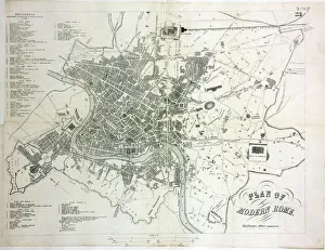
Map of Rome
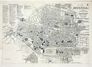
Map of BrusselsMap of the city of Brussels, Belgium Date: 19th century
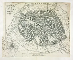
Map of ParisBradshaws Plan of Paris, France and map of the environs Date: 19th century
Railway Map of EnglandLondon & North Western Railway Co rail map of England, 1899 Date: 1899
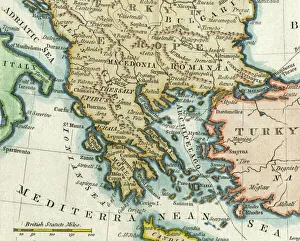
Map of Greece, 1792Map of Greece and Greek islands plus Romania (which appears on this map to be incorrectly labelled or positioned south of Bulgaria), Macedonia, Albania and parts of Turkey and Italy
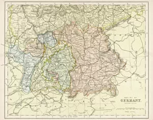
Map / Europe / Germany 1880SMap of the German Empire (southern part) after the war with France, including Alsace and Lorraine
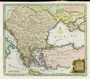
Map / Europe / Balkans 1792A map showing Turkey in Europe and its neighbouring European states of the Balkans
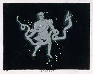
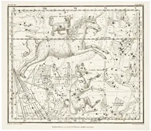
Blunt / Ophiucus / Plate 36The constellation of Ophiucus - the figure is that of a man wrestling with a serpent
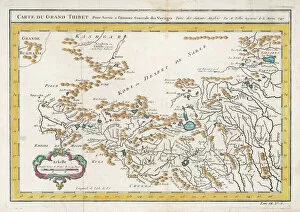
Map / China / Tibet 1749CARTE DU GRAND THIBET scale in French leagues
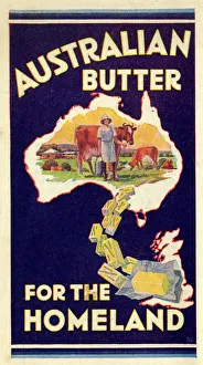
Advert, Australian Butter for the Homeland. 1936
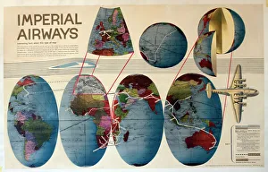
Route map, Imperial Airways. 1938
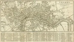
London Map 1806London extending from the head of the Paddington Canal West, and to the West India Docks East. Date: 1806
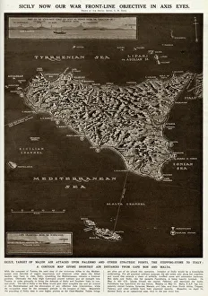
Map of Sicily by G. H. DavisA contour map of Sicily, giving the shortest air distances from Cape Bon and Malta. At this stage in the Second World War it was a British front-line objective in Axis eyes
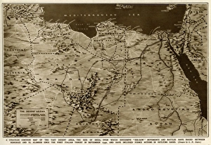
Map of the war in North Africa by G. H. DavisThe war in North Africa: a strategic contour map of the desert arena during the Second World War. Conflict began there in September 1940. Date: 1942
Whittaker / Canis MajorIncluding the Canis Major (dog) and Lepus (hare) constellation
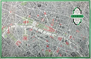
Poster, map of the City of ParisPoster, three-dimensional map of the City of Paris Date: 1958
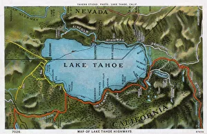
Map of the Lake Tahoe area, Nevada and California, USA, showing the highway system. Date: 1922
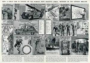
London Fire Brigades organisation and equipmentA selection of small drawings of the events that take place in 1937, when a call by a pedestrian seeing flames and smoke to the very end when the fire has been put out
Present Day Types - Week-End RamblersTwo chaps with sturdy walking boots, pipes in mouth, set off on a countryside ramble while consulting their maps. Date: 1914
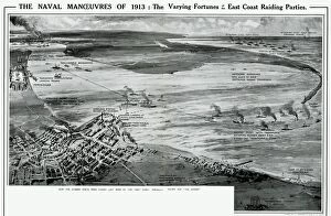
Naval manoeuvres on East Coast by G. H. DavisThe naval manoeuvres of 1913: the varying fortunes of the East Coast raiding parties. How the Humber Ports were raided last week by the Red fleet
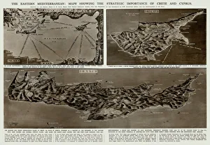
Strategic importance of Crete and Cyprus by G. H. DavisThe Eastern Mediterranean: maps showing the strategic importance of Crete and Cyprus during the Second World War. Date: 1941
Barcelona (19th c. ). Geometrical map, by Jos項Barcelona (19th c.). Geometrical map, by Jos頍 as y Vila. SPAIN. Barcelona. Historical Archive of Barcelona
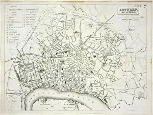
Map of AntwerpMap of the city of Antwerp, Belgium Date: 19th century
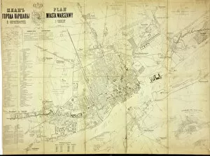
Map of WarsawMap of the city of Warsaw, Poland from 1862 Date: 1862
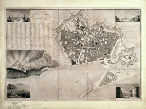
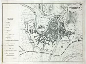
Map of VeronaMap of the city of Verona, Italy Date: 19th century
Crimean War
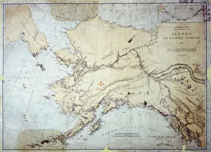
Alaska, US Coast Survey, America 1869 Date: 1869
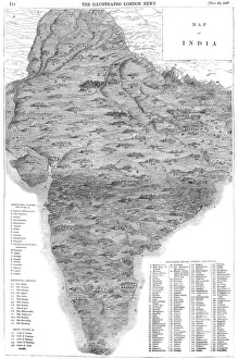
Map of IndiaA map of India in 1857 (the year of the Indian Mutiny) showing the kingdoms, states and provinces; the principal rivers; the bays and gulfs; and the principal cities, towns and forts
Map of Malaysia 1908A map showing all the islands that make up Malaysia Date: 1908
Map of Vicksburg, Mississippi, during the US Civil War when Ulyssess Grant and his army of the Tennessee drove the Confederate army of John C Pemberton back to Vicksburg and besieged the city
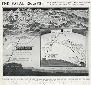
How Bad Weather held back Captain ScottA map showing the different routes taken by the Norwegian team led by Roald Amundsen and the British team led by Captain Robert Falcon Scott towards the South Pole in 1911/12
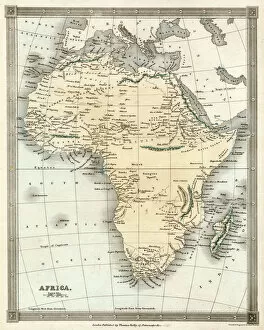
MAP / AFRICA 1842Map of Africa
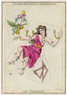
Andormeda Star MapAndromeda (Gloria Federici), in chains, plus triangles constellation
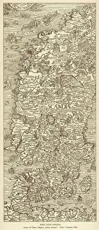
Map / Scandinavia 1539Map of Norway, Finland, Sweden and Denmark
MAP / EUROPE 1763Map of Europe
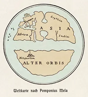
World Map / Pomponius MelaA world map according to Pomponius Mela, showing Europe, Africa, Asia, and the rest in the lower half
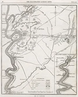
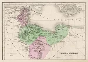
Map / North Africa 19CTunisia and Tripoli (now largely Libya)
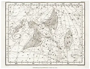
Whittaker Star Maps 11Including Cygnus, Lacerta and Lyra
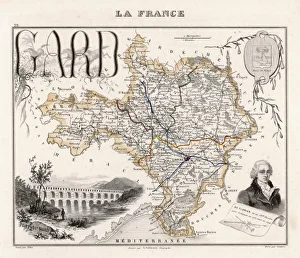
Map of Gard, FranceGARD A Map surrounded by the Pont du Gard, a portrait of poet and writer Jean-Pierre Claris De Florian (1755-1794) and the coat of arms