mail_outline sales@mediastorehouse.com
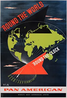
Poster advertising Pan American World Airways - Round the World, Round the Clock Date: 1955
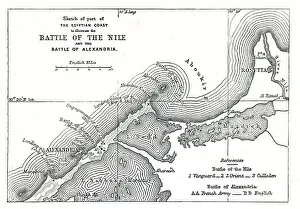
Map of the Battle of the Nile, and Battle of Alexandria. 1798
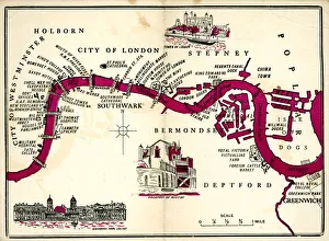
Map of London, 1952Map of London in 1952. 1952
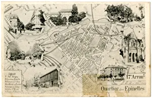
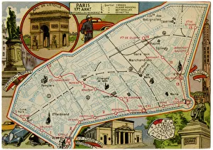
Map of the 17th Arrondissement, Paris, FranceMap of the 17th Arrondissement, Quartier des Epinettes, Paris, France. Date: circa 1900s
Map of Batignolles-Monceau, Paris, FranceMap of Batignolles-Monceau, 17th arrondissement, Paris, France. Date: circa 1900s
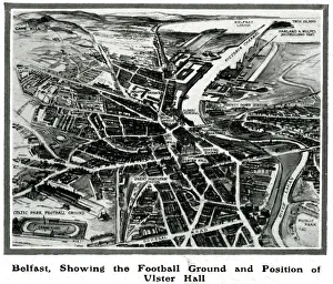
Belfast, 1912, showing the football ground & Ulster HallOverhead drawing of Belfast, showing the football ground and the position of Ulster Hall. Illustration accompanied a feature in The Sphere reporting on Winston Churchills visit to Belfast in 1912
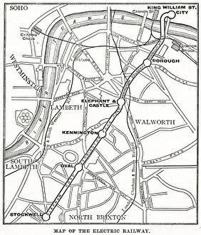
Map of underground and overground stations, South LondonMap of underground and overground stations connecting the City to South London. The overground lines are the London & South Western Railway and the London Chatham & Dover Railway
Map showing the distances between cities 1939Map showing the distance from Moscow, Danzig, Warsaw, Berlin and Venice in relation to London in order to highlight the likelihood of air raids. 1939
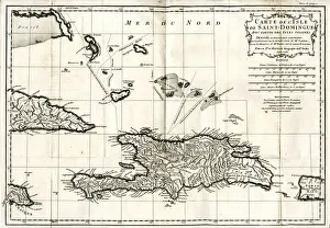
Map of Hispaniola (San Domingo, Haiti), West Indies. The island is now divided into two separate nations: Haiti to the west (French Creole-speaking)
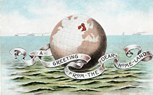
Great Britain highlighted on the globeA Greeting from the Dear Home-Land, showing Great Britain highlighted in red on a globe of the planet
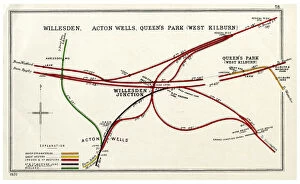
Railway map, Willesden, Acton Wells, Queens Park, LondonRailway map, Willesden, Acton Wells, Queens Park (West Kilburn), London, with colour coding of the various railway companies. Date: 1920
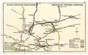
Railway map, Aldgate, Bishopsgate, Haydon Square, LondonRailway map, Aldgate, Bishopsgate, Haydon Square, Mansion House, Spitalfields & Whitechapel, London, with colour coding of the various railway companies. Date: 1922
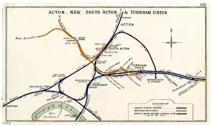
Railway map, Acton, Kew, Turnham Green, LondonRailway map, Acton, Kew, South Acton & Turnham Green, London, with colour coding of the various railway companies. Date: 1913
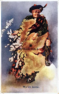
Scotsman with map of Scotland, pinpointing Pitlochry, Perthshire. Date: circa 1910s
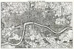
Map of London by John Rocque, 1745. 1745
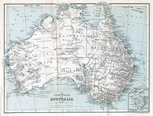
Map, The Commonwealth of Australia. Date: circa 1900s
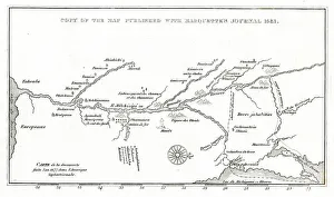
Map of Marquettes ExplorationsA map of Jacques Marquettes missionary journey up the Mississippi river towards New France. A small dotted line marks the route there up through Green Bay to the Mississippi
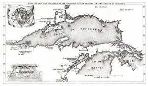
Map of New France, all Jesuit French settlements around Lake Superior, Lake Huron, and Lake Illinois in 1670-1671. Date: 1670-1
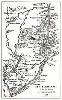
Map of New NetherlandsMap of the New Netherlands area in 1652, from the writings and descriptions of Adriaen Vanderdonck. Date: 1656
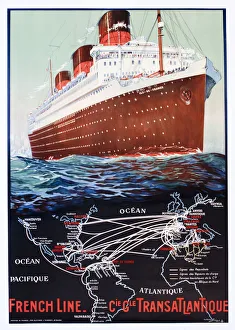
Poster, French Line, transatlantic cruise linerPoster, French Line, Compagnie Generale Transatlantique, design by Albert Sebille. circa 1935
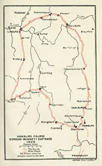
Homburg Course, Gordon-Bennett Cup RaceEarly Motor Car Racing - Homburg Course, Gordon-Bennett Cup Race, 1904. 1904
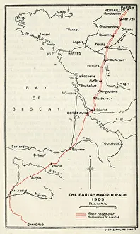
The Paris-Madrid Race route, 1903Early Motor Car Racing - The Paris-Madrid Race route, 1903. 1903
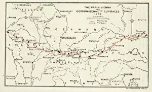
Paris-Vienna and Gordon-Bennett Cup RacesEarly Motor Car Racing - Paris-Vienna and Gordon-Bennett Cup Races map, 1902. 1902
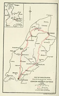
Isle of Man Course, Gordon-Bennett Cup RaceEarly Motor Car Racing - Isle of Man Course, English Eliminating Trials, Gordon-Bennett Cup Race of 1904. 1904
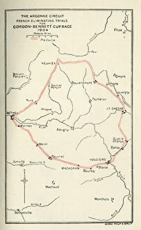
Argonne Circuit, Gordon-Bennett Cup RaceEarly Motor Car Racing - Argonne Circuit, French Eliminating Trials, Gordon-Bennett Cup Race 1904. 1904
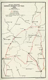
Irish Course, Gordon-Bennett Cup RaceEarly Motor Racing - Irish Course, Gordon-Bennett Cup Race. 1903
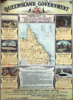
Advert for Queensland, Australia, a call for more people to live and work there. circa 1890
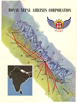
Poster, Royal Nepal Airlines Corporation, with a map showing routes. 1958
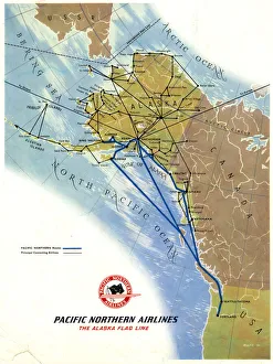
Poster, Pacific Northern Airlines, The Alaska Flag Line, with a map showing routes. 1958
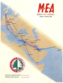
Poster, Middle East Airlines, with a map showing routes. 1958
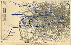
Map, Metropolitan Underground Railway, serving Aldgate, City, Kew Gardens, Richmond and other London locations. 1880
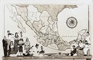
Players at Padua Hills Theatre, Claremont, California, USAMexican Players at Padua Hills Theatre, Claremont, Los Angeles County, California, USA. In costume, some with musical instruments, and a large map as a backdrop. Date: circa 1930
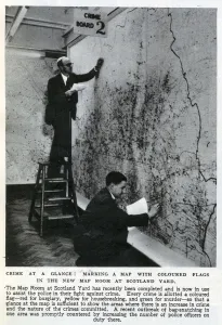
New Map Room at Scotland YardMarking a map with coloured flags in the new Map Room at Scotland Yard, 1947. Each flag represents a crime(yellow for housebreaking, red for burglary, green for murder)
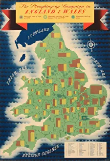
Poster, The Ploughing-Up Campaign in England and Wales, for the growing of crops during the Second World War. Date: early 1940s
Perspective view of the plan of Athens, Greece 1700 Date: 1700
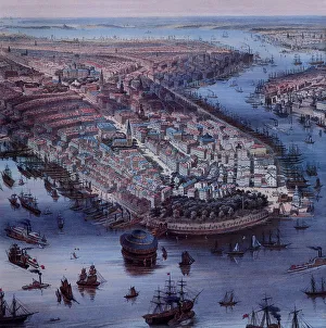
View of New York City 1849 and Waterways Date: 1849
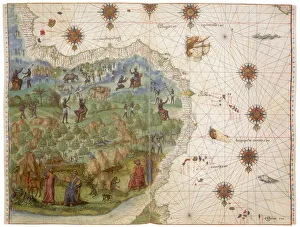
West Africa 1547 Date: 1547
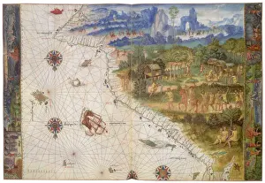
Terra Java 1547 Date: 1547
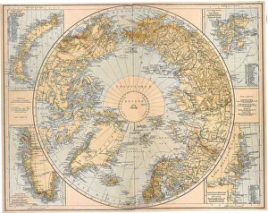
North Polar Region 1897 Date: 1897
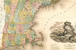
East Coast Map 1823 Date: 1823
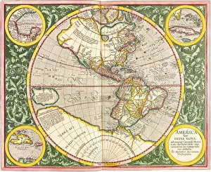
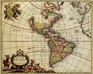
Map of the Americas1633 Date: 1633
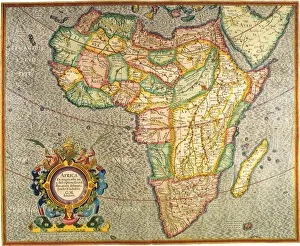
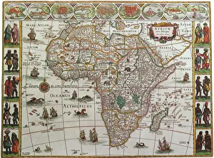
Map of Africa 1633 Date: 1633
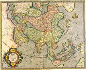
Map of Asia 1633 Date: 1633
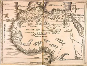
Map of North Africa 1513 Date: 1513
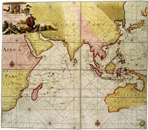
Map of the Indian Ocean 1700 Date: 1700
Map of Africa, 1645 Date: 1645
Map of the Americas 1685 Date: 1685
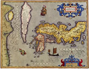
Ancient Map of Japan 1606 Date: 1606