mail_outline sales@mediastorehouse.com
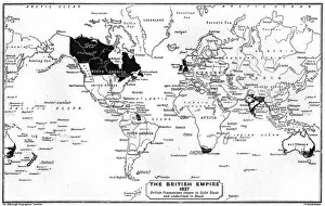
World Map - 1897Map of the world showing British Empire possessions Date: 1897
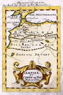
MAP / AFRICA / MOROCCO 1719LEmpire du Cherif de Fez, Maroc, Sus &c. the Moroccan empire in the early 18th century, with the Atlas Mountains and the Sahara Date: 1719
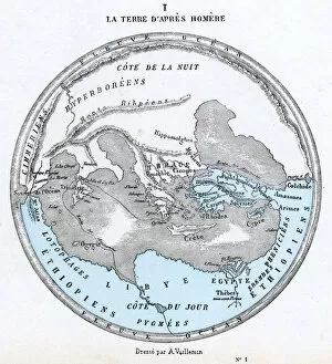
MAPS / WORLD / HOMER 9BCThe world as known to Homer Date: 9th century BC
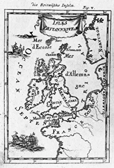
BRITISH MAP LATE 17CMap showing the British Isles Date: late 17th century
MAPS, ASIA, INDIA 1719Crude map of northern India, previous to any extensive colonisation, including parts of Pakistan & Bangladesh & the sources of two great rivers the Ganges & Indus
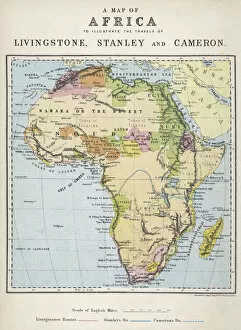
Map of Africa illustrating travels of explorersA map of Africa which illustrates the travels of the explorers Livingstone, Stanley and Cameron. Date: 19th Century
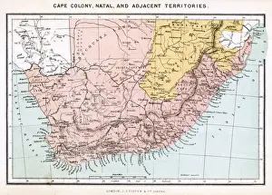
Map of Southern AfricaA map of Southern Africa, showing Natal and the Cape Colony. Date: 1885
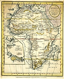
Map of Africa 1818Map of Africa in 1818 Date: 1818
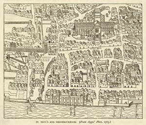
Map of St Pauls and area in 1563 Date: 1563
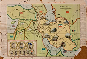
Arabic map of Middle East with heads of state, WW2Arabic map of Middle East with heads of state during the Second World War. 1940s
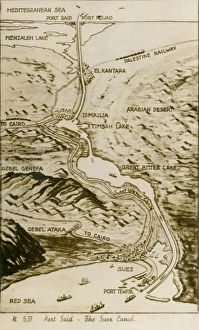
Map of the Suez Canal, EgyptMap of the Suez Canal in Egypt showing the water way from the Mediterranean Sea to the Red Sea which was constructed in the 19th century by the Suez Canal Company founded by Ferdinand de Lesseps
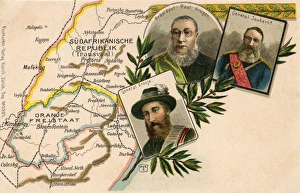
Kruger, Joubert and Cronje with map of South AfricaPresident Paul Kruger, General Piet Joubert and General Piet Cronje with a map of the Transvaal, South Africa. Date: circa 1900
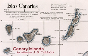
Map of the Canary Islands: Lanzarote, Fuerteventura, Gran Canaria, Tenerife, Gomera, La Palma and Hierro. Date: circa 1920
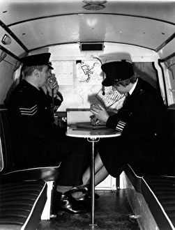
Two police officers in SPG van, Met Police, LondonTwo police officers, one male, one female (WPC McKay), in an SPG (Special Patrol Group) van, Met Police, London. The SPG was set up in 1961 to provide a centrally-based mobile capability for dealing
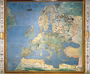
Map / Europe C1130Map of Europe in the 12th century Date: circa 1130
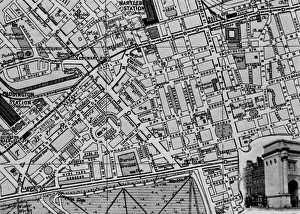
Map of the St Marylebone area, London. Date: circa 1900
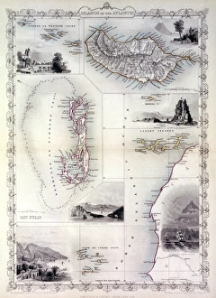
Map of the islands in the Atlantic Ocean -- Azores or Western Isles, Madeira, Bermuda, Canary Islands, Cape Verde. Date: 1851
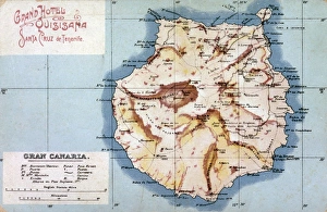
Map of Gran Canaria, Canary Islands. Date: circa 1908
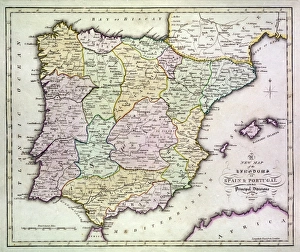
Map of Spain and Portugal, with part of southern France and northern Africa. Date: circa 1801
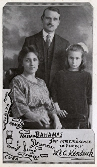
Missionary family with map of Bahamas, West Indies. They are Walter and Clara Kendrick and their daughter. He was a medical missionary from Aston, Birmingham
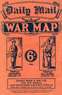
Daily Mail War Map, WW1Front cover of a fold out war map issued by the Daily Mail in the early weeks of the First World War. On the cover, and inside
ITALY. Caprarola. Villa Farnese. Map of Europe. 1574 painting by Giovanni Antonio da Varese Vanosino. Stanza del Mappamondo (Geographic room or Room of the World Map). Renaissance art. Cinquecento
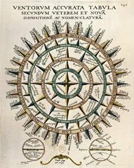
Tabula secundum accurata Ventorum veterem et nova [m] dispositione [m] ac nomenclature [m] (Table of the winds according to the old and new layout and nomenclature)
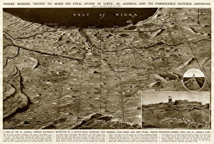
Defences of El Agheila, Libya, by G. H. DavisWhere Rommel planned to make his final stand in Libya during the Second World War: El Agheila and its formidable natural defences
British and American soldiers with map, France, WW1British and American soldiers consulting a map on a road near the Western Front in France during World War One. Date: circa 1916
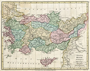
Map of Asia Minor (Turkey) - in antiquity - pre-Ottoman Empire. Date: 1804
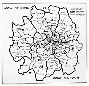
Area map for the National Fire Service in London, WW2Area map for the National Fire Service in London
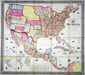
Map of the USA 1855
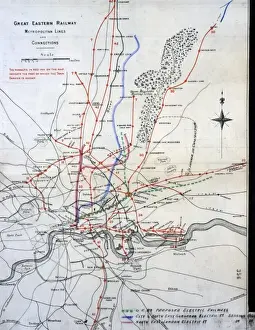
Great Eastern Railway MapGreat Eastern Railway lines and connections, 1901 Date: 1901
WORLD MAP / 1837Map of the world showing British Empire possessions Date: 1837
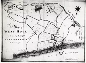
Colliery map of Hook, Pembrokeshire, South WalesA colliery map (by Thomas Lewis) of the village of Hook, described here as West Hook in the parish of Langwn (Llangwm), showing fields, trees and mining locations
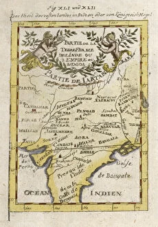
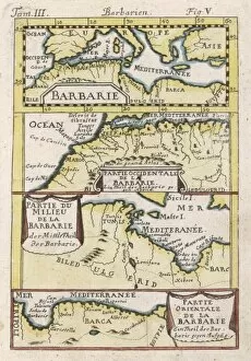
Map / Nw Africa 1719North-west Africa, showing portions of Barbary, land of the Berbers, known to Europeans as barbarians (today Morocco, Tunisia &c)
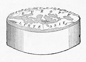
Cylindrical EarthAnaximanders cylindrical Earth
Map of Africa, with travellers routesMap of Africa, with the routes of the modern travellers, Parke, Browne and Le Vaillant. 1799
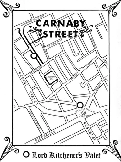
Map of Carnaby Street, 1960sMap of showing the location of epicentre of sixties cool, Carnaby Street, in central London, as directed by one of the leading male boutiques, Lord Kitcheners Valet. Date: 1966
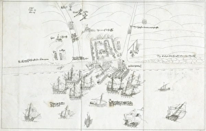
One of 25 maps from a leather case presented to Gen Richard Vyse who commanded the King?s Dragoon Guards and the Cavalry Brigades at the Battle of Beaumont
Attack on Brighthelmstone (Brighton) by French raidersAttack made by French raiders on the village of Brighthelmstone (Brighton, Sussex) in June 1514. Almost every building was burnt to the ground. 1514
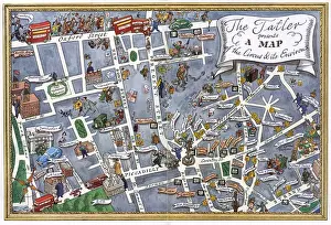
Map of central London with Piccadilly Circus at centreA map of the West End of London with Piccadilly Circus at its centre. Famous theatres, night spots, cinemas and hotels are marked with decorative labels and symbolic drawings. Date: 1950
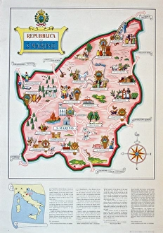
Poster, San Marino, Italy. circa 1950s
CS Winifred Barker and Superintendent Shirley BeckeWinifred Theodora Barker (c1909-1995), third commander of the Met Police A4 (Women s) Branch, rising to the rank of Chief Superintendent in 1960
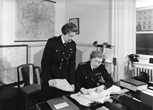
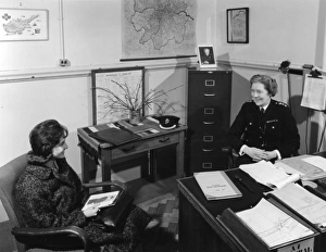
Chief Superintendent Winifred Barker in her officeWinifred Theodora Barker (c1909-1995), third commander of the Met Police A4 (Women s) Branch, rising to the rank of Chief Superintendent in 1960
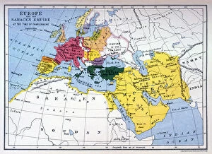
Charlemagne Era MapA map of Europe, Asia and Africa in the time of Charlemagne and the Saracen empire. Date: circa 800
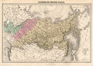
Map / Russia / Siberia C1860Siberia and Eastern Russia Date: circa 1860
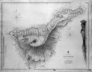
Map of Tenerife, Canary Islands, with soundings in fathoms. Date: 1838
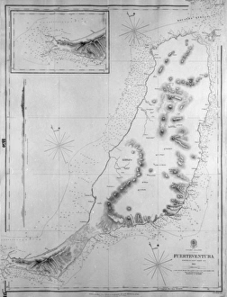
Map of Fuerteventura, Canary Islands, with soundings in fathoms. Date: 1835
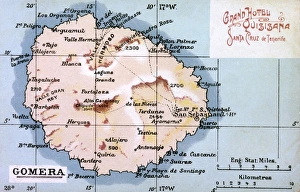
Map of La Gomera, Canary Islands. Date: circa 1908
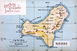
Map of Hierro, Canary Islands. Date: circa 1908
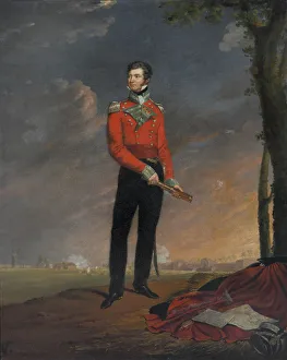
Major (later Major-General) Sir Neil Campbell CB (1776-1827), 1815 (c).Oil on canvas by Edouard Henri Pingret (1788-1875), 1819.Full-length