
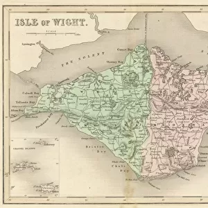
Map of Isle of Wight

Cards
crop_landscape
extension
Mounted Prints
local_cafe
![]()
Wall Art and Photo Gifts from Mary Evans Picture Library
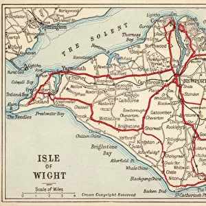
Map of Isle of Wight
A Map of the Isle of Wight, showing the internal railway system and the new & short route between the island and the Hampshire coast
Media ID 4348747
© Mary Evans Picture Library/GROSVENOR PRINTS
1874 Connections Engineering Hampshire Internal Isle Links Maps Plans System Wight
MADE IN THE UK
Safe Shipping with 30 Day Money Back Guarantee
FREE PERSONALISATION*
We are proud to offer a range of customisation features including Personalised Captions, Color Filters and Picture Zoom Tools
SECURE PAYMENTS
We happily accept a wide range of payment options so you can pay for the things you need in the way that is most convenient for you
* Options may vary by product and licensing agreement. Zoomed Pictures can be adjusted in the Basket.
Beautiful Photo Prints and Gifts
Professionally Printed
Photo Prints are in stock
Professional quality finish
Made with high-grade materials
Carefully packed to aid safe arrival
Related Images

+
Shipping
+
Choices
+