mail_outline sales@mediastorehouse.com
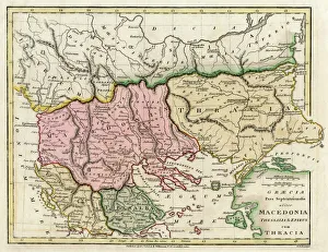
Map of the Macedonian and Thracian Empire. Date: 1808
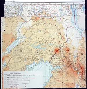
Map of Kenya and UgandaMap of Kenya Uganda boundary, 1926 Date: 1926
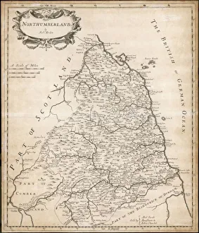
Map of NorthumberlandMap of the English county of Northumberland by Robert Morden, originally produced for the 1695 edition of Camdens Britannia
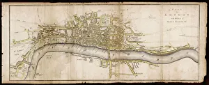
Elizabethan London, stretching from St James Park in the west to Whitechapel and the Tower in the east. Theatres and other places of ill-repute are located on the south bank
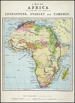
Map of Africa illustrating travels of explorersA map of Africa which illustrates the travels of Livingstone, Stanley and Cameron. Date: 19th Century
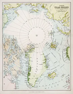
Map / Arctic Circle C1880Map of the Arctic Circle with details of explorations
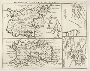
Map / Channel Islands 18CMap of Jersey, Guernsey, Alderney, Sark and the Scilly Isles
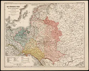
Map / Europe / Poland 1772A German map of Poland and its neighbours in the late 18th century
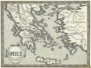
Map / Europe / Greece / FordMap of ancient Greece
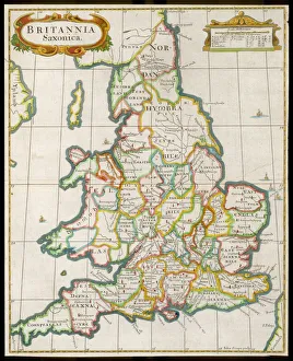
Map / England & Wales 9CEngland and Wales during the Saxon era
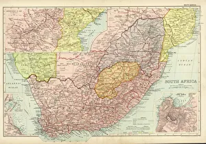
Map /s Africa / Boer C1898SOUTH AFRICA on the eve of the Boer War
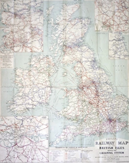
Railway map of BritainPhilips railway map of the British Isles, c1923 Date: c. 1923
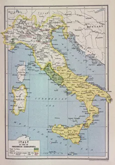
Barbarossa-Era Italy MapA map of Italy in the reign of Holy Roman Emperor Friedrich I, known as Barbarossa
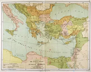
Map / Roman Empire / CupPart of the Roman Empire, showing St Pauls journeys
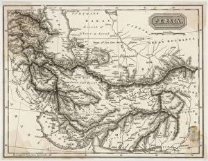
Map / Asia / Persia 19CMap of Persia (Iran)
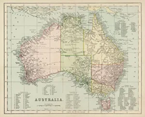
Maps / Australia Post-1876Map of Australia with names of Counties
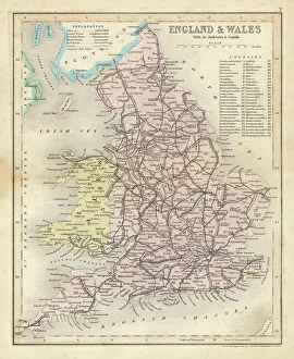
Map / England & Wales 1857Map of England and Wales showing railways and canals
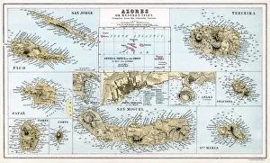
MAPS / AZORESmaps of the individual islands of the Azores group Date: mid 19th century
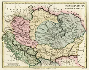
Map of the Dacian Empire and Roman provinces. Date: 1801
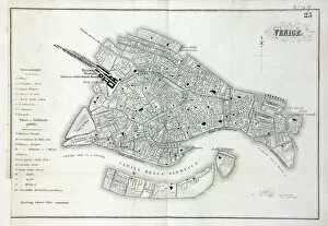
Map of VeniceMap of the city of Venice, Italy Date: 19th century
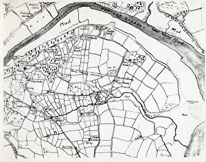
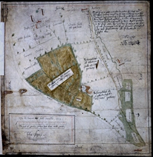
Sketch map of Hook, Pembrokeshire, South WalesA sketch map of the village of Hook, including the various mining shafts of the colliery, on the Western Cleddau near Haverfordwest, Pembrokeshire, South Wales
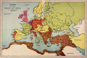
1815 Europe MapA map of Europe at the time of the Congress of Vienna
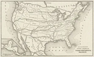
USA Railway MapTranscontinental railway map of the United States of America and the adjoining British possessions. Date: 1883
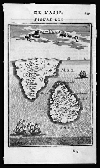
Map / Asia / Sri Lanka 1719ISLE DE CEYLAN and southern India
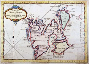
Map of Spitsbergen, NorwayMap of Spitsbergen, Svalbard, Norway Date: 1758
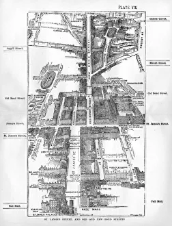
Map of the St. Jamess & Bond Street areas of LondonA map of the St. Jamess and Bond Street areas of London, with a number of key landmarks annotated including the famous gentlemens clubs of St
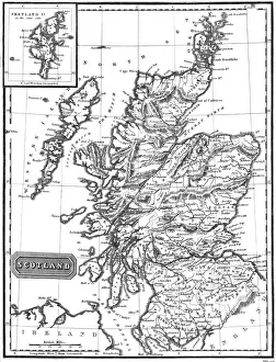
Map / Britain / ScotlandA map of Scotland 1817
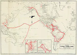
Pan American Airways route mapPan American Airways System global route map of the Flying Clipper Ships (passengers, mail, express). circa 1938
Coggeshall, EssexMap of Coggeshall, Essex, by John Agas, 21 May 1619 Date: 21st May 1619
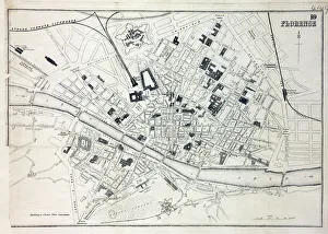
Map of FlorenceMap of the city of Florence, Italy and the River Arno Date: 19th century
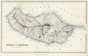
Map / Europe / Madeira 19CMap of Madeira
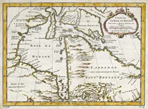
Hudsons Bay MapHUDSONs BAY, at the time of the Seven Years War, showing French and English forts including Fort York, the principal settlement of the Hudsons Bay Company
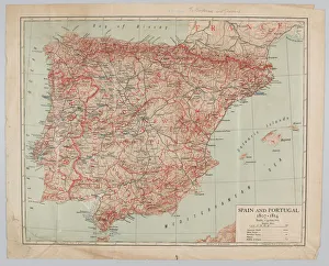
Map - Spain and Portugal, 1807-1814Spain and Portugal, 1807-1814. From a collection of maps relevant to campaigns between 1794-1815. From the collection of the former Buffs Regimental Museum
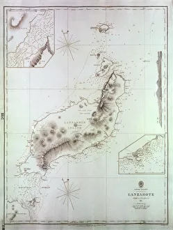
Map of Lanzarote, Canary Islands, with soundings in fathoms. Date: 1835
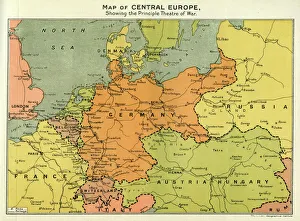
Map of Central Europe, World War OneMap of Central Europe in World War One, showing the Principal Theatre of War. Date: World War One
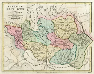
Map of Persia (Iran) - all place names in their Latin form. The ancient realms of Assyria, Babylonia Date: 1807
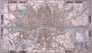
Map of London
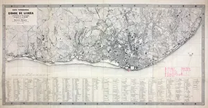
Map of LisbonMap of the city of Lisbon, Portugal 1871 Date: 1871
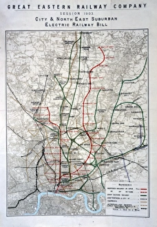
London railways mapCity & North East Suburban Electric Railway map, 1903 Date: 1903
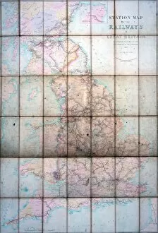
Station mapZ Macaulays station map of the railways in Great Britain, 1854 Date: 1854
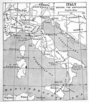
Italy Map Pre-UnityA map of Italy prior to unification
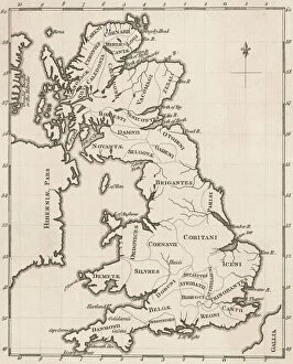
Map of Pre-Roman BritsA map showing the distribution of tribes in pre- Roman Britain
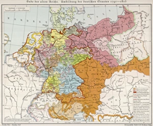
Map / Europe / Germany 18CShowing the end of the old German Empire and the reconstruction of the German States, 1791 - 1815
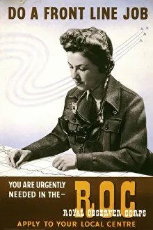
World War Two recruitment posterPoster from the Second World War encouraging women to join the Royal Observer Corps
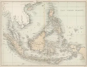
Map / East India IslandsMap of the East India Islands, including Borneo, the Celebes, Sumatra, Papua New Guinea, the Philippines
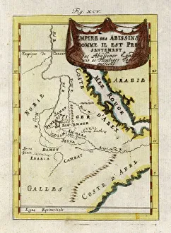
Map / Africa / Ethiopia 18CMap of Ethiopia (Abyssinia)
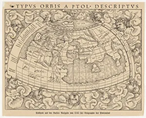
World Known to Ptolemy1545 map from Basel, Switzerland, depicting the world as known to Ptolemy in the 2nd century
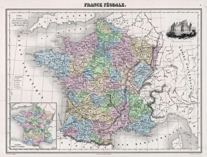
Map / Europe / France C1000France in feudal times, with the country allotted to various nobles who bore more or less allegiance to the king, whose acquisitions are shown in map lower left