mail_outline sales@mediastorehouse.com
Aerial map-making by G. H. DavisA revolution in aerial map making during the Second World War: perspective maps for airmen. Used as an aid to air navigators and air bombers in precision bombing. Date: 1943
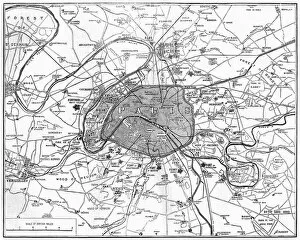
The War: Fortifications in ParisMap showing the fortifications in Paris during the Franco-Prussian War. Date: 1870
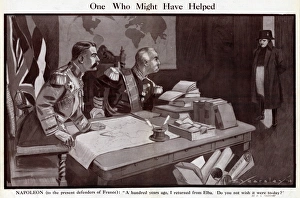
Cartoon, One Who Might Have Helped, WW1Cartoon, One Who Might Have Helped. Showing Lord Kitchener and General Pau, defenders of France at the start of the First World War, sitting at a desk with books and maps
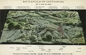
The Battlefield of Gettysburg. Photograph from Huidekopers relief map of the battlefield. As it was in 1863. Date: 1901
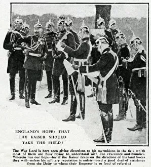
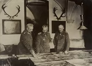
Kaiser Wilhelm with his generals, WW1Kaiser Wilhelm II of Germany giving directions to his generals at the start of the First World War. Date: 1914
Map of the Belgian frontier with forts, World War OneMap of the Belgian frontier with forts at the beginning of World War One. Date: 1914
Map of northern Tunisia by G. H. DavisThe battleground which was expected to seal the fate of North Africa and gain full control of the Mediterranean during the Second World War
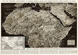
Development of French Africa by G. H. DavisThe vast economic development of French Africa: roads and communications from Algeria to Congo. A contour map of French African possessions under Allied control at this stage of the Second World War
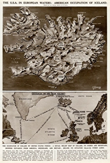
American occupation of Iceland by G. H. DavisThe USA in European waters: American occupation of Iceland during the Second World War. A detailed relief map of Iceland, its fjords and mountains, showing distances from America
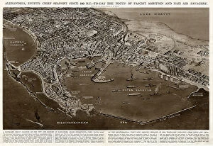
Seaport of Alexandria, Egypt, by G. H. DavisAlexandria, Egypts chief seaport since 330 BC, and chief naval base of the Allied Mediterranean Fleet during the Second World War
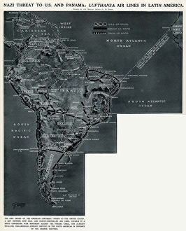
Lufthansa airlines in Latin America by G. H. DavisGerman threat to America and Panama: Lufthansa airlines in Latin America. A map showing how German-controlled airlines, capable of a converging war movement against the Panama Canal
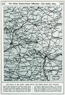
Battle of the Somme map 1916A map showing the advancement of British troops north and south of the River Somme. 1916
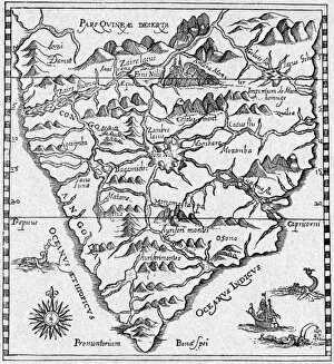
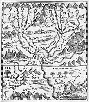
MAP AFRICAPortuguese and other early navigators got the African coast fairly well, but the interior, including the source of the Nile, is somewhat fancifully depicted. Date: 16th century
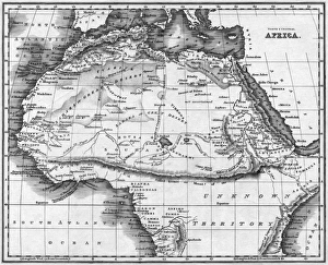
Map Africa NorthThe most prominent feature is the Mountains of the Moon, separating the Sahara and Soudan Deserts from the unknown territory to the south. Date: 1768
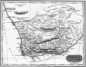
Map Africa Good HopeThe Colony of Good Hope, with useful warnings about the sea cows (hippopotami) in the Orange River and the wildness of the Boshiesmans or Hottentots. Date: 1817
Map Egypt and SudanMap covering the area from the Nile delta to the Mountains of the Moon. Zambia and the Zaire river are marked. Date: 16th century
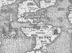
Map AmericaMunster has got the general picture reasonably right, including Japan (Zipangri) but the Hesperides surprisingly are in mid- Atlantic and Canada (Francisca) skewed. Date: 1553
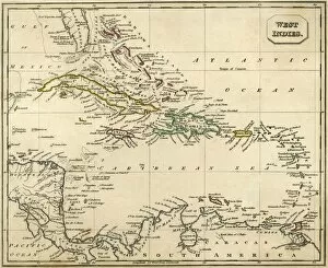
Map West IndiesThe European powers are competing who can grab the greater portion of these islands : the French and British are doing better than the Spanish and Dutch... Date: 1827
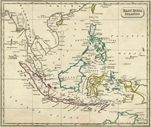
Map East IndiesMuch of this region is still under Dutch rule : but todays Malaysia is part of the Birman Empire and the Philippines are claimed by Spain : Britain has yet to stake her claim... Date: circa 1827
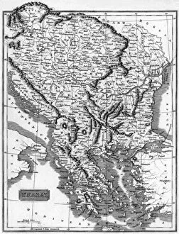
Map BalkansThe map is labelled Turkey because at this time the Balkans are under the dominion of the Ottoman Empire and constitute most of Turkey in Europe. Date: 1812
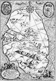
Sri Lanks MapKnown to the Dutch navigators as Ceilon. Date: 1646
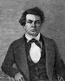
Charles PreussCHARLES PREUSS German-born cartographer, botanist and artist in America, working with Fremont to make important maps of the newly-explored West. Date: 1803 - 1864
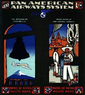
Pan American Airways System route maps for South America
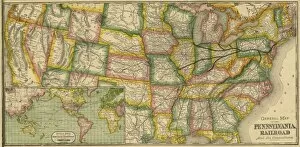
The Pennsylvania Railroad and its connectionsGeneral map of the Pennsylvania Railroad and its connections
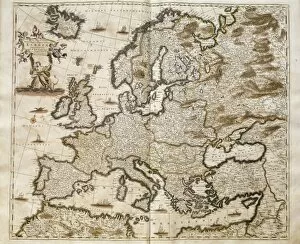
Map of Europe of Frederick de Wit (Amsterdam, 17th c.). Engraving
World map by Joan Martines (1591). Miniature Painting
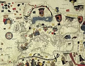
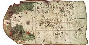
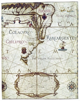
COSA, Juan de la (1460-1510). Cartographer. Nautical chart. 1500. Detail. SPAIN. Madrid. Navy Museum
Chart by Juan de la Cosa (1500). SPAIN. Madrid. Navy Museum
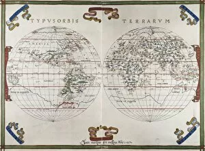
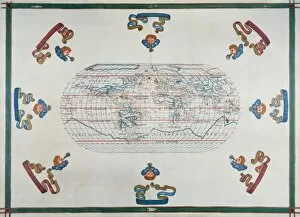
Portolan chart atlas, 1591. World map. Renaissance
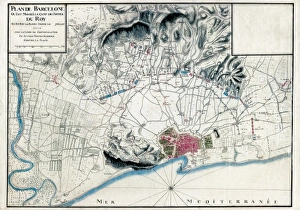
Spain (1713). War of the Spanish Succession. Siege of Barcelona. French map with the position of the Louis XIVs troops
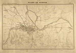
Map of Gerona (1809). SPAIN. Madrid. National Library
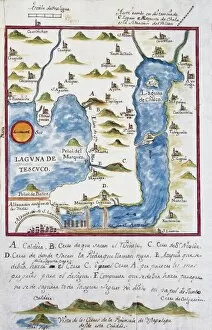
Map of the archbishopric of Mexico (1767), by Jos頁 ntonio Alzate. View of the area of Tenochtitlan, the lagoons of Chalco and Tescuco. From the Lorenzana-Borb ollection. SPAIN. Toledo
Plan of the archbishopric of Mexico: Mexico City and his lagoon. 1767. Collection Lorenzana-Borb Miniature Painting. SPAIN. Toledo. State Public Library
Universa ac Navigabilis Totius Terrarum Orbis
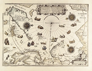
BARENTS, Willem (1550-1597). Dutch Navigator
Kaiser & GeneralsKaiser WILHELM II (centre), having a strategic meeting with Field Marshall Paul von Hindenburg (left) and General Erich Ludendorff (right). Date: 1859 - 1941
Map / Europe / Germany 1789Map of Germany in the late 18th century, showing the many independent states Date: 1789
London fire officer dies at Covent Garden fireStation Officer Charles Fisher died fighting the blaze at the Covent Garden Market fire. The plan shows the extent of the fire but cannot show the extreme heat
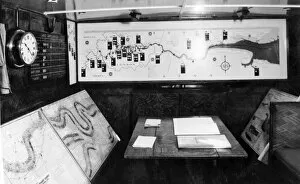
NFS (London) River Thames Formation control boat, WW2Interior view of the control room cabin of one of the London River Formations (River Fire Service) fireboats designated as a control unit for major incidents on the River Thames
Plan of Fire Guard Organisation, WW2Plan of the Fire Guard Organisation
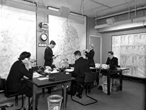
Home Office NFS Coordination Control Room, WW2The resources of the various Regions were recorded at the central deployment control room of the Home Office, the government department responsible for the NFS
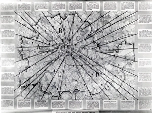
Map of the LCC-LFB areaMap showing 30 incidents of note in the LCC-LFB area
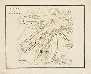
Map, Battle of FleurusMap of the Battle of Fleurus - it was won by the French Army, with the first military use of a reconnaissance balloon. The hydrogen balloon L Entreprenant was used to pass messages to the ground
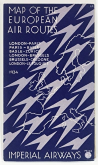
Cover design, Imperial Airways map of the European Air Routes for 1934: London-Paris, Paris-Basle, Basle-Zurich, London-Brussels, Brussels-Cologne, London-Le Touquet
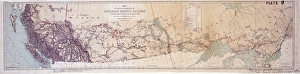
Canadian Pacific Railway map
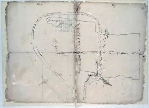
LimerickHand drawn map of Limerick, Ireland, c. 1603 Date: c. 1603
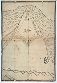
Culmore Fort
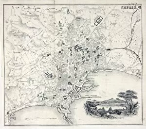
Map of NaplesMap of the city of Naples, Italy