mail_outline sales@mediastorehouse.com
Lifford
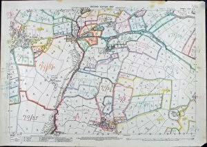
Map of CornwallMap of part of Cornwall Date: 1907
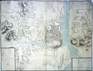
Siege of Badajoz
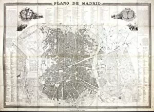
Map of MadridMap of the city of Madrid, Spain 1848 Date: 1848
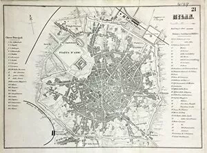
Map of MilanMap of the city of Milan, Italy Date: 19th century
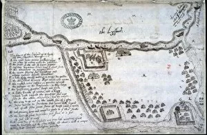
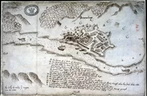
Doonalong, Tyrone, Ireland, 1600 Date: 1600
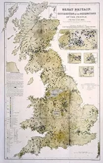
Occupation map of the UKUK Occupations map 1851 Date: 1851
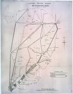
Passenger Traffic mapPlan of licensed stage coaches running between London and the East of England, c.1840 Date: c. 1840
ThorneEarly map of Thorne, near Doncaster showing the River Ouse and the River Trent
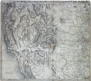
Pacific Coast USA MapRand McNally Official Railway Guide map of the Territories and the Pacific Coast, 1877-1879 Date: 1877-1879
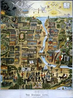
The Divided City, 1895 Date: 1895
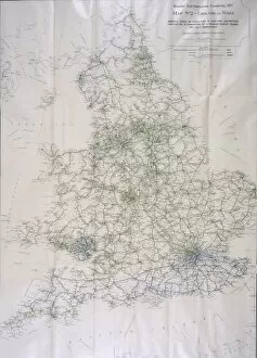
Electrification of Railways mapElectrification of railways in England and Wales, 1927 Date: 1927
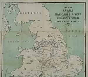
Canals and rivers of England and WalesMap of canals and navigable rivers of England and Wales, c1910 Date: c. 1910
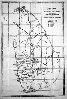
Ceylon riots mapCeylon (now Sri Lanka) riots plan 1915 Date: 1915
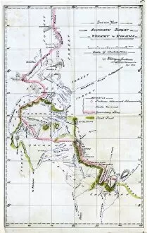
Map of VenezuelaVenezuela - British Guiana (now Guyana) Boundary survey, Wenamu to Roraima, May 1904 Date: 1904
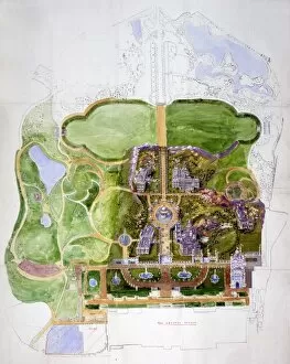
Festival of Empire 1911Plan of the Festival of Empire Exhibition, Crystal Palace, London, 1911 Date: 1911
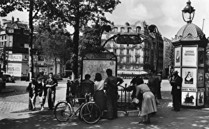
Members of the public stop to look at a map in Pigalle in Paris
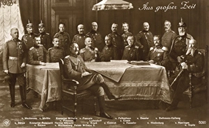
A portrait of German generals sitting and standing around a table with a large map. 1910s
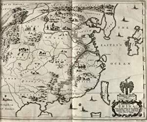
Map of China, the route of the embassy is marked. From: An embassy from the East-India Company of the United Provinces, to the Grand Tartar Cham Emperor of China Date: 1655
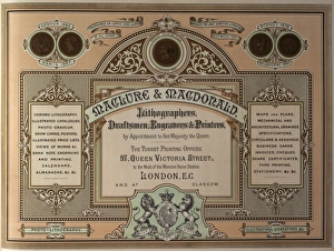
Advertisement for Maclure & Macdonald, Lithographers, Draftsmen, Engravers & Printers of London and Glasgow. circa 1883
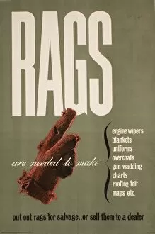
Poster requesting Rags for salvagePoster: request for Rags for salvage. Rags are needed to make engine wipers, blankets, uniforms, overcoats, gun wadding, charts, roofing felt, maps, etc
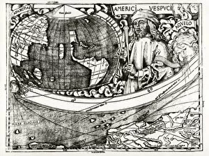
World Mao 1507
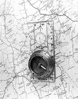
Map CompassA compass on a map of the area around Lladerchymedd, Wales. Date: 1980s
Map of Stockholm 1942Map showing Stockholm, Sweden 1942 Date: 1942
Map of CalicutCalicut in India, also Ormus and Canonor Date: 1599
Map of Greenland 1721
Map of the Industries in England and WalesThe location of the main places in England and Wales where items are made. Date: 1931
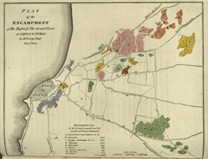
Turkish military camp at JaffaPlan of the the Turkish military camp at Jaffa (then in Syria) on 25 July 1800 by Mr George Pink. 1800
Girls on road trip in a Jowett JupiterJust about to start in their Jowett Jupiter car, these girls are dressed by Simpsons of Piccadilly. The girl on the left pointing at the map wears a double-breasted three-quarter coat of Donegal
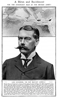
Lord Kitchener made Military Admiral, 1909Fascinating page from the Bystander showing a photograph of Lord Kitchener with critical editorial of his new position as Military Admiral which required him to travel hundreds of miles to inspect
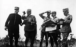
General Joffre and General Cadorna, WW1General Joseph Joffre (1852-1931), Commander of the French Army during the first half of the First World War (left) with General Luigi Cadorna (1850-1928), Italian Field Marshal
Map of Central London with Woburn House Hotel marked, in Upper Woburn Place, WC1. Date: circa 1920s
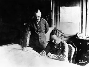
Crown Prince Wilhelm studying a map, WW1Friedrich Wilhelm Victor August Ernst (1882-1951), the last Crown Prince of Germany and Prussia. Seen here with one of his army officers, studying a map during the First World War. Date: 1914-1918
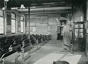
Portslade Industrial School - classroomEmpty desks in classroom at Portslade Industrial School near Brighton in Sussex. Maps hang on the wall. The school opened in 1902 to house children placed there for reasons such as vagrancy, begging
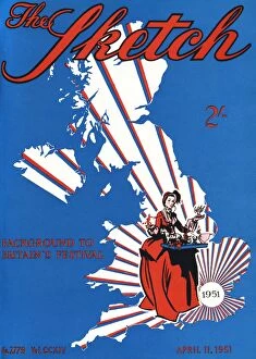
The Sketch front cover - Festival of BritainFront cover of the Sketch magazine, showing a map of the United Kingdom with rays emanating from the London area, together with a lady in historical costume holding a tray of toys
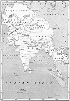
MAPS / ASIA 1908Map of the countries surrounding India Date: 1908
British India 1801Map showing the expanision of the British Dominion in India Date: 1801
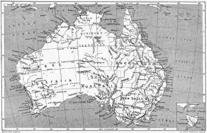
Maps / Australia 1908A map of the commonwealth of Australia and Tasmania Date: 1908
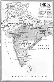
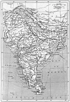
MAPS / INDIA 1908Map of India Date: 1908
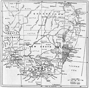
Industry / AustraliaA map of south-eastern Australia showing the products of different districts Date: 1908
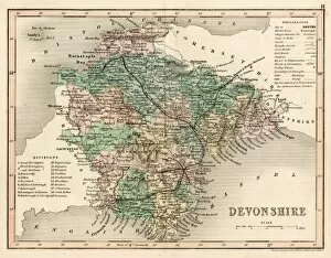
MAP / DEVON C1857MAP/DEVON C1857
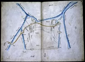
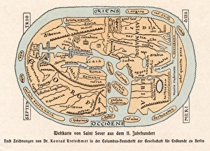
World Map / St Sever 11CA world map according to Saint Sever, showing various countries, seas and rivers Date: 11th century
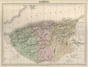
Map / Africa / Algeria C1850Algeria under French rule, divided into three provinces of Oran, Algiers and Constantine Date: circa 1850
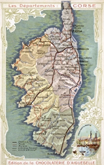
Map / Europe / Corsica C20Map of Corsica Date: early 20th century
Map / Oxfordshire Mid-18CMap of Oxfordshire Date: mid-18th century
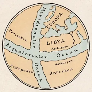
World Map / Crates MallosA world map according to Crates of Mallos, showing Europe, Libya, the Antipodes, and various seas Date: circa 168 BC
Maps / Suez CanalMap of the Suez Canal Date: 1908
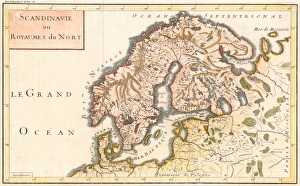
Map / Europe / ScandinaviaMap of Sweden, Denmark and Norway Date: c1800