mail_outline sales@mediastorehouse.com
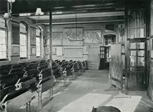
Portslade Industrial School - classroomEmpty desks in classroom at Portslade Industrial School near Brighton in Sussex. Maps hang on the wall. The school opened in 1902 to house children placed there for reasons such as vagrancy, begging
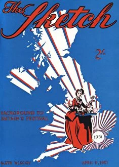
The Sketch front cover - Festival of BritainFront cover of the Sketch magazine, showing a map of the United Kingdom with rays emanating from the London area, together with a lady in historical costume holding a tray of toys
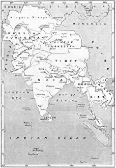
MAPS / ASIA 1908Map of the countries surrounding India Date: 1908
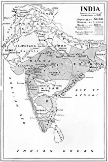
British India 1801Map showing the expanision of the British Dominion in India Date: 1801
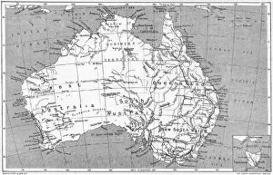
Maps / Australia 1908A map of the commonwealth of Australia and Tasmania Date: 1908
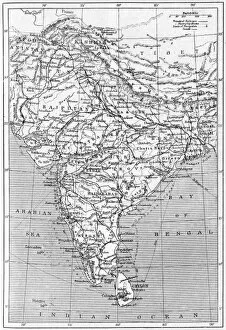
MAPS / INDIA 1908Map of India Date: 1908
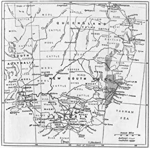
Industry / AustraliaA map of south-eastern Australia showing the products of different districts Date: 1908
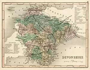
MAP / DEVON C1857MAP/DEVON C1857
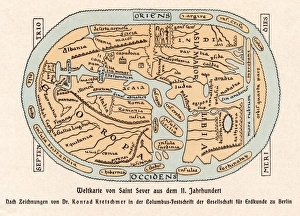
World Map / St Sever 11CA world map according to Saint Sever, showing various countries, seas and rivers Date: 11th century
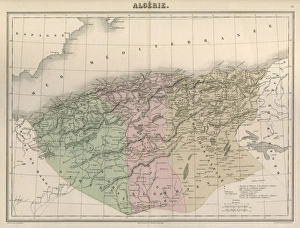
Map / Africa / Algeria C1850Algeria under French rule, divided into three provinces of Oran, Algiers and Constantine Date: circa 1850
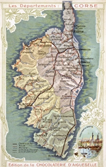
Map / Europe / Corsica C20Map of Corsica Date: early 20th century
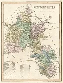
Map / Oxfordshire Mid-18CMap of Oxfordshire Date: mid-18th century
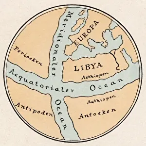
World Map / Crates MallosA world map according to Crates of Mallos, showing Europe, Libya, the Antipodes, and various seas Date: circa 168 BC
Maps / Suez CanalMap of the Suez Canal Date: 1908
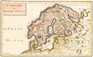
Map / Europe / ScandinaviaMap of Sweden, Denmark and Norway Date: c1800
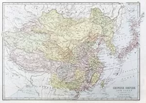
Map / Asia / China 1871The CHINESE EMPIRE with Korea and Japan. The Treaty Ports are underlined, Hong Kong is underlined in red Date: 1871
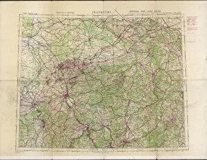
RAF navigators map of FrankfurtOrdance survey map of Germany around Frankfurt, showing the location of Cologne (Koln), Koblenz, Frankfurt and other towns and cities in the area, compiled and drawn at the War Office
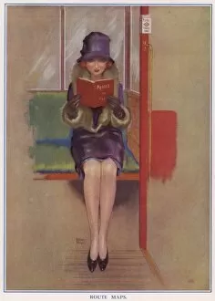
Lady passenger on the underground -- Route MapsAn illustration entitled Route Maps, depicting a seductive lady passenger on the underground reading a little book with the word Kisses on the front cover
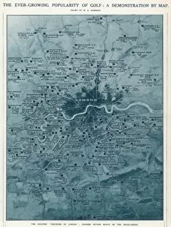
The Ever-Growing Popularity of GolfA demonstration by map of the ever growing popularity of golf in the early part of the 20th century. The illustration shows the many golf clubs and courses within easy reach of London
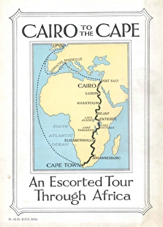
Cairo to the Cape, an Escorted Tour through AfricaCover illustration for Cairo to the Cape, an Escorted Tour through Africa. A map of Europe and Africa shows the route from Cairo to the Cape and the stopping places en route -- Port Said, Luxor
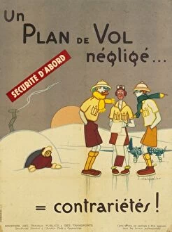
French travel & transport posterAmusing poster issued by the French Ministry of Travel and Transport which appears to be advising intrepid aviators to plan their route in advance, or suffer the consequences
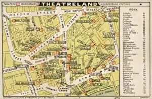
London TheatrelandMap of theatres in London Theatreland
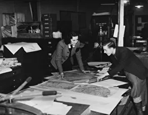
Map Department, WWIIWorking in the map department during World War II
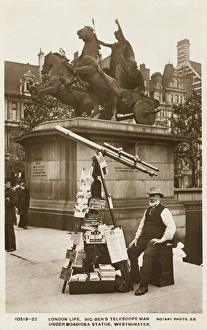
Telescope Man - WestminsterA wonderful photographic postcard depicting Big Bens Telescope Man under the Boadicea Statue, Westminster. The statue was sculpted by Lord Thomas Thorneycroft (1815 - 1865)
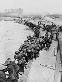
Battle of Messines 1917Soldiers of the 13th Brigade (who were to take part in the second phase of the battle) studying a large contour map of the area to be attacked between Petit Pont
1911 Map of Australia
French travel poster - Le Pays de CauxPoster advertising the Pays de Caux region along the North West French coast with two ladies in swimsuits presenting a map depicting all the resorts with beaches close to hand
Turkish School at UskudarThe Turkish School at Scutari (Uskudar) - Asian side of the Bosphorus
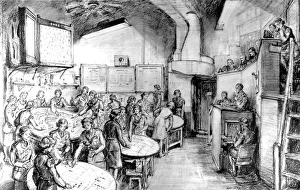
The Gun Control Room, Britain; Second World War, 1944Illustration showing the interior of the Gun Control Room, the headquarters of Londons anti-aircraft defences during the Second World War, 1944
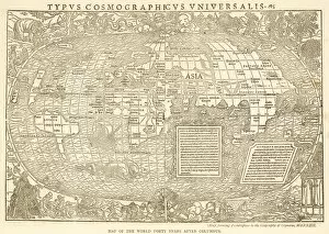
World Map 1532 GrynaeusWORLD MAP OF GRYNAEUS with all manner of exotic creatures on it and around it
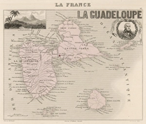
Guadeloupe MapThe two main islands, Guadeloupe and Grande Terre, are separated by a narrow channel : they were discovered by Columbus in 1493
Map / Europe / Germany 1866The growth of Prussia between 1815 and 1866
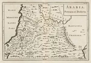
Map of Arabia DesertaMap of Arabia Petraea et Deserta, including much of northern Iraq. Petra is down on the left, a few centimetres above the word felicis
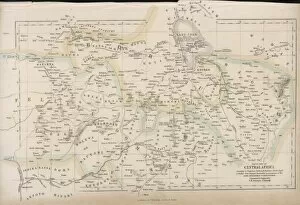
Map / Central Africa C1860Map of Central Africa
Map / Oxfordshire C1857Map of Oxfordshire
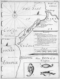
Map / Africa / Angola 1714Map of Angola, with a mermaid
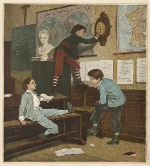
French Schoolboys C1880Three French schoolboys in the classroom: one of them is moving the clock forward in the hope that they will be able to go home early
Compass on a MapA compass with a scale ruler, used as an aid to map reading
Zodiac Star Map 1805The signs of the zodiac
Map / USA / Pennsylvania 17CPENNSYLVANIA Late 17th Century map
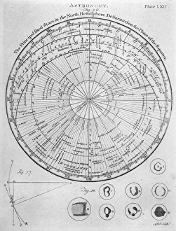
Star Map of the Northern HemisphereMap showing the principal fixed stars in the Northern Hemisphere delineated on the plane of the equator
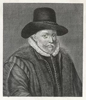
JOHN SPEED cartographer who produced classic maps of Britain
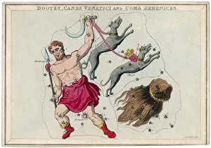
Bootes Star MapThe constellation of Bootes - holding a club in his right hand and leading two hounds with his left. The beautiful hair of Berenice, daughter of Ptolemy is seen on the right
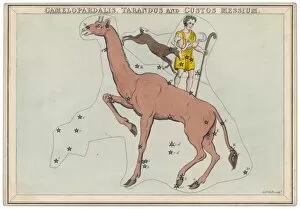
Guard Star MapConstellaton showing Camelopardalis (giraffe), Tarandus (deer) and Custos Messum (guard) with his staff and scythe
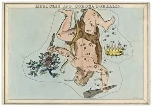
Hercules Star MapHercules and Corona Borealis constellation
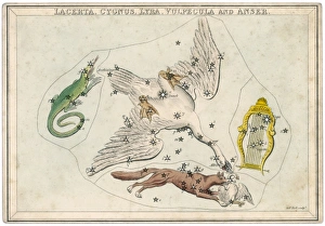
Swan Etc Star MapLizard, swan, lyre, fox and goose star constellation
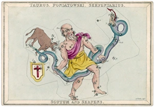
Poniatowski Star MapThe Polish astronomer Poniatowski, with the Taurus the bull, shield and serpent constellation he discovered in the 18th century
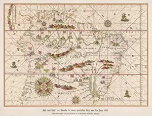
Map /s America 1582Part of a map by Juan Martinez atlas, published at Messina, of the Northern countries of South America