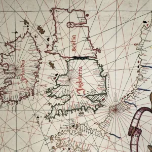
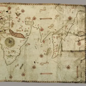
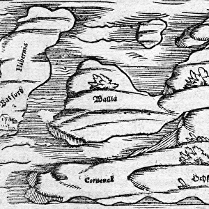
Portolan chart, 1587. Map of England, Scotland

![]()
Wall Art and Photo Gifts from Mary Evans Picture Library
Portolan chart, 1587. Map of England, Scotland
Portolan chart, 1587. Map of England, Scotland and Ireland with the north France coast. Realized in Messina. Facsimile. Renaissance art. Miniature Painting
Media ID 8284275
© Mary Evans/J. Bedmar/Iberfoto
Banner Banners Chart Facsimile Geographic Geographical Geography Illuminated Manuscript Manuscripts Messina Miniatures Portolan Renaissance Scot Land
MADE IN THE UK
Safe Shipping with 30 Day Money Back Guarantee
FREE PERSONALISATION*
We are proud to offer a range of customisation features including Personalised Captions, Color Filters and Picture Zoom Tools
SECURE PAYMENTS
We happily accept a wide range of payment options so you can pay for the things you need in the way that is most convenient for you
* Options may vary by product and licensing agreement. Zoomed Pictures can be adjusted in the Basket.