mail_outline sales@mediastorehouse.com
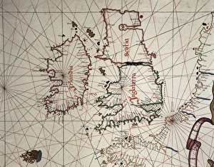
Spanish map of England, Scotland and IrelandA Spanish map of England, Scotland and Ireland and the coast of northern France from the time of the Anglo Spanish War. Joan Martines (1556-1591). Date: 1587
Portolan chart, 1591. Map of the Pacific Ocean. It depicts the western coast of Central and South America, from Mexico to the Strait of Magellan. Renaissance art. Miniature Painting
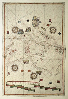
Portolan chart, 1582. Map of the central part of the Mediterranean sea. Printed in Messina. Renaissance art. Miniature Painting
Portolan Atlas, 1587. Map of the Iberian Peninsula, the north coastline of Africa and the Vasque Countrys region in France. Made in Messina. Facsimile. Miniature Painting. SPAIN. Madrid
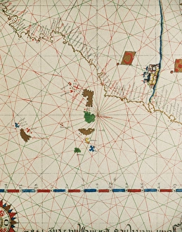
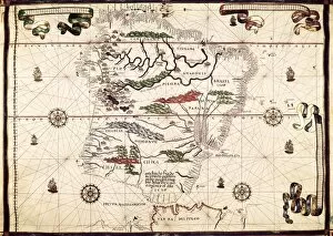
Portolan of Joan Martines (16th century). 1587. Map of the CPortolan of Spanish cartographer Joan Martines (16th century). Majorcal school. 1587. Map of the Canary Islands and the west coast of Africa. Messina, Sicily. National Library. Madrid. Spain
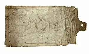
Portolan chart of the Mediterranean sea (1439) of Gabriel de Vallseca. It belonged to Amerigo Vespucci. SPAIN. Barcelona. Barcelona Maritime Museum
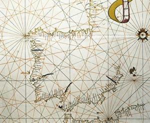
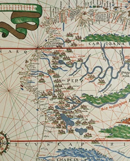
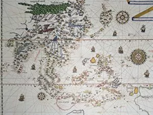
Portolan of Joan Martines (16th century). American west coasPortolan of Spanish cartographer Joan Martines (16th century). Majorcan school. American west coast (Peru, Ecuador and Colombia). 1587 Messina, Sicily
Nautical atlas (Civitate Marsilia) by Francesc Oliva II, 1658. Made up of five papers. The first paper is a chart of the Mediterranean sea and the others are portolan charts. Issued in Marseille
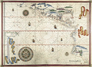
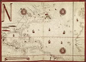
Portolan chart, 1591. Map of the North Atlantic Ocean. Miniature Painting
Portolan chart, 1587. Map of England, Scotland and Ireland with the north France coast. Realized in Messina. Facsimile. Renaissance art. Miniature Painting
Map of the Mediterranean (Add. Ms. 25691). ItMap of the Mediterranean (Add.Ms. 25691). It is probably the oldest portolan chart from the school of Mallorca ca. 1327-1330. Are represented Italy, Sicily and North Africa. Miniature Painting
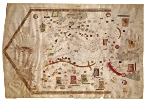
Lopo Homem (16th c. ); REINEL, Jorge (1502 - 1572)Lopo Homem (16th c.); REINEL, Jorge (1502 - 1572); REINEL, Pedro (ca. 1462 - 1542). Atlas Miller. 1519. Portolan chart, 1587. Map of Western Europe and North Africa. Printed in Messina. Facsimile
Portolan Atlas, 1587. Map which depicts a piece of land from India to the Himalayas, from Sulawesi to Papua New Guinea. Drawn in Messina. Facsimil. Miniature Painting. SPAIN. Madrid. National Library
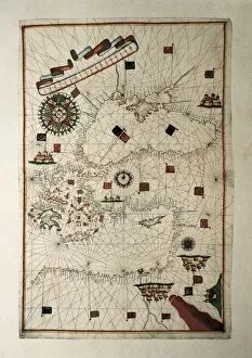
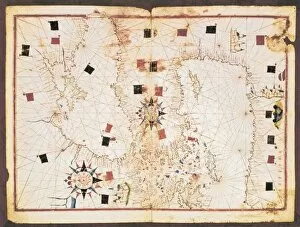
Portolan chart, 16th c. Map of the Eastern Mediterranean Sea and the Black sea. (Anonymous, it is believed to be made by Joan Martines or by his workshop). Renaissance art. Miniature Painting. SPAIN
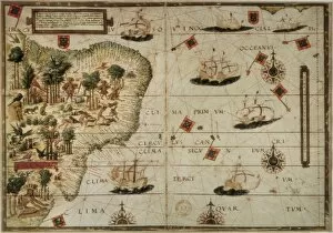
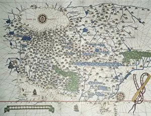
Portolan chart, 1587. Map of South America. Made in Messina. Renaissance art. Miniature Painting. SPAIN. Madrid. National Library
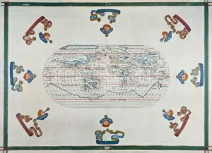
Portolan chart atlas, 1591. World map. Renaissance
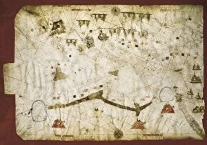
Venetian portolan chart. Anonymous, 14th c. It includes the Atlantic coast to the Middle East, and from the African coast of the Mediterranean to England and Ireland
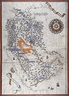
Portolan atlas, 1591. Map of the Arabian Peninsula
Portolan Atlas, 1587. Map of Asia, from Armenia, Iran, Afghanistan to the Indus River. Made in Messina. Facsimile. Miniature Painting. SPAIN. Madrid. National Library