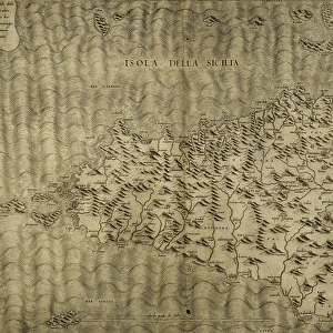
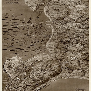
Map of Sicily by G. H. Davis

![]()
Wall Art and Photo Gifts from Mary Evans Picture Library
Map of Sicily by G. H. Davis
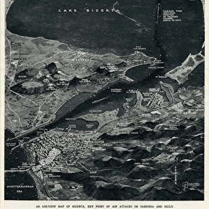
A contour map of Sicily, giving the shortest air distances from Cape Bon and Malta. At this stage in the Second World War it was a British front-line objective in Axis eyes, a target of major air attacks on Palermo and other strategic points, and the stepping stone to Italy. Date: 1943
Media ID 14133379
© Illustrated London News Ltd/Mary Evans
1943 Allied Allies Attack Attacks Axis Cape Contour Davis Distance Distances Focal Focus Ionian Major Malta Maps Mediterranean Palermo Points Sicilian Sicily Stepping Strategic Target Tyrrhenian
MADE IN THE UK
Safe Shipping with 30 Day Money Back Guarantee
FREE PERSONALISATION*
We are proud to offer a range of customisation features including Personalised Captions, Color Filters and Picture Zoom Tools
SECURE PAYMENTS
We happily accept a wide range of payment options so you can pay for the things you need in the way that is most convenient for you
* Options may vary by product and licensing agreement. Zoomed Pictures can be adjusted in the Basket.