mail_outline sales@mediastorehouse.com
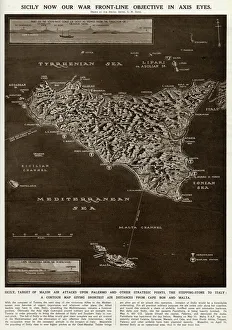
Map of Sicily by G. H. DavisA contour map of Sicily, giving the shortest air distances from Cape Bon and Malta. At this stage in the Second World War it was a British front-line objective in Axis eyes
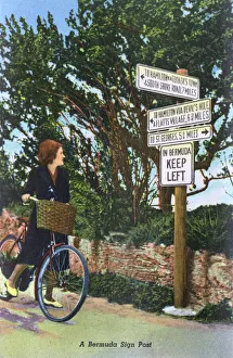
A Bermuda Sign post Date: circa 1930s
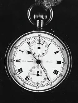
Met Police stopwatch -- inside faceA Metropolitan Police issue stopwatch for the purpose of catching speeding motorists. This method worked on the principle of timing motorists over specific distances to estimate their speed
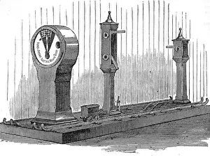
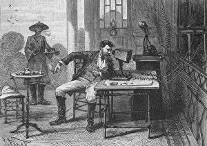
Lecture on Stephen Grays discoveries in electricityA lecture at the Charterhouse, London on Stephen Grays discoveries in electricity. In the early eighteenth century, Gray demonstrated that charges of electricity could be conducted by some materials
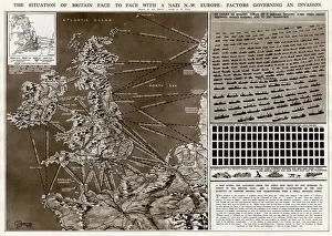
Factors governing an invasion by G. H. DavisThe situation of Britain face to face with a German north-west Europe: factors governing an invasion during the Second World War
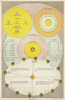
Comparative OrbitsA diagram of the relative orbit distances of planets in the Solar System and the variable light hitting the Earth during different seasons
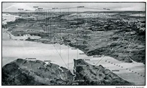
Map showing the distances between cities 1939Map showing the distance from Moscow, Danzig, Warsaw, Berlin and Venice in relation to London in order to highlight the likelihood of air raids. 1939
TELEVISION FORESEEN 1891In the coming century, we shall be able to send not only spoken words but visual images across distances of thousands of leagues ! Date: 1891
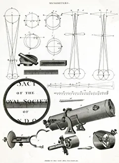
MICROMETERSA micrometer and its mechanisms, designed for measuring very small distances, objects or angles Date: 1810
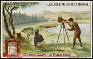
Diy HeliographA simple heliograph is easily constructed, and uses the suns rays to transmit messages, in morse code, over distances up to 100 kilometres
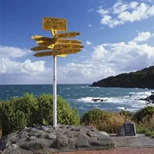
Signpost at Bluff, South Island, New ZealandThe signpost at Stirling Point, Bluff, South Island, New Zealand, showing distances to major cities around the world. Bluff is the southernmost town in New Zealand
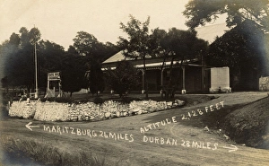
Traffic Hotel, Drummond, Natal Province, South Africa, with the distances to Pietermaritzburg and Durban written on the picture. Date: circa 1920
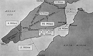
Map of the Gallipoli PeninsulaMap showing the distances separating the vital points in the Gallipoli Peninsula. The area held by the Allies is shown in a darker tone
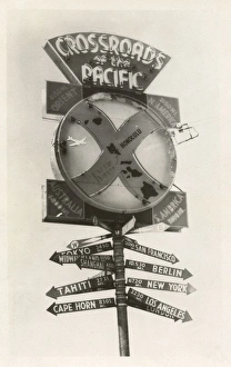
Kau Kau Korner, Honolulu, Hawaii, USASignpost at Kau Kau Korner, a drive-in restaurant in Honolulu, Hawaii, USA, also known as the Crossroads of the Pacific, showing the distances to various places such as Tokyo, Shanghai, Tahiti
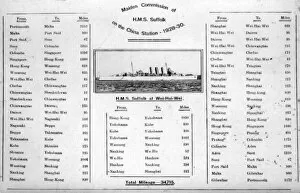
HMS Suffolk, British heavy cruiser, itinerary, ChinaHMS Suffolk (55), British County class heavy cruiser, at Wei-Hai-Wei, China Station. Giving details of her itinerary. Date: 1928-1930
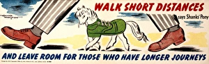
Poster, Walk Short Distances says Shanks Pony, and leave room for those who have longer journeys
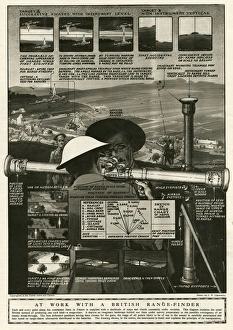
British range-finder 1918This diagram explains the usual Britsih method of producing a range chart. It depicts an imaginary landscape behind safe lines under survey prepartory to the possible contingency of an enermy
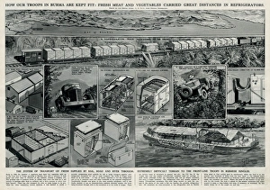
Allied troops in Burma by G. H. DavisHow the Allied troops in Burma are kept fit: fresh meat and vegetables carried great distances in refrigerators. Showing the system of transport of fresh supplies by rail
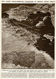
Allied occupation of French North Africa by G. H. DavisThe Allied Anglo-American occupation of French North Africa during the Second World War. A contour map of the Algerian and Tunisian coasts, with distances from Algiers to important sites
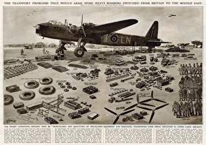
Allocation of heavy bombers by G. H. DavisThe transport problems that would arise were heavy bombers switched from Britain to the Middle East during the Second World War
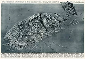
Malta, target of German bombers, by G. H. DavisA British stronghold in the Mediterranean during the Second World War: Malta, the target of German dive-bombers. The British naval and air base commanding the Sicilian Straits
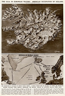
American occupation of Iceland by G. H. DavisThe USA in European waters: American occupation of Iceland during the Second World War. A detailed relief map of Iceland, its fjords and mountains, showing distances from America
Ilfracombe LighthouseLantern Rock, Ilfracombe, North Devon, England, a guiding light at the entrance the harbour, built into an old disused church. It is visible for considerable distances. Date: 1950s
Met Police stopwatch -- outer casingA Metropolitan Police issue stopwatch for the purpose of catching speeding motorists. This method worked on the principle of timing motorists over specific distances to estimate their speed
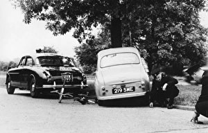
Traffic Accident Investigation officers at workMet Police Traffic Accident Investigation officers measuring distances on the road to determine speed and braking distance
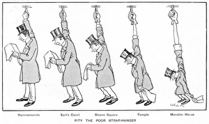
Pity the poor strap hangerAn image illustrating the introduction of hand straps on underground trains. When straps were added to underground railway carriages in the early 1900s, there was an outcry among travellers
A German telescopic field-periscopeA photograph of a German army field-periscope captured by the French army in 1916. The device, whose telescopic tube could be extended up to twenty-five meters in height
Johann Elert Bode / FrickeJOHANN ELERT BODE German astronomer Worked on relative distances between planets and the sun