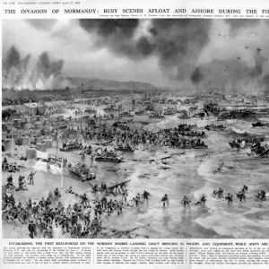
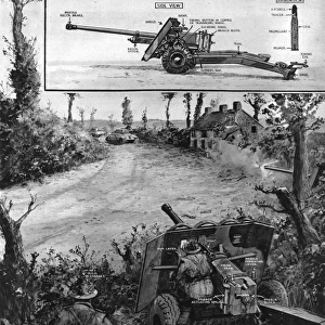
Invasion coast of Normandy by G. H. Davis

![]()
Wall Art and Photo Gifts from Mary Evans Picture Library
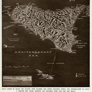
Invasion coast of Normandy by G. H. Davis
The invasion coast of Normandy, showing the terrain of operations during the Second World War. A panoramic map of the coastal regions from Cap Gris Nez to the Cherbourg Peninsula. Date: 1944
Media ID 14133465
© Illustrated London News Ltd/Mary Evans
1944 Allied Allies Cape Channel Cherbourg Coastline Davis Gris Invasion Landing Landings Maps Normandy Operations Panoramic Peninsula Regions Terrain
MADE IN THE UK
Safe Shipping with 30 Day Money Back Guarantee
FREE PERSONALISATION*
We are proud to offer a range of customisation features including Personalised Captions, Color Filters and Picture Zoom Tools
SECURE PAYMENTS
We happily accept a wide range of payment options so you can pay for the things you need in the way that is most convenient for you
* Options may vary by product and licensing agreement. Zoomed Pictures can be adjusted in the Basket.