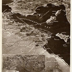
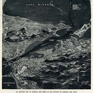
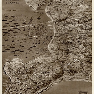
Map of Pantellaria (Pantelleria) by G. H. Davis
 by G. H. Davis")
![]()
Wall Art and Photo Gifts from Mary Evans Picture Library
Map of Pantellaria (Pantelleria) by G. H. Davis
A contour map of Pantellaria (Pantelleria), a volcanic Italian island outpost which surrendered unconditionally on 11 June 1943 -- the first loss of Italian soil to the Allies during the Second World War. It is a small island in the Strait of Sicily, between Sicily and the Tunisian coast. Date: 1943
Media ID 14133385
© Illustrated London News Ltd/Mary Evans
1943 Allies Contour Davis Gain Lava Loss Maps Mediterranean Outpost Sicily Soil Strait Success Surrender Surrendered Volcanic Volcano
MADE IN THE UK
Safe Shipping with 30 Day Money Back Guarantee
FREE PERSONALISATION*
We are proud to offer a range of customisation features including Personalised Captions, Color Filters and Picture Zoom Tools
SECURE PAYMENTS
We happily accept a wide range of payment options so you can pay for the things you need in the way that is most convenient for you
* Options may vary by product and licensing agreement. Zoomed Pictures can be adjusted in the Basket.