mail_outline sales@mediastorehouse.com
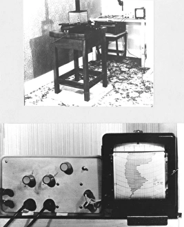
Cuttens pendulum recorder for psychical researchJohn Cuttens pendulum recorder (general view above, close-up below), for use in psychical research. This electronic device detects the movements of a pendulum which are recorded on the chart
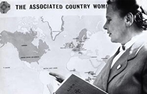
ACWW - President Geerda Johanna van Beekhoff-van SelmsMrs Geerda Johanna van Beekhoff-van Selms (1913-1998), President of the ACWW - The Associated Country Women of the World. Date: 1955
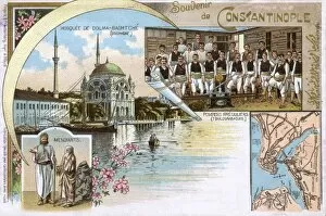
Volunteer Fire Brigade, Ortakoy Mosque, Beggars and MapIstanbul, Turkey - Volunteer Fire Brigade, Ortakoy Mosque, Beggars and Map of the City. Date: 1898
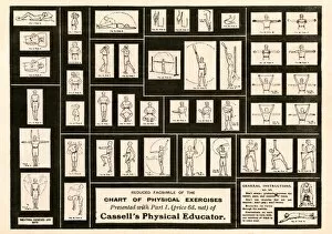
Reduced facsimile of a Chart of Physical Exercises (supplied with Cassells Physical Educator). Date: circa 1910s
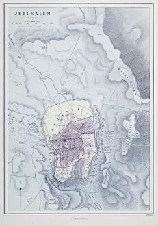
Map of Jerusalem, Israel. 19th century
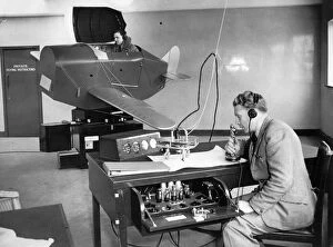
RAF Volunteer Reserve pilot undertaking instruction on a Link Trainer, Gatwick, circa 1940. By relating the position of the students aircraft to marks on a chart
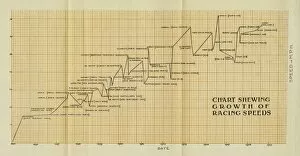
Chart shewing growth of racing speeds, 1895 to 1906 Date: circa 1906
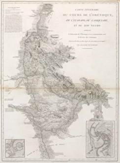
Du cours de l OrenoquePlate 16 from Atlas Geographique et Physique du Nouveau Continent (1814) by Al. de Humboldt
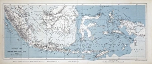
Map of the Malay ArchipelagoA map from The Malay Archipelago (1874) by Alfred Russel Wallace
Chart of oceanic section, Tenerife to SombreroA photograph taken during the voyage of H.M.S. Challenger (1872-1876) funded by the British Government for scientific purposes
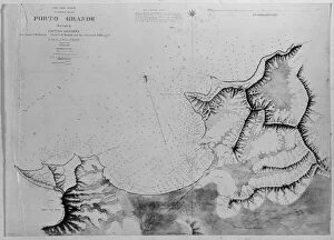
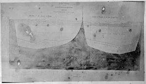
Chart of Roadstead, Porto Grande, St. Vincent, Madeira, PortA photograph taken during the voyage of H.M.S. Challenger (1872-1876) funded by the British Government for scientific purposes
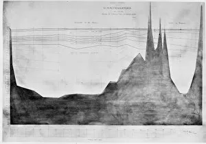
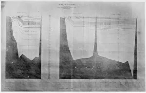
Chart of oceanic section, Bermuda to AzoresA photograph taken during the voyage of H.M.S. Challenger (1872-1876) funded by the British Government for scientific purposes
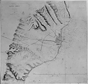
Chart of Roadstead, Santa Cruz, Tenerife, Canary IslandsA photograph taken during the voyage of H.M.S. Challenger (1872-1876) funded by the British Government for scientific purposes
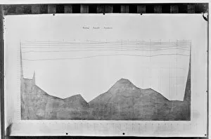
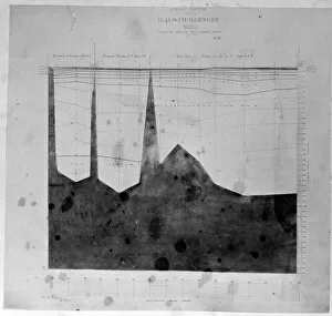
Chart of oceanic section, to St. Pauls Rocks
Chart of oceanic section, Tristan D Acunha to Cape of Good HA photograph taken during the voyage of H.M.S. Challenger (1872-1876) funded by the British Government for scientific purposes
Chart of oceanic section, Halifax, BermudaA photograph taken during the voyage of H.M.S. Challenger (1872-1876) funded by the British Government for scientific purposes
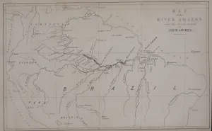
Map of the River Amazon and the Northern part of South America - from Narrative of Travels on the Amazon and Rio Negro (1853) by Alfred R. Wallace
Sydney CoveA section of Drawing LS 2 from the Watling Collection titled New South Wales, Port Jackson from the entrance up to Sydney Cove, taken in October 1788 by a Port Jackson Painter, 1788
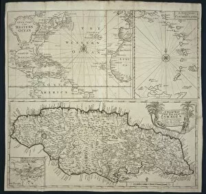
A Map of the Island of Jamaica
Eye-sketch of the harbour of Port JacksonDrawing LS 2 from the Watling Collection titled New South Wales, Port Jackson from the entrance up to Sydney Cove, taken in October 1788 by a Port Jackson Painter, 1788
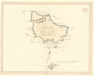
Chart of Norfolk, Nepean and Phillip IslandsDrawing 1 from the Watling Collection titled Norfolk Island by Thomas Watling, 1791
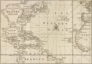
Map of Western OceanMap of the Western Ocean taken from Voyage to Jamaica (1707-25) by Sir Hans Sloane (1660-1753)
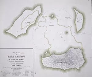
Krakatau mapFigure 1 from Krakatau by R D M Verbeek showing the group of islands
Nautical atlas (Civitate Marsilia) by Francesc Oliva II, 1658. Made up of five papers. The first paper is a chart of the Mediterranean sea and the others are portolan charts. Issued in Marseille
Portolan chart, 1591. Map of the North Atlantic Ocean. Miniature Painting
Chart of Mediterranean Sea by Petru Russu, made in Messina in 1508. SPAIN. Barcelona. Barcelona Maritime Museum. Proc: ITALY. Messina
Portolan chart, 1587. Map of England, Scotland and Ireland with the north France coast. Realized in Messina. Facsimile. Renaissance art. Miniature Painting
Map of the Mediterranean (Add. Ms. 25691). ItMap of the Mediterranean (Add.Ms. 25691). It is probably the oldest portolan chart from the school of Mallorca ca. 1327-1330. Are represented Italy, Sicily and North Africa. Miniature Painting
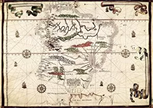
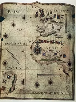
Lopo Homem (16th c. ); REINEL, Jorge (1502 - 1572)Lopo Homem (16th c.); REINEL, Jorge (1502 - 1572); REINEL, Pedro (ca. 1462 - 1542). Atlas Miller. 1519. Portolan chart, 1587. Map of Western Europe and North Africa. Printed in Messina. Facsimile
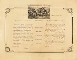
Spain. Peninsular War (1808-1814). Letter of Napolon to his brother Jos頉, king of Espa SPAIN. Madrid. Army Museum
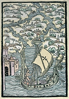
Christopher Columbus First Voyage to America" Christopher Columbus First Voyage to America (1492). Discover of the islands of Concepci Fernandina, Isabela, Salvador
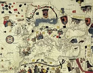
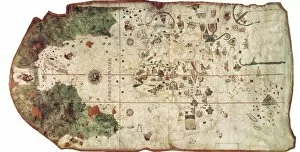
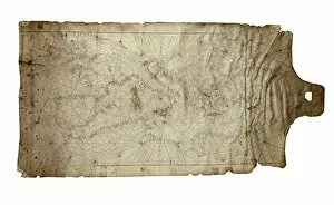
COSA, Juan de la (1460-1510). Cartographer. Nautical chart. 1500. Detail. SPAIN. Madrid. Navy Museum
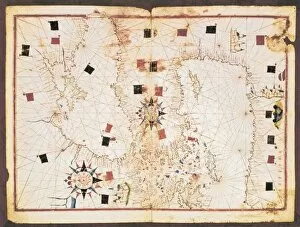
Portolan chart, 16th c. Map of the Eastern Mediterranean Sea and the Black sea. (Anonymous, it is believed to be made by Joan Martines or by his workshop). Renaissance art. Miniature Painting. SPAIN
Chart by Juan de la Cosa (1500). SPAIN. Madrid. Navy Museum
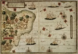
Portolan chart, 1587. Map of South America. Made in Messina. Renaissance art. Miniature Painting. SPAIN. Madrid. National Library
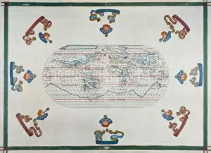
Portolan chart atlas, 1591. World map. Renaissance
Venetian portolan chart. Anonymous, 14th c. It includes the Atlantic coast to the Middle East, and from the African coast of the Mediterranean to England and Ireland
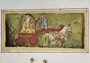
Scene of Mahabharata (18th c. ). Arjuna on a chartScene of Mahabharata (18th c.). Arjuna on a chart led by Krishna. Hindu art. Miniature Painting. FRANCE. Paris. National Library
Nautical chart depicting the West Coast of Africa, Brazil, the North Atlantic Ocean and the South Atlantic Ocean, by Jorge Reinel. 1535
Plan of Fire Guard Organisation, WW2Plan of the Fire Guard Organisation
Chronological chart of American history--Dedicated to the people of the United States by the publisher. Tree inscribed with historical events and vignettes of three Native Americans on bank
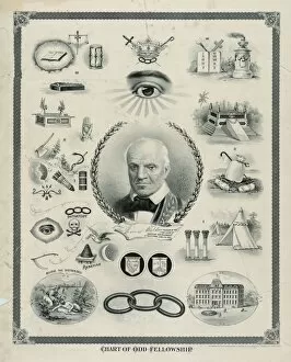
Chart of odd fellowship. Date c1895 Feb. 8
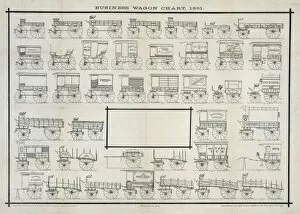
Business wagon chart, 1881. Date c1881 Aug. 24
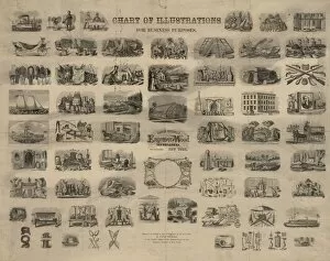
Chart of illustrations for business purposes. Date c1855
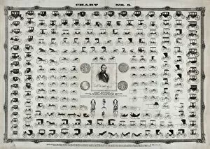
Chart no. 5
Symbolical centenary chart of American history 1876. Date c1874
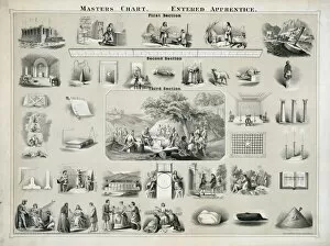
Masters chart. Entered apprentice
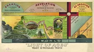
Light of ages. Chart of revealed truth. Date c1894 May 18