mail_outline sales@mediastorehouse.com
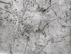
Aerial view, Hollebeke, West Flanders, Belgium, WW1Aerial view of Hollebeke, near Ypres, West Flanders, Belgium, on 28 December 1917, a front line area with snow on the ground. The crossroads with canal and railway can be seen
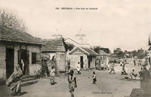
Street life in Dakar, SenegalLife in a rural street in Dakar, the capital of Senegal (then French West Africa). Date: circa 1906
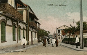
Rue de Thiong in Dakar, SenegalRue de Thiong in Dakar, the capital of Senegal (then French West Africa). Date: circa 1910s
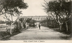
Road to the palace of Isma il Pasha in Ismailia, EgyptRoad to the residential palace of Isma il Pasha in Ismailia, a city in north-eastern Egypt. Isma il Pasha, also known as Ismail the Magnificent, was the third Khedive of Egypt from 1863 to 1879
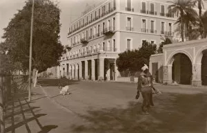
Grand Hotel in Aswan (Assuan), EgyptPerson walking on a road while two goats follow behind in front of the Grand Hotel in Aswan (Assuan), south of Egypt. Date: 1943
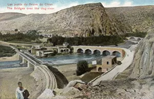
Bridges over Nahr al-Kalb (El Kelb), LebanonRailway and road bridges at Nahr al-Kalb (El Kelb) estuary, Lebanon. Nahr al-Kalb (meaning dog river ) runs from Mount Lebanon near Beirut to the Mediterranean Sea. Date: circa 1910
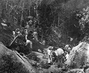
Road making on Praslin Island, SeychellesRoad making on Praslin Island, part of Dr N P Jewells remit in the Seychelles, Indian Ocean. 1912-1914
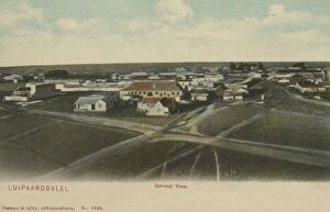
Luipardsvlei, Krugersdorp, Transvaal, South AfricaLuipaardsvlei (Luipardsvlei), a suburb of Krugersdorp, a gold mining town in Transvaal (now Gauteng), South Africa. Date: circa 1905
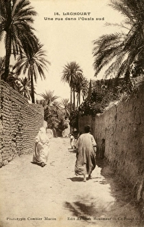
A road in the south of the Oasis, LaghouatPeople walk down a road in the south of the Oasis, Laghouat Date: circa 1910s
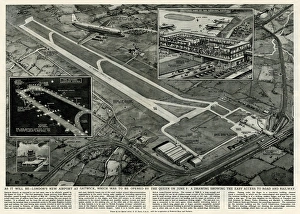
New Extended Gatwick Airport, South London 1958Illustration by George Horace Davis, showing the transport links by road and railway to the new extended international Gatwick airport, and the 7000ft long runway with reflective lights
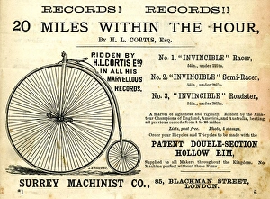
Advertisement, Surrey Machinist Co, Blackman Street, London, depicting a pennyfarthing bicycle. 1883
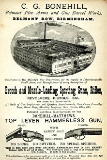
Advertisement, C G Bonehill, BirminghamAdvertisement, C G Bonehill, Belmont Row, Birmingham, Guns and Rifles. 1890s
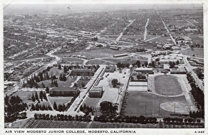
Aerial view, Modesto, Stanislaus County, California, USAAerial view over Modesto Junior College, Modesto, Stanislaus County, California, USA. Date: circa 1940
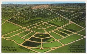
Aerial view of Marion, Ohio, USA, including a planned new town called Vernon Heights. Date: 1922
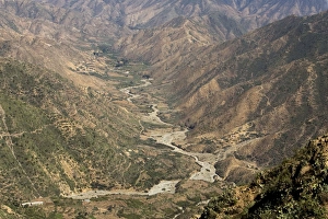
Valley - Seen from the old road from Asmara to Massawa, built by Italians during colonialism. Eritrea - Africa
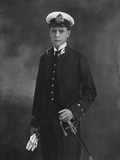
Prince Albert as a midshipman in the Royal NavyH.R.H. Prince Albert, the second son of King George V, and himself later King George VI (1895-1952), as an officer of the Collingwood of the First Battle Squadron
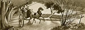
Man in a Horse-Drawn CartA 19th century man with a top hat on riding a horse drawn cart through a lane. The man has come out of a part of the road which is surrounded by trees
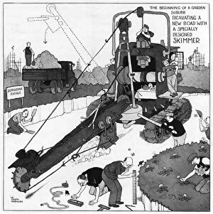
The Gentle Art of Excavating - a specially designed skimmerThe beginning of a garden suburb. Excavating a new road with a specially designed skimmer, a typically rickety contraption from the inventive mind of gadget king, William Heath Robinson. Date: c.1938
Old Chester RoadThe Old Chester Road, now a very modern one, Bebbington, Wirral, Merseyside, England. Date: 1950s
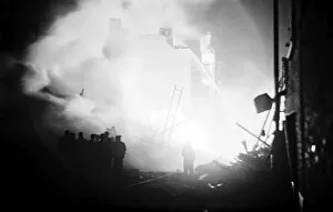
V1 (flying bomb) attack in Poplar, East London, WW2In June 1944 the first flying bombs were launched against London, and between 2 and 3 August 107 flying bombs hit London targets
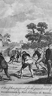
Highwaymen punishedA new plan is proposed fo the punishment of highwaymen by hard labour on the roads. Date: 18th Century
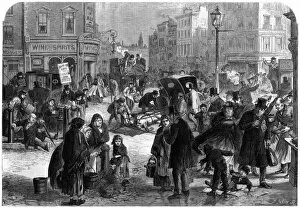
Frost in London, 19th centuryA touch of frost in London brings chaos to the streets, with horses slipping on the icy surfaces. Date: 1865
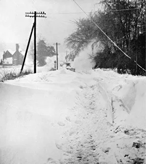
Snow blocked road in Kent, 1963A snow plough bulldozes its way through deep snow on Westerham Hill in Kent on a road that had been impassable for days during the very cold conditions of the winter of 1963
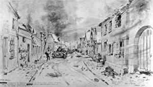
The Battle in Susteren; Second World War, 1945Sketch showing a battle between British infantry (in buildings on right) and German tanks (on left) in the town of Susteren, Holland, 1945
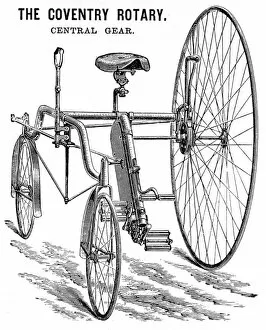
Advertisement for a Rudge Coventry Rotary Tandem Tricycle, 1Advertisement showing the Coventry Rotary Tandem, built by D. Rudge & Co. of Coventry, 1885. An example of this machine, it was claimed, had travelled over 230 miles on roads with 2 inches of mud
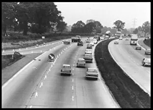
M1 MotorwayA section of the M1 motorway from London to the north : characteristically, road works are in evidence
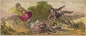
Spill on a Rural RoadThe uneven surfaces of rural roads, interacting with the inherent instability of the bicycle, are, alas, apt to cause occasional regrettable mishaps such as this
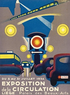
Traffic Exposition 1934Poster for the EXPOSITION DE LA CIRCULATION held at Liege, Belgium
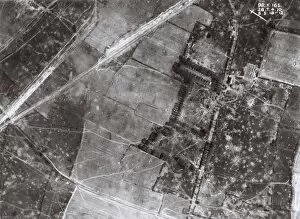
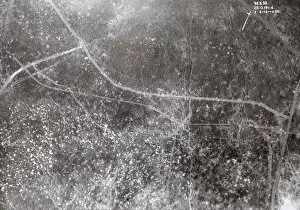
Aerial view near Kemmel, West Flanders, Belgium, WW1Aerial view of a shelled area south-east of Kemmel Hill, a front line area near Ypres, West Flanders, Belgium, on 8 May 1918. Date: 1918
Aerial view, Wytschaete, West Flanders, Belgium, WW1Aerial view of the ruined village of Wytschaete, a front line area near Ypres, West Flanders, Belgium, on 7 May 1918, showing damage from shelling. Date: 1918
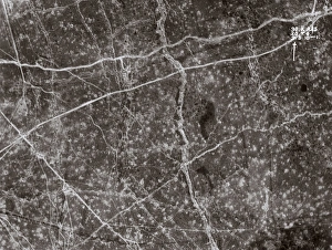
Aerial view near Messines, West Flanders, Belgium, WW1Aerial view of a shelled area east of Messines, a front line area near Ypres, West Flanders, Belgium, on 9 May 1918. Date: 1918
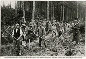
German prisoners making a road in southern England 1917Some 102, 000 German prisoners making a road through the woods in a picturesque corner of southern England, where they are building their own camp. 1917
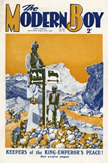
The Modern Boy front cover - the Khyber PassFront cover of The Modern Boy magazine featuring a photograph of roads around the Khyber Pass with a signpost pointing in one direction for cars and another for camels and horses
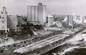
General view of Vedado, Havana, Cuba. On the right is the Memorial to the Victims of the USS Maine, built in honour of the American sailors who died in an explosion
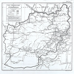
Road Communications in Afghanistan. Sketch No 1. Map showing details of railways, roads and telegraph lines. Published by General Staff, India, February 1939
Britain?s Second Front roads are widenedPhotograph: Britain?s Second Front roads are widened. Important: these pictures must not be published until D-Day. Many roads in many parts of Britain have been extensively widened
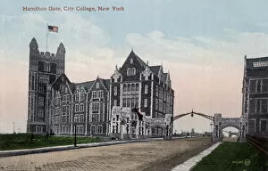
Northern Campus of the City College in New York CityShepard Hall and Hamilton Gate at the Northern Campus of the City College in Harlem (Manhattan) - New York City, USA. Date: circa 1908
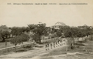
S駯u, SenegalView of the administration district in S駯 u, a village near the southern border of Senegal (then French West Africa), with a line of people carrying baskets on their head following the road
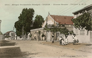
A. O. F. Theatre at Avenue Roume in Dakar, SenegalA. O. F. (Afrique occidentale fran硩 se) Theatre at Avenue Roume with women carrying bowls and baskets on their heads in Dakar, the capital of Senegal (then French West Africa). Date: circa 1910
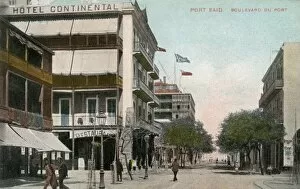
Hotel Continental in Port Said, EgyptHotel Continental in Port Said in north-eastern Egypt, on the shore of the Mediterranean Sea and on the western bank of the Suez Canal. Date: circa 1910
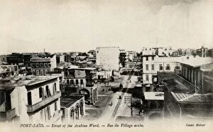
Street of the Arabian District in Port Said, EgyptGeneral view over Port Said in north-eastern Egypt, on the shore of the Mediterranean Sea and on the western bank of the Suez Canal, with the Street of the Arabian District in focus. Date: circa 1910
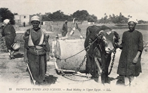
Traditional road making in Upper EgyptTwo construction workers and ox-drawn road roller in Upper Egypt. Date: circa 1910s
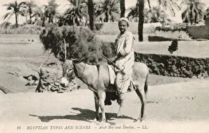
Native boy riding a donkey in EgyptNative boy riding a donkey in rural Egypt. Date: circa 1910s
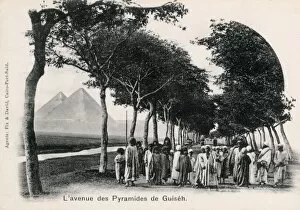
Avenue to the Pyramids of Giza, EgyptGroup of mostly children standing on an avenue leading to the pyramid complex in Giza, Egypt, which can be seen in the background. Date: circa 1905
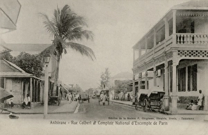
Rue Colbert in Antsirabe, MadagascarRue Colbert and Comptoir National d Escompte de Paris in Antsirabe, central Madagascar. Date: circa 1908
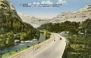
Valley leading to Rabwey near Damascus, SyriaValley leading to the village Rabwey near Damascus, Syria. Date: circa 1910
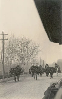
Firewood vendors on the road in Damascus, SyriaFirewood vendors transporting their goods on the road in Damascus, Syria. Date: circa 1915
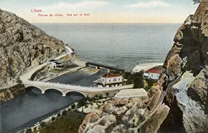
Nahr al-Kalb (El Kelb) estuary, LebanonEstuary of Nahr al-Kalb (El Kelb) into the Mediterranean Sea, north of Beirut, Lebanon. Nahr al-Kalb (meaning dog river ) has its source in Mount Lebanon. Date: circa 1910