mail_outline sales@mediastorehouse.com
Falkland Islands Royal Engineer briefing map, 1982 (c); with typescript annotations relating to the condition and passibility of airfields, roads and tracks by tracked and wheeled vehicles
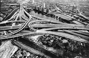
Spaghetti JunctionSPAGHETTI JUNCTION Aerial view of the famous tangle of roads known collectively as " Spaghetti Junction", Birmingham, England. Date: 1970s
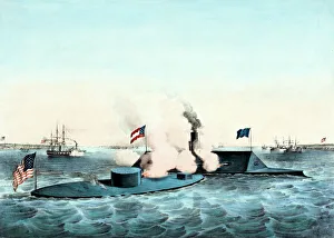
USS Monitor and CSS Virginia ironclad naval battleTerrific Engagement Between the USS Monitor with 2 Guns, and the CSS Virginia (aka Merrimac) with 10 Guns, in Hampton Roads, March 9th 1862. The First Fight between Ironclad ships of War
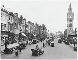
High Row, Darlington, County DurhamA view of High Row in Darlington, County Durham, showing a clock tower, traffic and shops
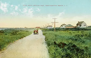
Westhampton beach, Long IslandDune road looking east, Westhampton beach, Long Island, New York
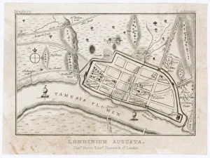
London Map / Roman PeriodMap showing Roman London (Londinium) with its grid of straight roads
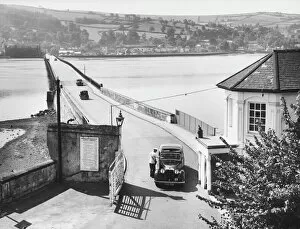
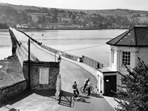
Teignmouth-Shaldon TollThe Teignmouth-Shaldon Toll Bridge, over the River Teign, Devon, England
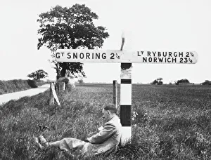
Great SnoringA signpost pointing to the village of Great Snoring, North Norfolk, England, has clearly effected the man beneath it!
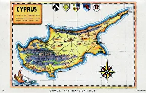
Map of Cyprus - The Island of Venus. circa 1930s
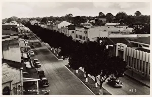
Cecil Avenue, Ndola, Northern Rhodesia, South Central AfricaAerial view of Cecil Avenue, Ndola, Northern Rhodesia (now part of Zambia), South Central Africa. Date: 1940s
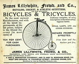
Advertisement, Bicycles & TricyclesAdvertisement, James Lillywhite, Frowd and Co, Bicycling, Cricket and Athletic Outfitters, Bicycles and Tricycles. 1880s
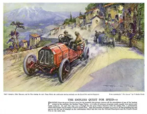
Autocar Poster -- Targa Florio race, SicilyAutocar Poster -- Italian champion Felice Nazzaro driving the Fiat car in which he won the Targa Florio race in Sicily. His average speed for the race was around 33 mph on gruelling mountain roads
Teignmouth-Shaldon TollThe Teignmouth-Shaldon Toll Bridge, over the River Teign, Devon, England. Date: 1950s
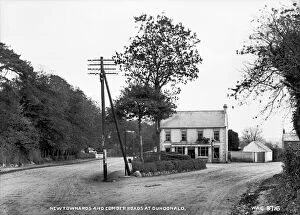
Newtownards and Comber Roads at Dundonald - a view of the Y road junction with building at the crossover. (Location: Northern Ireland; County Down; Dundonald). Date: circa early 1900s
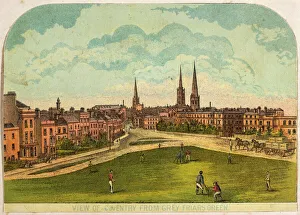
Cricket in CoventryCricket played on Grey Friars Green, Coventry
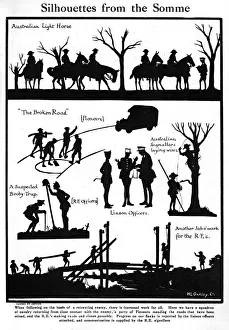
Silhouettes from the Somme by H. L. OakleyVarious scenes on the Somme cut by famous silhouette artist, Captain H. L. Oakley showing the work to be done when pursuing the retreating Germans
Dulwich Toll GateLondons last Toll Gate. Set in sylvan surroundings, at College Road, Dulwich, south London, it is on property belonging to Dulwich College. Date: 1950s
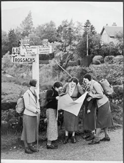
Hikers by Signpost / 1935Feminine rambling fashions of 3/4 length tweed or checked skirts worn with matching or contrasting jackets. Stockings or ankle socks are worn with various styles of shoe
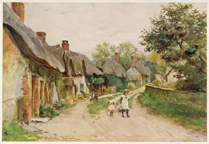
Dorset / Moreton / TalbothayA typical village lane at Moreton, Dorset, model for the village near Talbothays in Thomas Hardys novel Tess of the d Urbervilles
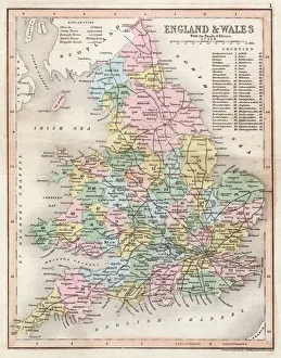
Map / England & Wales 1857Map of England and Wales showing roads and rivers Date: circa 1857
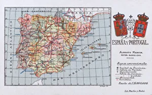
Map of the Kingdoms of Spain and Portugal (prior to the Portuguese Revolution in 1910). Date: circa 1908
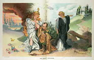
The Russian cross-roads. Illustration shows a diminutive Nicholas II, Emperor of Russia, wearing a fur robe, courting Medusa who is hiding behind the mask of a beautiful young woman; on the left
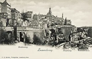
Luxembourg City - PanoramaPanoramic View of Luxembourg City with the Castle Bridge (right) and the New and Broad roads at the base ( New ) and the top ( Broad ) of the Castle Mount
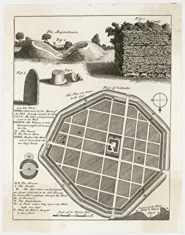
Plan of Silchester / 1777A plan and details from the well-preserved Roman town of Silchester (Calleva Atrebatum). The entire circuit of the town wall, and bowl of the amphitheatre have survived
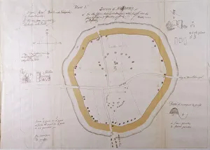
Aubreys Plan of AveburyJohn Aubreys plan of Avebury. Aubrey was an English antiquary, who suplimented his writings on sites with detailed plans and sketches
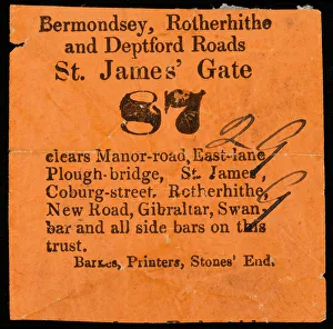
Tollgate TicketTollgate ticket for St James Gate, for the Bermondsey, Rotherhithe and Deptford Roads, Southeast London - probably abolished in 1864 along with many others
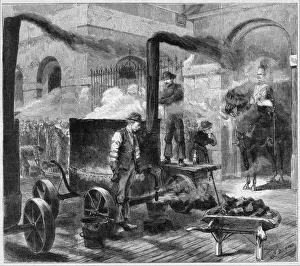
Road Works in Whitehall, London, 1882Engraving, originally entitled Horse Guards under Fire again, showing a group of workmen re-surfacing the road in Whitehall, London, 1882
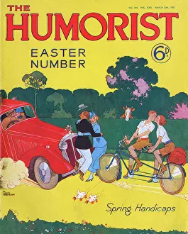
The Humorist - Easter Number front cover, Heath RobinsonSpring Handicaps. Front cover of The Humorist magazine featuring a glorious cartoon by William Heath Robinson showing the chaos created on the roads by spring romances. Date: 1937
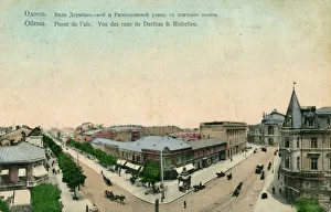
Odessa, Ukraine - Deribas and Richelieu Streets - partial aerial view. Date: 1909
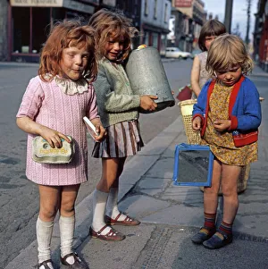
Hands Full. Southbank Middlesbrough 1970s 1970s
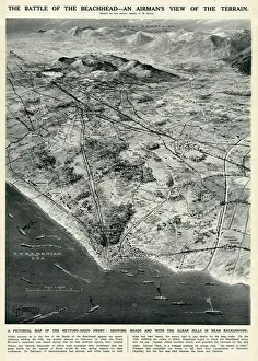
Nettuno-Anzio Front, Italy, by G. H. DavisThe battle of the beachhead -- an airmans view of the terrain. A pictorial map of the Nettuno-Anzio Front, showing roads, with the Alban Hills in the background
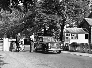
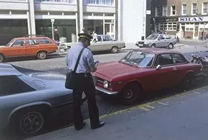
Traffic WardenA London traffic warden issuing a parking ticket to a hapless motorist. Not a popular profession. Date: 1980
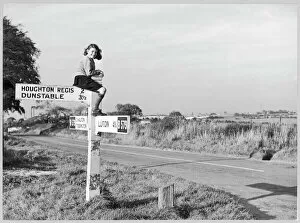
Bedfordshire road signs 1950A girl in sturdy shoes and long socks, probably school uniform, perches on top of a signpost by the B579 road near Chalton in Bedfordshire
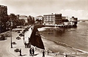
Avenue des Francais in Beirut (Beyrouth), Lebanon, with the Orient Hotel on the left and the New Royal Hotel, the Kit Kat club and the St. Georges Hotel in the background on the right
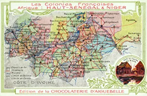
Senegal and Niger, French Colonies in Africa - Map showing main transport routes. Date: circa 1909
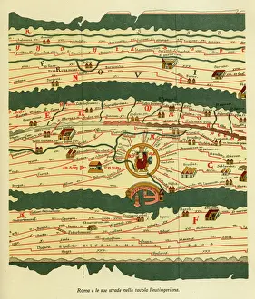
Rome and its roads from the Peutinger table, 13th century BCE Date: 13th century BCE
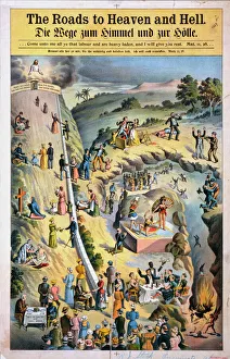
The roads to Heaven and Hell. People taking the road to Heaven by helping the poor, praying, etc. and others taking the road to Hell by drinking, being violent and engaging in other activities
Female Traffic WardenA female traffic warden in Chelsea, London, issuing a parking ticket to an unfortunate motorist. Date: late 1960s
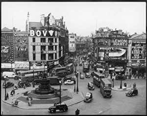
Piccadilly Circus 1950SPiccadilly Circus street scene, with huge billboards advertising Bovril, Wrigleys and Craven A cigarettes amongst others
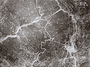
Aerial view of trenches, West Flanders, Belgium, WW1Aerial view of front line trenches near Kemmel and Wulvergem, West Flanders, Belgium, on 8 May 1918. Date: 1918
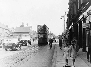
South London high street, late 1940sAn unidentified street somewhere in London, but as the tram is heading for Wandsworth and the van to the left of the picture is based in Streatham Hill, its likely to be in South London. 1940s
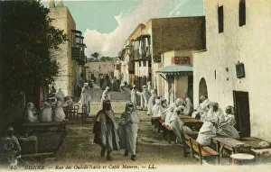
Rue des Ouleds-Naדּand Moorish cafes, BiskraThe busy street of Ouleds-Naדּ, Biskra, lined with several Moorish cafes. Date: circa 1910s
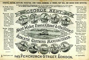
Advertisement, George Kent Athletic ClothingAdvertisement, George Kent Shirt Maker, Hosier, Glover & Outfitter, Athletic Clothing Manufacturer, Fenchurch Street, London. 1900
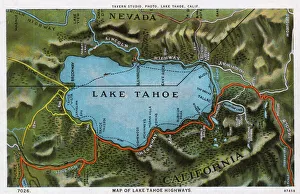
Map of the Lake Tahoe area, Nevada and California, USA, showing the highway system. Date: 1922
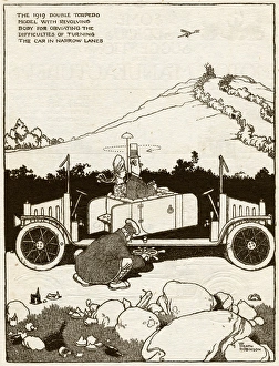
Three point turns by W H RobinsonNo need for three point turns, with this double torpedo model with revolving body for obviating the difficult of turning the car in narrow lanes. 1919
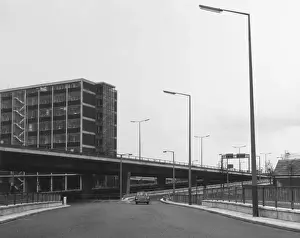
Mancunian Way FlyoverThe newly-built Manchunian Way flyover, Manchester, England, part of the M6 motorway network. Date: 1960s
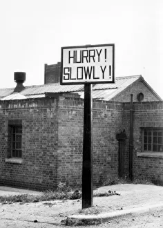
HURRY! SLOWLYHurry! Slowly! This curiously worded signpost is to be seen by the roadside near Ashby-de-la-Zouche, Leicestershire, England. It warns of a open Level Crossing Date: 1950s
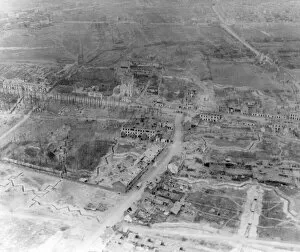
Aerial photograph of ruined suburbs, Arras, France, WW1Aerial photograph (Canadian) of the ruined suburbs of Arras in northern France, taken from a kite balloon during the First World War. Date: November 1917