mail_outline sales@mediastorehouse.com
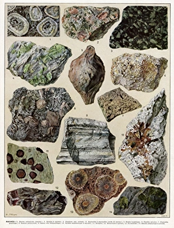
Roche - rocksVariety of rocks including graphite and basalt. Date: 1930
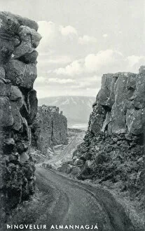
Location of Parliament Plains and First National Park in Iceland Date: circa 1930
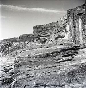
Cornish rock faceClose up of a Cornish rock face. circa 1946
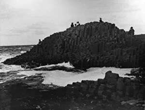
Giants Causeway, County Antrim, Northern Ireland. Date: circa 1900s
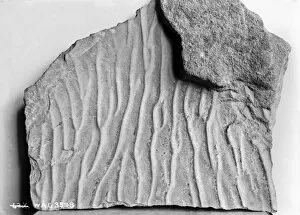
View of an unidentified geological specimen. (Location: Ireland). Date: circa early 1900s
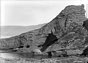
Coastal scene showing some geological feature on the sandstone escarpment down to the sea. (Location: Ireland). Date: circa early 1900s
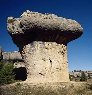
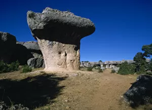
Spain. Cuenca. Enchanted City
Spain. Castile-La Mancha. Ciudad Encantada (Enchanted City). Province of Cuenca
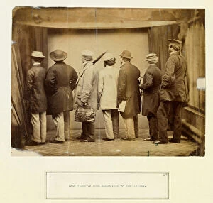
Geologists of the 1860 sc.1860 s. From collection of manuscript material by Benjamin Waterhouse Hawkins, donated by his granddaughter Mary Hawkins Date: circa 1860
Thomas Sopwith (1803-1879) & geological modelsThomas Sopwith (1803 - 1879) was an eminent geologist and civil engineer who pioneered methods of representing geological features
Sopwith Model XII: Denudation of mineral veinsThis model shows the influence of surface denudation and faulting on inclined strata, with increased complexity to the situation in Model VII
Sopwith Model VII: Surface denudation of veinsThis model shows the influence of surface denudation and faulting on otherwise flat, horizontal strata. The discontinuity between the beds as viewed at the surface can be seen
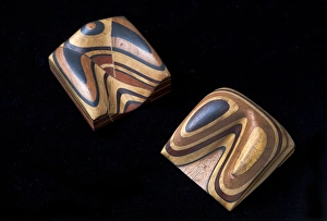
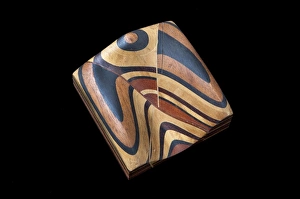
Sopwith Models: denudation & faultingModels showing the effect of denudation and faulting on how rock strata appear at the surface. Thomas Sopwith (1803 - 1879)
Sopwith Model II: Coal strata near NewcastleUnlike the models of generic situations this representation of coal strata was specific to a particular surveyed location in England showing several thin, and mostly hidden, coal seams
Sopwith Model VII: Denudation of mineral veinsThis model shows the influence of surface denudation and faulting on otherwise flat, horizontal strata. The discontinuity between the beds as viewed at the surface can be seen
Sopwith Model VI: Intersecting mineral veinsThis Model, rather than representing the strata as they would appear at the surface, shows how a seam of coal can be displaced in the subsurface by various modes of faulting
Sopwith Model XI: Vertical intersecting veinsThis model, when separated, shows the complex interface between faulted strata of rocks. Thomas Sopwith (1803 - 1879) was an eminent geologist
Sopwith Model XII: Mineral vein denudationThis model shows the influence of surface denudation and faulting on inclined strata, with increased complexity to the situation in Model VII
Sopwith Model VIII: Overcutting of strataThis model shows overcut strata: when the layers of rock are inclined at a gentler angle than the eroded slope, the resulting vee pattern points uphill
Sopwith Model VII: Surface denudationThis model shows the influence of surface denudation and faulting on otherwise flat, horizontal strata. The discontinuity between the beds as viewed at the surface can be seen
Sopwith Model X: Denuded basset of strataThis model shows undercut strata: when the layers of rock are inclined at a steeper angle than the eroded slope, the resulting vee pattern points downhill
Sopwith Model V: Dislocations of coal strataThis model shows that while very little coal may appear at ground level, coal seams (subject to faults and dislocations) can be found below the ground
Sopwith Model IV: Fallacious coal indicationsThis model depicts the scenario where from the surface an abundance of coal appears to exist, but there is actually very little quantity below
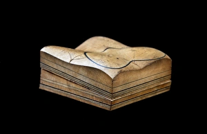
Sopwith Model III: Dislocation of strataThis model represents the side of a valley of denudation, with undisturbed horizontal beds of sedimentary rock when fully assembled
Sopwith Model I: Stratified rocks / denudationBlack lines in this model represent coal seams, between lighter shales and sandstones. When separated the lower section shows a gently inclined valley floor
Sopwith Model II: Coal strata nr NewcastleUnlike the models of generic situations this representation of coal strata was specific to a particular surveyed location in England showing several thin, and mostly hidden, coal seams
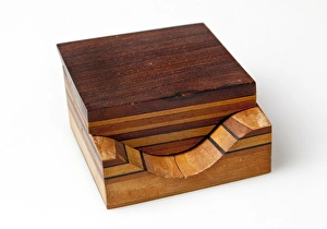
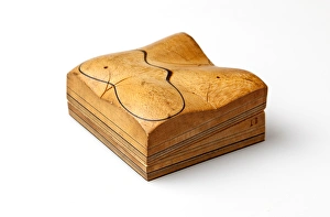
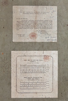
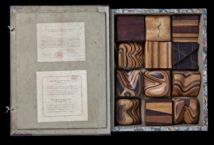
Cover of Thomas Sopwiths Geological Model SetThomas Sopwith (1803 - 1879) was an eminent geologist and civil engineer who pioneered methods of representing geological features
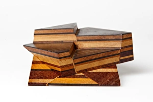
Thomas Sopwiths Geological Model SetThomas Sopwith (1803 - 1879) was an eminent geologist and civil engineer who pioneered methods of representing geological features
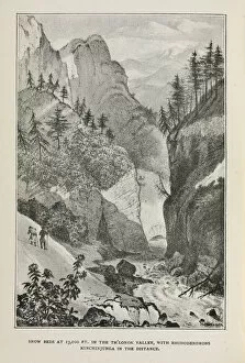
Snow beds in the Th lonok Valley, HimalayasLithograph from Himalayan Journals by Joseph Dalton Hooker
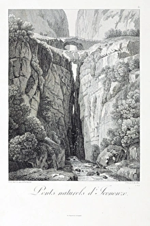
The natural arches of Icononzo, BoliviaEngraving of a sketch by Alexander Humboldt, 1810, of the natural geological formations that provide a crossing for the deep canyon Date: 1810
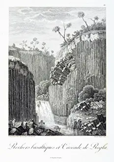
Tequendama Falls, ColombiaEngraving of a sketch by Alexander Humboldt, 1810 Date: 1810
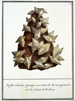
Plate 25 from Mineralogie Volume 1 (1790)Spath calcaire groupes sur mine de Fer en pyramide. Tire du Cabinet de Mr d Orcy. From Recuille complet de Mineralogie vol.1 (1790) by F.L. Swebach Desfontaines. Date: 1790
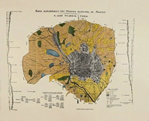
VILANOVA i PIERA, Joan (1821-1893). Agronomic map of Madrid municipal area. SPAIN. MADRID (AUTONOMOUS COMMUNITY). Madrid. Instituto Geol o y Minero de Espa
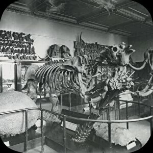
North Geological Room - MegatheriumBlack and white lantern slide capturing image of the British Museums North Geological Room with a megatherium skeleton in the centre
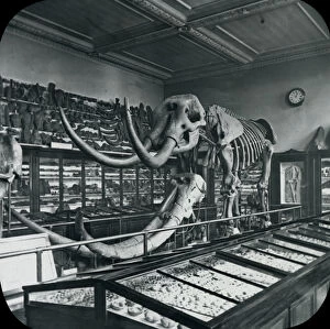
North Geological Room - Mastodon (British Museum)Black and white lantern slide capturing anterior view of the British Museums North Geological Room with a Mastodon skeleton in the centre
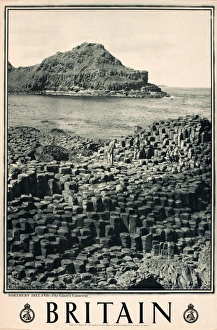
Britain poster, Northern Ireland, The Giants Causeway, for The Travel Association. Date: circa 1948
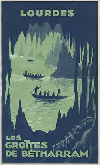
Lourdes, France - The Betharram Caves Date: circa 1920s
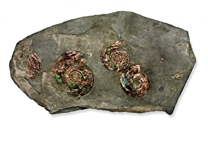
Psiloceras planorbis, nacreous ammoniteThese specimens of Psiloceras planorbis are Britains earliest ammonites. Part of the William Smith collection
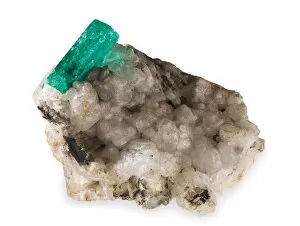
EmeraldPossibly from the collection of Rt Hon Charles Greville in 1810. Emerald is a variety of beryl (beryllium aluminum silicate). The green colour attributed to small amounts of chromium
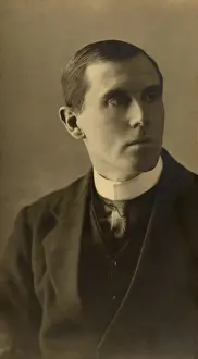
William Dickinson Lang (1878-1966)Photograph of W.D. Lang. Archive reference PH/10/13
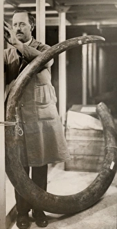
The largest mammoth tusk, 1931A mammoth tusk from Siberia, nearly 14 feet long, just presented to the Natural History Museum, South Kensington, is believed to be the largest yet known. It is the gift from the Rowland Ward Trustees
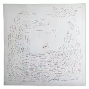
Woodward Tablecloth
Mineralogy corridorThe mineralogy department within the Natural History Museum