mail_outline sales@mediastorehouse.com
William Smith Geological Map
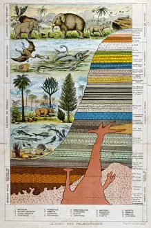
Geological Strata 19CA schematic representation of geology and palaeontology
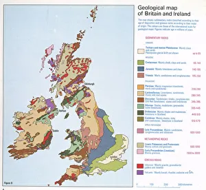
Geological map of Britain and IrelandFig 9 from Britain Before Man (1978), a Geological Museum publication
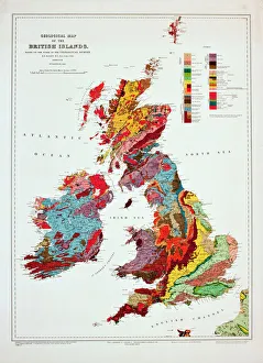
Geological map of the British Islands. 1941
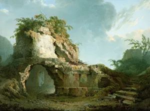
Virgils Tomb (1785). Wright, Joseph of Derby 1734-1797. Wright travelled in Italy from 1774-76 and produced many fine drawings of classical subjects and geological curiosities
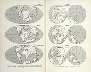
Continental drift mapsReconstruction of the map of the world for three periods according to the Displacement Theory. Figs 1-2 from The Origin of Continents and Oceans (1924) by Alfred Wegener
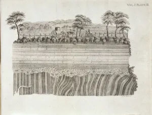
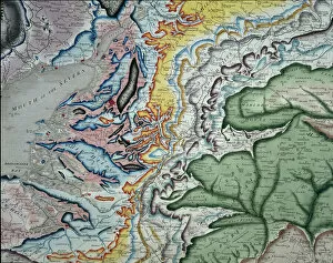
Geological unconformity on the river Jed. Plate 3 from Theory of the Earth (1795) Vol. 1, by James Hutton
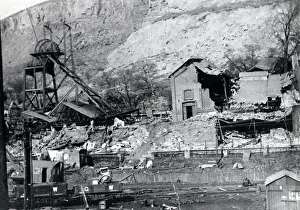
New Tredegar Colliery, Rhymney Valley, South WalesAn engine house damaged by subsidence at New Tredegar Colliery, Rhymney Valley, South Wales. This colliery suffered from many landslips and other geological problems, and eventually closed in 1930
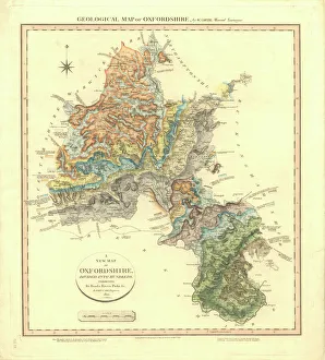
Geological Map of OxfordshireDelineation of Strata of Oxfordshire by William Smith
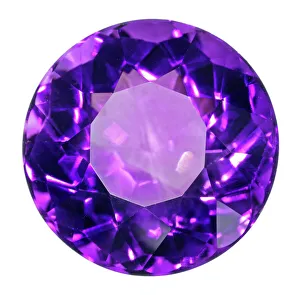
Birthstone Series: Amythest QuartzAn Amythest quartz specimen. Amythest is a form of quartz that is usually purple in colour, it is the birthstone for the month of March. Natural History Museum specimen number 84817
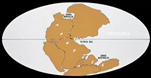
Continental DriftThe world 200 million years ago in Upper Triassic times, showing the single continent of Pangaea and the universal ocean, Panthalassa
William Smiths geological mapPart of William Smiths geological map of Great Britain, published in 1815
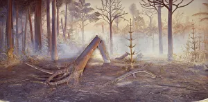
Coal forest dioramaA diorama of a Carboniferous coal forest (354 to 290 million years ago) previously on display at the former Geological Museum which is now part of the Natural History Museum, London
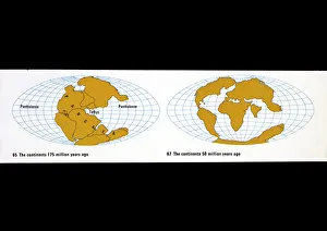
Continental drift diagramsA) The continents 175 million years ago. B) The continents 50 million years ago. Figs 65 & 67 from The Age of the Earth. See also < a href= http://piclib.nhm.ac.uk/results.asp
Continental Drift5 diagrams illustrating the positions of the continents 380 mya, 200 mya, 135 mya, 50 mya and the present
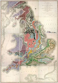
William Smiths Geological MapFig. 6 from Delineation of Strata of England and Wales (1815) by William Smith
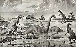
Dinosaurs of the Mesozoic Era - ChinaAn artificial reconstruction by Neave Parker (with the co-operation of Dr. W. E. Swinton) of Dinosaurs of the Mesozoic Era found in China especially in the Provinces of Kansu and Szechuan
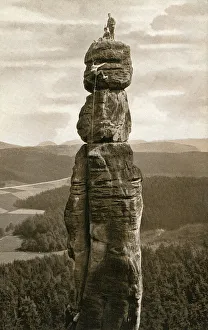
The Barbarine - first climbed 1905 - GermanyThe Barbarine - the best-known, free-standing rock formation in the German part of the Elbe Sandstone Mountains. The pinnacle is the symbol of Saxon Switzerland
The Jurassic Coast of Lyme Regis, Dorset
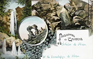
Sliven, Bulgaria - The Sinite Kamani rocksSliven, Bulgaris. The famous rocky massif Sinite Kamani ( The Blue Rocks ) and the associated national park, the fresh air and the mineral springs offer diverse opportunities for leisure and tourism
Henry De LA BecheSir Henry Thomas DE LA BECHE Distinguished geologist, responsible for the Geological Ordnance Survey, and for the institution which would grow into the Geological Museum
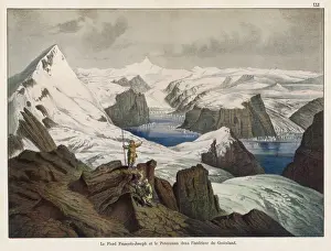
Franz Josef Fjord and Peterman Mountain, GreenlandView of the Franz Josef Fjord (named after the Emperor who helped to fund an expedition there) and the Peterman Mountain, with glacier, in north eastern Greenland
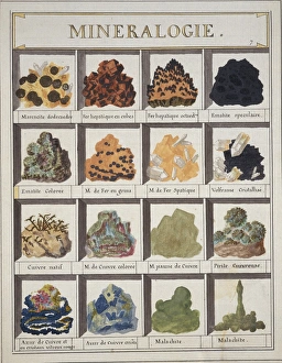
Plate 7a from Histoire naturelle? (1789)Plate 7a, Mineralogie [unfinished] from Histoire naturelle: ou, Exposition des morceaux, les mieux choisis pour servir? (1789) by by Swebach Desfontaines
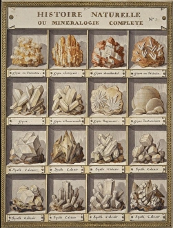
Plate 1 from Histoire naturelle? (1789)Plate 1 Histoire Naturelle ou Mineralogie Complete, from Histoire naturelle: ou, Exposition des morceaux, les mieux choisis pour servir? (1789) by by Swebach Desfontaines
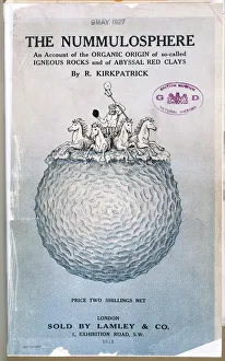
The Nummulosphere Part I. Front CoverAn account of the organic origin of so-called igneous rocks and of abyssal red clays by Kirkpatrick, Randolph (1863-1950), London. 1913
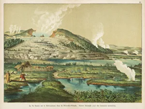
Te Tarata hot springs, Rotomahana, New ZealandView of the Te Tarata hot springs by Lake Rotomahana, North Island, New Zealand -- thermal springs with encrusted terraces
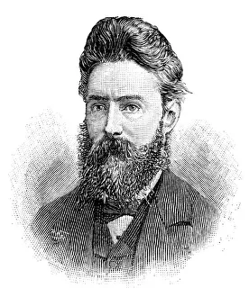
Thomas Davies, mineralogistThomas Davies (1837 - 1892), Mineralogist at the British Museum and Fellow of the Geological Society. Date: C.1890
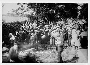
Geologists at PiltdownGeologists Association party visiting the pit at Piltdown on 12 July 1913
Glacial rock, Halifax 1873A photograph taken during the voyage of H.M.S. Challenger (1872-1876), funded by the British Government for scientific purposes
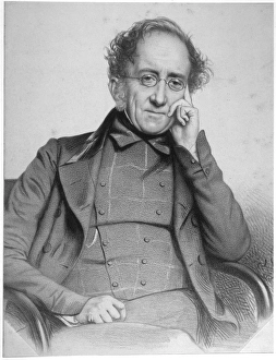
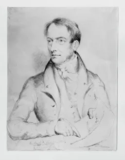
William Daniel Conybeare (1787-1857)Portrait of William Daniel Conybeare, a distinguished English geologists. Drawing, charcoal on paper, artist unknown, c. 1824. Original held at the Natural History Museum, London
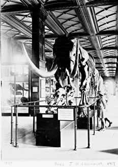
Mastodon in Geological Gallery, December 1919The Guide Lecturer, John Henry Leonard, took this shot of two girls inspecting a primitive elephant or mastodon (Mammut americanus), in December 1919
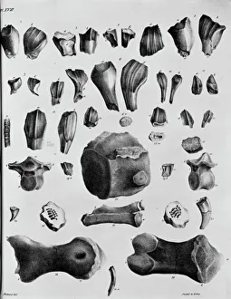
Plate 17. Mantells Geology of SussexPlate 17 from Illustrations of the Geology of Sussex, 1827 by G. A. Mantell
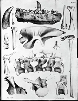
Plate 19. Mantells Geology of SussexPlate 19 from Illustrations of the Geology of Sussex, 1827 by G. A. Mantell
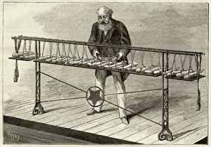
Piano De Silex - 1Honore Baudres geological piano uses a series of selected stones, each of which emits a different note when struck
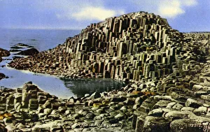
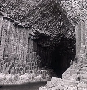
The Giants Causeway, County Antrim, Northern IrelandThe Giants Causeway - The Honeycomb - 40, 000 interlocking basalt columns on the coast at County Antrim, Northern Ireland. Date: circa 1930s
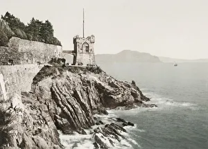
Vintage 19th century photograph: Gropallo Tower, Nervi Genoa, Genova, Italy
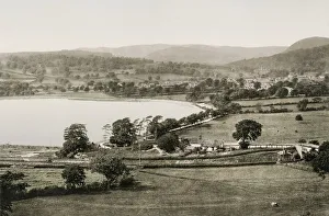
Vintage 19th century photograph: Bala town and lake, Wales
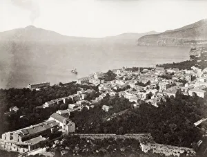
19th century vintage photograph: View of Sorrento, with some coming from the volcano Mount Vesuvius in the background
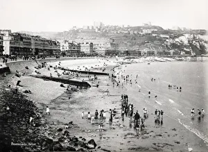
Vintage 19th century photograph - bathers and tourists on the beach at Dover, England
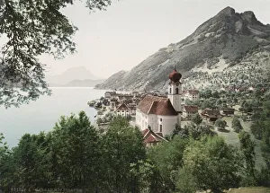
Vintage 19th century photograph - Gersau is a municipality and district in the canton of Schwyz in Switzerland, sitting on the shores of Lake Lucerne
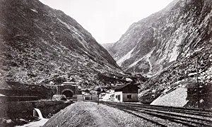
Vintage 19th century photograph - entrance to the St Gotthard tunnel, railway line, Switzerland
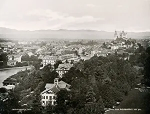
Vintage 19th century photograph - view of the town of Thun in Switzerland
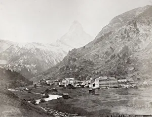
Vintage late 19th century photograph - village of Zermatt and Mont Cervin Palace Hotel, Switzerland, Alps
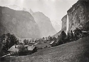
Vintage late 19th century photograph - Laurebrunnen and the Staubbach Waterfall, Swiss Alps, Switzerland
Fingals Cave, Inner Hebrides of ScotlandFingals Cave, a sea cave on the uninhabited island of Staffa, in the Inner Hebrides of Scotland. Date: circa 1920s
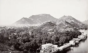
India - Ajmere Ajmer city from the Dowlat BaghVintage 19th century photograph, India - Ajmere Ajmer city from the Dowlat Bagh, India, Bourne and Shepherd studio
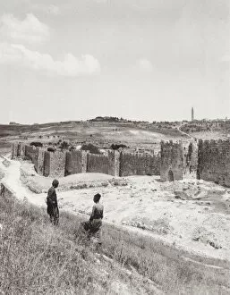
Wall of Jerusalem, Mount of Olives, Palestine, Israel, HolyVintage early 20th century photograph - city wall of Jerusalem, Mount of Olives, Palestine, Israel, Holy Land
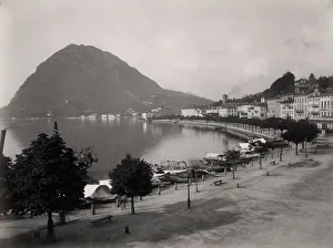
View from Hotel Washington Lugano Switzerland / Italy borderVintage 19th century photograph: View from the Hotel Washington in Lugano town, looking over the lake shore, Switzerland Italy border