mail_outline sales@mediastorehouse.com
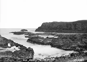
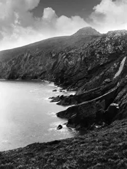
Rue Point, Dunseverick - a view of a rugged coastline. (Location: Northern Ireland; County Antrim; Dunseverick). Date: circa early 1900s
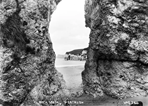
Rock Vista, Portrush - a view through an eroded archway on the beach to the coastline beyond. (Location: Northern Ireland; County Antrim; Portrush). Date: circa early 1900s
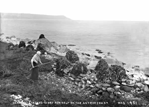
Seaweed Stacked to Dry for Kelp on the Antrim CoastSeaweed Stacked to Dry forKelp on the Antrim Coast - a view of a lady stacking seaweed on the coastline to dry. (Location: Northern Ireland; County Antrim). Date: circa early 1900s
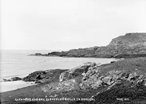
Glenhead and Bay, Glencolumbkille, Co. Donegal - a view of a rugged coastline. (Location: Republic of Ireland: County Donegal: Glencolumbkille). Date: circa early 1900s
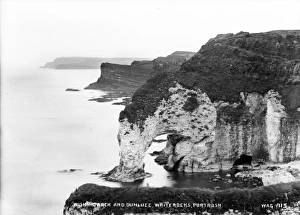
Wishing Arch and Dunluce, Whiterocks, Portrush - a high level view of an eroded cliff arch with a glimpse of Dunluce castle and a continuing rugged coastline
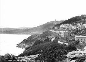
Dalkey and Killiney Hill Fr Sorrento - an elevated view looking down on buildings on a rugged coastline. (Location: Republic of Ireland; County Dublin; Sorrento). Date: circa early 1900s
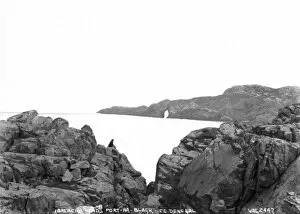
Breachy Head, Port-Na-Blagh, Co. Donegal - a view over a rugged coastline with a woman sitting on rocks in the foreground. (Location: Republic of Ireland; County Donegal; Port-na-Blagh)
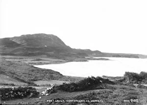
Port Lough, Dunfanaghy, Co. Donegal - a view across a rugged coastline. (Location: Republic of Ireland; County Donegal; Dunfanaghy). Date: circa early 1900s
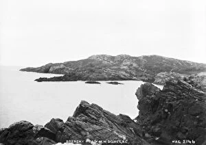
Breachy Head, North West Donegal - a view over a rugged coastline. (Location: Republic of Ireland; County Donegal). Date: circa early 1900s
Horn Hd, Co Donegal - a view across the coastline of Donegal. (Location: Republic of Ireland; County Donegal; Horn Head). Date: circa early 1900s
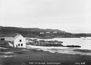
Port Na Blagh, Dunfanaghy - a view over a rugged coastline with buildings to the left and distance. (Location: Republic of Ireland; County Donegal; Dunfanaghy). Date: circa early 1900s
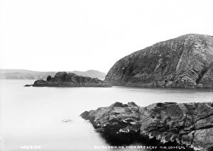
Bunrabbin Hd. from Breaghy, North West Donegal - a view of the rugged coastline. (Location: Republic of Ireland; County Donegal; Breaghy td.). Date: circa early 1900s
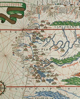
Portolan of Joan Martines (16th century). American west coasPortolan of Spanish cartographer Joan Martines (16th century). Majorcan school. American west coast (Peru, Ecuador and Colombia). 1587 Messina, Sicily
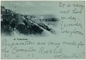
Folkstone, Kent - showing the two piers Date: 1902
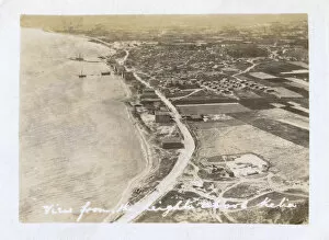
View looking down on Kilia, Gallipoli Peninsula, Turkey from the Heights. Date: 1923
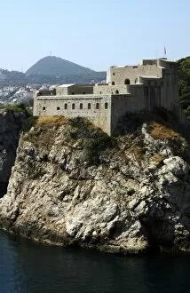
CROATIA. DUBROVNIK. Coastal scene with Fort Lovrjenac
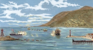
The Pacific War. Battle of Iquique. The Chilean corvette Esmeralda is sunk by the Peruvian ironclad Huascar on May 21, 1879. Colored engraving
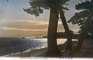
Coastline at Akashi in southern Hyogo Prefecture, JapanThe Coastline at Akashi in southern Hyogo Prefecture, Japan, on the Seto Inland Sea west of Kobe. Date: circa 1910s
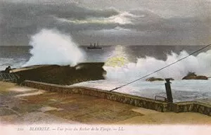
Biarritz, France - waves crash near the Rock of the VirginBiarritz, France - waves crash on the coastline close to the famous Rock of the Virgin. Date: circa 1909
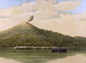
Volcanic Coast SceneA fairly placid volcano dominates the coastline at Ternate, in the Moluccas of Indonesia, where a steamboat and a sailing boat sail on an equally placid sea. Date: 1883
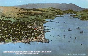
Sausalito, Mount Tamalpais, Marin County, California, USAAerial view of Sausalito, coastline and Mount Tamalpais, Marin County, California, USA. Date: 1923
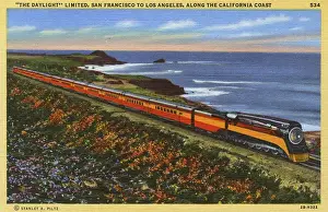
Daylight Train on the coast, California, USADaylight Train on the Southern Pacific line, travelling along the coast between San Francisco and Los Angeles, California, USA. Date: 1942
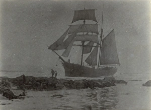
Wreck of French Fishing Boat Varenne, Lands End, CornwallWreck of the French Fishing Boat Varenne of Cherbourg, at Dollar Cove, Lands End, Cornwall Date: 1968
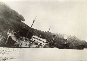
Wreck of the Broadmayne, ashore at Mill Bay Cove, DevonWreck of the Broadmayne, ashore at Mill Bay Cove, Kingswear, South Devon. Date: 1922
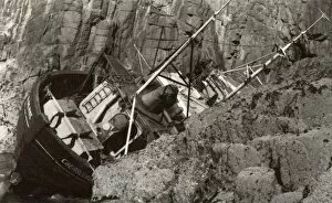
Wreck of the Brigontine Crossowen at Thurleston, Devon Date: 1908
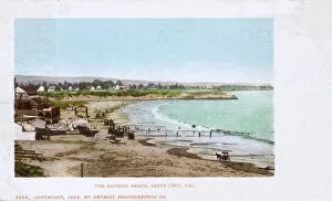
Bathing beach, Santa Cruz, California, USA. Date: 1902
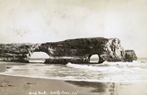
Arch Rock, Santa Cruz, California, USA. Date: late 1930s
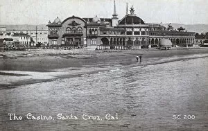
Casino, Santa Cruz, California, USA. Date: circa 1910
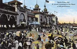
Crowd listening to band, Santa Cruz, California, USACrowd listening to a band of 60 performers, Santa Cruz, California, USA. Date: circa 1910
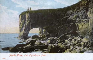
Lighthouse point, Santa Cruz, California, USA. Date: circa 1906
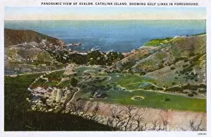
View of Avalon, Santa Catalina Island, California, USA, with golf links in the foreground. Date: 1926
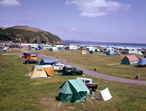
Caravan park, Mevagissey, CornwallCars and tents at the Pentewan caravan park, near Mevagissey, Cornwall. Date: 1960s
European coastline 1944A double page spread of The Illustrated London News, published less than a month before the Allied D-Day Normandy landings
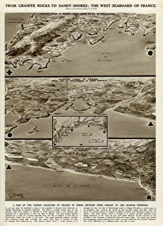
West seaboard of France by G. H. DavisA supplementary illustration to that which had appeared in the previous issue of The Illustrated London News (picture 10948123)
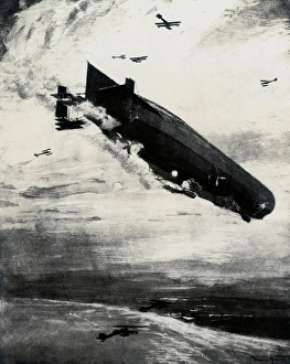
WW1 - Commodore Bigsworth drops bombs on zeppelin, 1915WW1 - Air Commodore Arthur Wellesley Bigsworth (1885-1961) was a pioneer aviator who had a distinguished military career in the service of the British armed forces
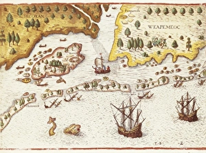
BRY, Theodor de (1528-1598). Arrival of the English in Virginia in 1607. Detail of map in Admiranta Narratio. 1590- 1634. Engraving. FRANCE. Ό E-DE-FRANCE. Paris
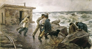
Ferrer Calatayud, PedroFERRER CALATAYUD, Pedro (1870-1944). Rescuing a shipwrecked. 1895. Realism. Oil on canvas. SPAIN. Valencia. San Pio V Fine Arts Museum
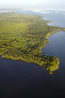
Sulu Sea and rainforest on shore near Sandakan. helicopter view; Sabah, Borneo, Malaysia; morning in June
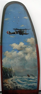
Wooden Propeller painted with either an RE8 or a BE2E on a spotting and reconnaissance mission leaving English coastline over the North Sea.. J. Willey J
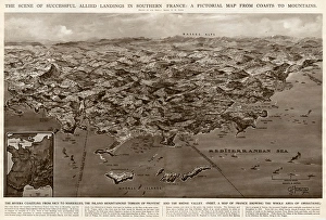
Allied landings in southern France by G. H. DavisThe scene of successful Allied landings in southern France during the Second World War: a pictorial map from coasts to mountains. Date: 1944
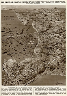
Invasion coast of Normandy by G. H. DavisThe invasion coast of Normandy, showing the terrain of operations during the Second World War. A panoramic map of the coastal regions from Cap Gris Nez to the Cherbourg Peninsula. Date: 1944
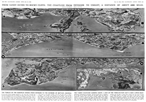
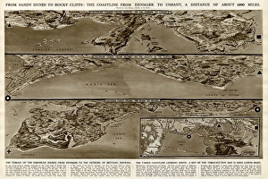
Coastline from Denmark to Ushant by G. H. DavisFrom sandy dunes to rocky cliffs: the coastline from Denmark to Ushant (Brittany), a distance of about 1200 miles. The terrain of the European shores from Denmark to the extreme of Brittany
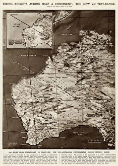
Rocket firing tests by G. H. DavisFiring rockets across half a continent: the new V2 test range. The UK-Australian experimental guided missiles range, with 1200 miles from firing point to coastline
Bishops Rock, Isles of ScillyRocky outcrop off the coast called Bishops Rock - St Agnes, Isles of Scilly Date: circa 1890s
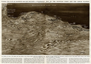
Map of Egyptian coast and Libyan plateau by G. H. DavisWhere the fate of mankind may be decided: a panoramic map of the Egyptian coast and the Libyan plateau. The theatre of war in the Middle East during the Second World War
Carmarthenshire CoastThe rocky coast at Pembrey, near Burry Port, Carmarthenshire, Wales. Date: 1930s
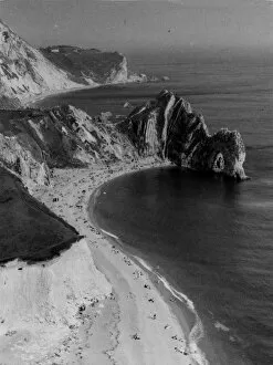
Dorset CoastlineA striking impression of the Dorset (England) coastline, with its cliffs and sands, seen here at Durdle Dor, a fine cliff formation, with an arched rock. Date: 1950s
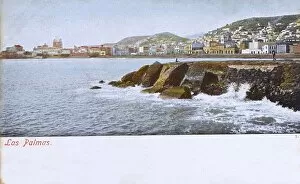
Canary Island, Gran Canaria, Las Palmas, Panoramic view Date: 1906