mail_outline sales@mediastorehouse.com
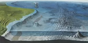
Ocean floorDiagram of the main features of the ocean floor, including an oceanic ridge, island arc and sea mounts
Sydney CoveA section of Drawing LS 2 from the Watling Collection titled New South Wales, Port Jackson from the entrance up to Sydney Cove, taken in October 1788 by a Port Jackson Painter, 1788
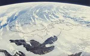
Pleistocene BritainAn artists impression of Britain at the time of the penultimate glaciation, from space during the Pleistocene period (1.8 million to 11, 000 years ago)
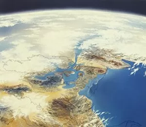
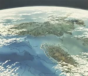
Permian BritainAn artists impression of Permian (290 to 248 million years ago) Britain from space, with desert lands and the Zechstein sea
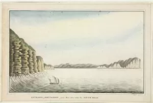
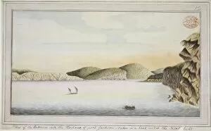
Raper drawing No. 15Entrance of Port Jackson from a boat close under the South Head; 1789
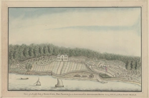
Raper drawing No. 16View of the east side of Sydney Cove, Port Jackson; from the Anchorage also showing the Governors House. By George Raper c. 1790
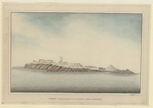
Raper drawing No. 10An illustration of Cobras, a fortified island close to the city in Rio de Janeiro 1789
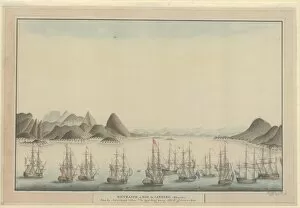
Raper drawing No. 8Entrance of Rio de Janeiro (Brasil). View from the anchorage without the Sugar Loaf bearing NW off shore 2 miles. By George Raper, 1790
Eye-sketch of the harbour of Port JacksonDrawing LS 2 from the Watling Collection titled New South Wales, Port Jackson from the entrance up to Sydney Cove, taken in October 1788 by a Port Jackson Painter, 1788
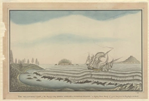
Raper drawing No. 22The melancholy loss of His Majestys Ship Sirius, wrecked on Norfolk Island. By George Raper, 1790
A view of the coastline to the south of Botany BayDrawing 5 from the Watling Collection titled A View of the Land to the Southward of Botany Bay with the Entrance of the Harbour by John Hunter, 1790-1797
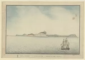
View of the entrance into the Harbour of Port JacksonDrawing 8 from the Watling Collection titled View of the Entrance into the Harbour of Port Jackson, taken in a boat under the North head by a Port Jackson Painter, 1788-1790
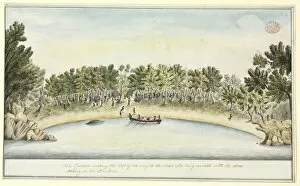
The Governor making the best of his way to the Boat after beDrawing 23 from the Watling Collection, by the Port Jackson Painter, c. 1790
Raper drawing No. 5View of SW coast of the Isle of Wight, 1. St Catherines Point; 2. the Needle Point. Painting by George Raper, 1789
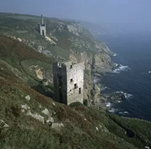
The cliff edge engine houses of Wheal TrewavasSituated on the Tregonning granite at Trewavas Head, south Cornwall. Image used in Minerals of Cornwall and Devon by P.G. Embrey and R.F. Symes, 1987, page 40. See also 4072
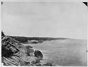
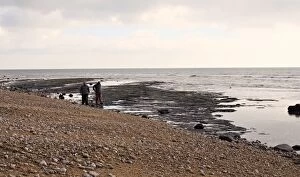
CoastlineA photograph taken during the voyage of H.M.S. Challenger (1872-1876) funded by the British Government for scientific purposes
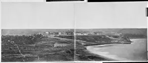
Panoramic: Cape Verde IslandsA photograph taken during the voyage of H.M.S. Challenger (1872-1876) funded by the British Government for scientific purposes
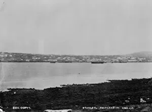
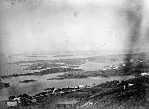
Port Stanley, Falkland IslandsA photograph taken during the voyage of H.M.S. Challenger (1872-1876) funded by the British Government for scientific purposes
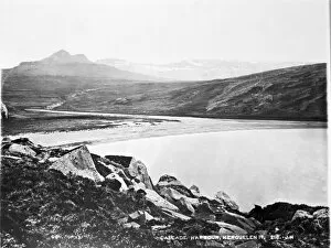
Cascade Harbour, Kerguelen IslandA photograph taken during the voyage of H.M.S. Challenger (1872-1876) funded by the British Government for scientific purposes
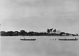
Hawaiian canoes, Diamond Head in background. Oahu, HawaiiA photograph taken during the voyage of H.M.S. Challenger (1872-1876) funded by the British Government for scientific purposes
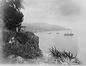
General view of Bermuda 1873A photograph taken during the voyage of H.M.S. Challenger (1872-1876), funded by the British Government for scientific purposes
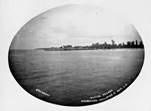
Native village, Zamboanga, Mindanao, PhilippinesA photograph taken during the voyage of H.M.S. Challenger (1872-1876) funded by the British Government for scientific purposes
Christmas Harbour, Kerguelen Island, c. 1870A photograph taken during the voyage of H.M.S. Challenger (1872-1876) funded by the British Government for scientific purposes
Harbour with ChallengerA photograph taken during the voyage of H.M.S. Challenger (1872-1876) funded by the British Government for scientific purposes
Excavating at CharmouthA team of palaeontologists from the Natural History Museum excavating an Ichthyosaur at Charmouth beach. December 2004
Jurassic BritainAn artists impression of Jurassic (206 to 144 million years ago) Britain from space, with forested swamps and warm seas