mail_outline sales@mediastorehouse.com
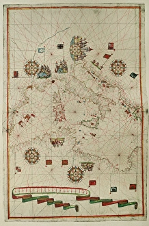
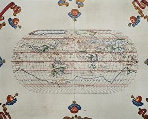
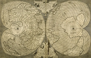
Portolan atlas by Joan Martines (1556-1590). WesternPortolan atlas of the world by Joan Martines (1556-1590). Messina, 1587. Western Mediterranean. National Library. Madrid. Spain
Map showing Auckland & the River Waikato, New Zealand, 1863Map of the country between Auckland and the River Waikato, New Zealand, illustrating the war with the native Maori tribes. Date: 1863
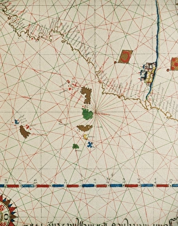
Portolan of Joan Martines (16th century). 1587. Map of the CPortolan of Spanish cartographer Joan Martines (16th century). Majorcal school. 1587. Map of the Canary Islands and the west coast of Africa. Messina, Sicily. National Library. Madrid. Spain
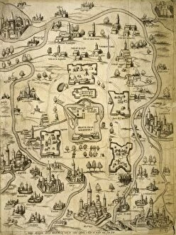
Italy. Cities of Mantua, Bologna, Venice, Modena, Ferrara and Parma. Italian engraving. Map. 16th century
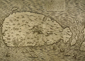
Map of Malta. Island. Mediterranean Sea. Italian engraving. 16th century
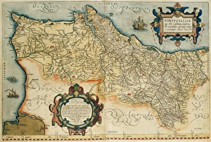
Map of Portugal. Theatrum Orbis Terrarum by Abraham Ortelius (1527-1598). First Edition. Antwerp, 1574. Library of Catalonia. Spain
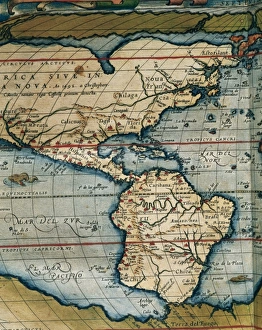
Theatrum Orbis Terrarum by Abraham Ortelius (1527-1598)Map of America. Theatrum Orbis Terrarum by Abraham Ortelius (1527-1598). First Edition. Antwerp, 1574
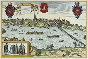
Poland. Warsaw. 16th century. EngravingPoland. Warsaw. 16th century. By Georg Braun (1541-1622) and Franz Hogenberg (1536-1590). Alte Europaische Stadtebilder. Civitates Orbis Terrarum
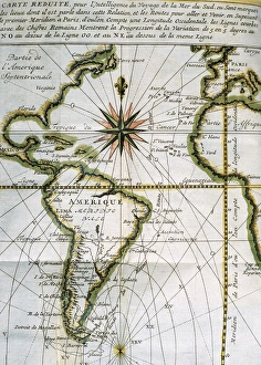
Map of the Atlantic Ocean. 18th centuryMap of the Atlantic Ocean from Newfoundland to Cape Horn. At A Voyage to the South-sea and along the coasts of Chili and Peru, in the years 1712, 1713 and 1714 by Amedee-Franc
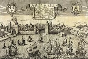
La Rochelle. Map of the city on the Atlantic. 16th centuryLa Rochelle. Map of the city on the Atlantic. Sixteenth-century engraving by Jollain
The Invincible Armada. Map of Robert Adams. Engraving" The Invincible Armada. Map of Robert Adams. Engraving by Augustine Ryther in " Expeditions in Anglian, Vera Descriptio" (1588). SPAIN. San Lorenzo de El Escorial
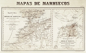
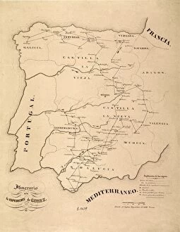
Spain. War of Africa (1859-1860). Maps of Morocco
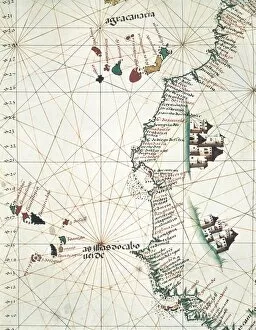
Map of the West of African coast with the Islands of Macaronesia, the Canary Isles and Cape Verde. 1514. Miniature Painting. PORTUGAL. Lisbon. Maritime Museum
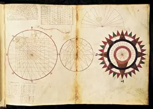
Nautical atlas (1436) of Andrea Bianco. Study of the cardinal points. ITALY. Venice. Biblioteca nazionale marciana (St. Marks Library)
Spain. First Carlist War (1836). Map of Spain
Chart by Joan Martines. Island of Sicily (1591). Miniature Painting
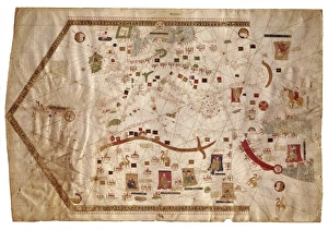
Portolan chart of the Mediterranean sea (1439) of Gabriel de Vallseca. It belonged to Amerigo Vespucci. SPAIN. Barcelona. Barcelona Maritime Museum
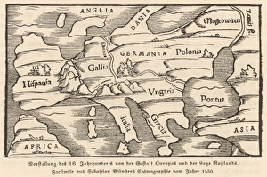
Map of Europe, 1550Europe, as conceived in 1550
Spain. Andalusia. Ecija and Genil river. Map, 1576 at Civitates Orbis Terrarum by Georg Braun (1541-1622) and Franz Hogenberg (1536-1590). Salamanca University Library
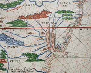
Portolan atlas by Joan Martines (1556-1590). Detail SouthPortolan atlas of the world by Joan Martines (1556-1590). Messina, 1587. Detail of South America. Atlantic Coast. National Library. Madrid. Spain
Portolan atlas by Joan Martines (1556-1590). West CoastPortolan atlas of the world by Joan Martines (1556-1590). West Coast of the African Continent. Messina, 1587. National Library. Madrid. Spain
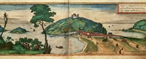
Spain. Basque Country. San Sebastian. Mount Igeldo. Map, 1576 at Civitates Orbis Terrarum by Georg Braun (1541-1622) and Franz Hogenberg (1536-1590). Salamanca University Library
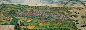
Spain. Catalonia. Barcelona. Map, 1576 at Civitates Orbis Terrarum by Georg Braun (1541-1622) and Franz Hogenberg (1536-1590). Salamanca University Library
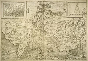
Portolan atlas by Joan Martines (1556-1590). MessinaPortolan atlas of the world by Joan Martines (1556-1590). Messina, 1587. National Library. Madrid. Spain
Italy. Pisa. Engraving. 16th century. Colored
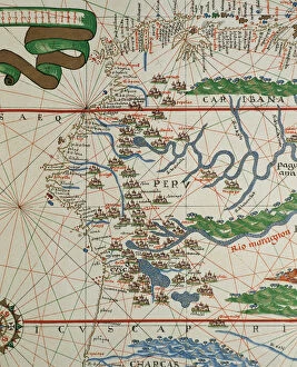
Portolan of Joan Martines (16th century). American west coasPortolan of Spanish cartographer Joan Martines (16th century). Majorcan school. American west coast (Peru, Ecuador and Colombia). 1587 Messina, Sicily
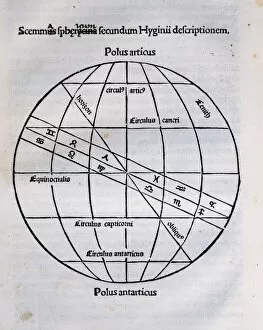
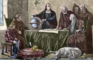
Earths Sphere according the author. Engraving in Poeticon Astronomicon, by Gaius Julius Hyginus (ca.64 BC-17 AD). Edited in Venice, 1485. Incunable
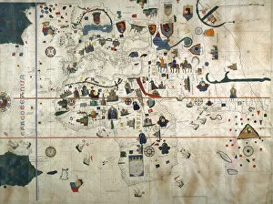
Chart by Juan de la Cosa (1450-1510). Spain. Madrid. Mavy Museum
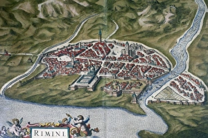
Rimini, Italy. Theatrum Orbis Terrarum by Abraham Ortelis, 1Italy. Rimini city. Theatrum Orbis Terrarum by Abraham Ortelis, 1570. Library Estense. Modena. Italy
World map. Italian engraving. 16th century
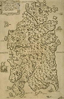
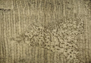
Map of Sardinia. Mediterranean Sea. Italian engraving. 16th century
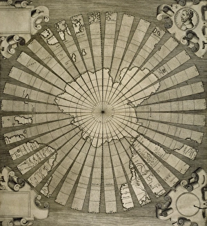
World map. South Pole. Map by Antonius Florianus. Engraving by 16th century
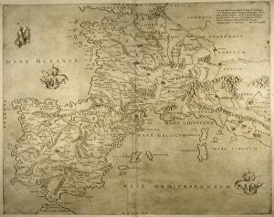
Iberian Peninsula, France and northern Italy. 16th century. Italian map
Map of the British Isles. 16th century. 1543
Map of the cities of North Africa. 16th century
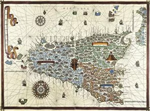
Map of Sicily. Mediterranean Sea. By Giacomo Gaftaldo Piermon. Italian engraving, 1545
Map of city of Rome. Italian engraving. 16th century
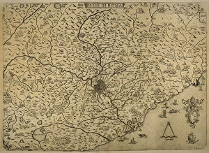
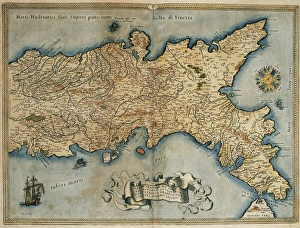
Map Kingdom of Naples. Southerm of Italian Peninsula. Italian engraving. 16th century
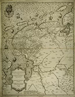
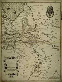
Friesland. Map of North of Netherlands. Made by Michaelis Tramezini, 1558. Printed by Iacobus Bossius
Map of Friesland. Netherlands. Made by Michaelis Tramezini, 1558. Printed by Iacobus Bossius
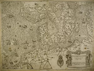
Map of Belgium, France and Luxembourg. Made by Michaelis Tramezini, 1558. Printed by Iacobus Bossius
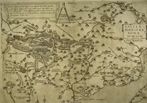
Holland, Belgium and part of Germany. Map. Made by Michaelis Tramezini, 1558. Printed by Iacobus Bossius
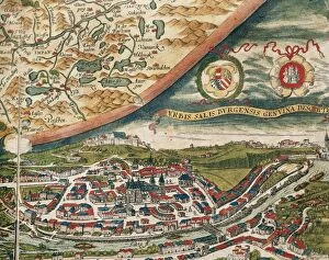
Salzburg and surroundings. Theatrum Orbis Terrarum by AbrahaView of Salzburg and surroundings. Theatrum Orbis Terrarum by Abraham Ortelius (1527-1598). First Edition. Antwerp, 1574. Library of Catalonia. Barcelona. Spain
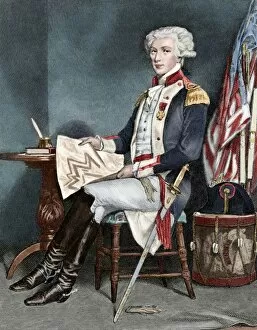
Marquis of La Fayette (1757-1834). Colored engravingMarquis of La Fayette (1757-1834). French military and politician. Engraving. Colored
Ramon de Jaudenes y Alvarez (1841-1884). Spanish military and cartographer. Their destinations were, Tetuan, Puerto Rico, Cuba and Ceuta. Engraving. La Ilustracion Espanola y Americana, 1884. Colored
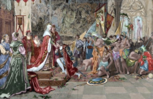
Presentation of Columbus to the Catholic Monarchs in BarceloChristopher Columbus (1451-1506). Genoese navigator. Presentation of Columbus to Ferdinand and Isabella, the Catholic Monarchs, in Barcelona
Christopher Columbus at La Rabida. Engraving. ColoredChristopher Columbus (1451-1506). Genoese navigator. Columbus at the Convent of La Rabida. Engraving after the painting by Felipe Manso in The Spanish and American Illustration, 1892. Colored
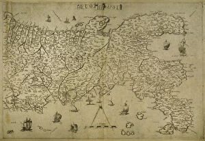
Map of the Kingdom of Naples. Theatrum Orbis Terrarum by Abraham Ortelius (1527-1598). First Edition. Antwerp, 1574. Library of Catalonia. Barcelona. Spain