mail_outline sales@mediastorehouse.com
Choose a picture from our Maps Collection for your Wall Art and Photo Gifts
27 items
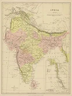
Map / Asia / India C1870India, showing the various Presidencies under British rule
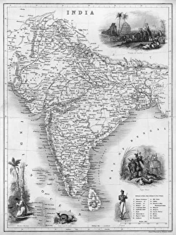
Map / Asia / India C1850India under British rule, about the time of the Mutiny
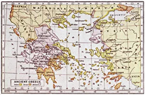
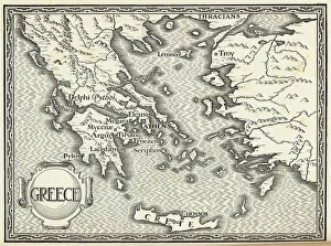
Map of Ancient GreeceA map showing the extent of the Greek Empire and the surrounding territories
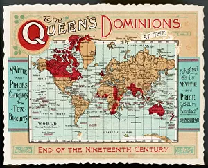
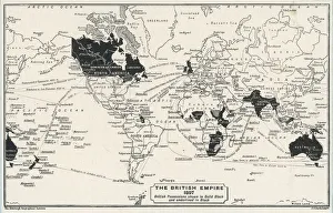
World Map Empire McVitieA map of the world, showing the British Empire coloured in red at the end of the nineteenth century
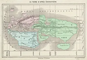
Maps / World / EratosthenesThe world as known to Eratosthenes
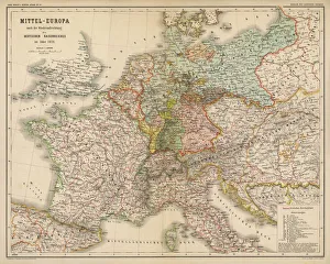
Map / Europe / Germany 1871Imperial Germany after the Franco- Prussian War, showing Alsace and Lorraine as part of the country, not to mention huge chunks of Poland in East Prussia
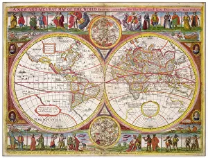
Overton World Map / 1670A new and accurate map of the world drawn according to the best and late discoveries of 1670
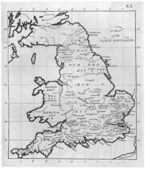
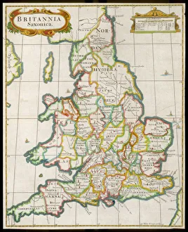
Map / Britain / Saxon PeriodMap of England and Wales showing kingdoms of Saxon heptarchy
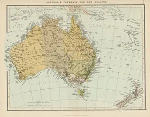
Maps / Australia / New ZeaMap showing Australia, Tasmania, New Zealand and neighbouring islands
Map / England & Wales 9CEngland and Wales during the Saxon era
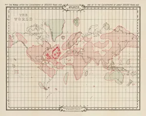
Atlantis / MapMap showing Atlantis during the period of its decadence
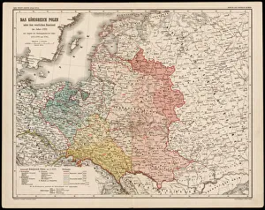
Map / Europe / Poland 1772A German map of Poland and its neighbours in the late 18th century
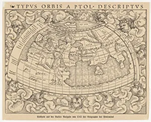
World Known to Ptolemy1545 map from Basel, Switzerland, depicting the world as known to Ptolemy in the 2nd century
WORLD MAP / 1897Map of the world showing British Empire possessions
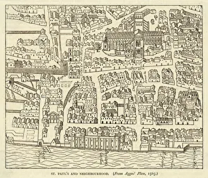
Map of St Pauls and areaMap of St. Pauls area, from Agass plan
Map / Europe / Greece / FordMap of ancient Greece
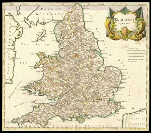
Map / England & Wales 1810England and Wales
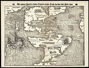
Maps / Americas 1540Map showing the discoveries by explorers during the first half-century after Columbus : note the confusion of India, Japan (Zipangri) and China (Cathay), & the Hesperides
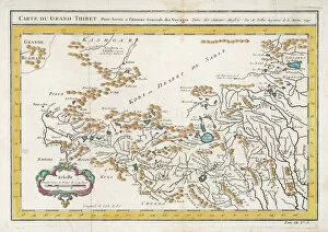
Map / China / Tibet 1749CARTE DU GRAND THIBET scale in French leagues
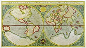
Mercator / World Map / 1587A map of the world by Gerhard Mercator
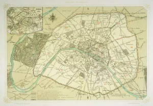
Map / Europe / France / ParisMap showing the growth of Paris from its earliest origins to the latest projects under Napoleon III
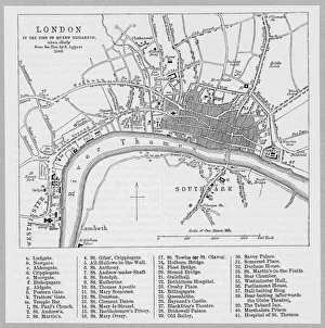
London Map 1560 / AggasMap of London at the time of Queen Elizabeth I
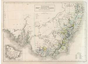
Maps / Australia 1854Victoria, New South Wales, South Australia
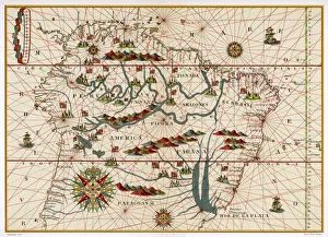
Map /s America / Brazil 16CMap of Brazil
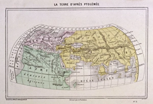
Maps / World / Ptolemy 2AdThe world as seen by Ptolemy
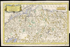
Map / Russia / Siberia 1764CARTE DE LA SIBERIE and adjoining lands
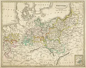
Map / Europe / Germany 1827Map of Germany (Prussia) showing the various nation states