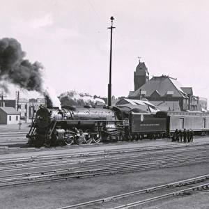
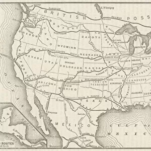
Map, route of Santa Fe Railroad, USA

![]()
Wall Art and Photo Gifts from Mary Evans Picture Library
Map, route of Santa Fe Railroad, USA
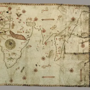
Map showing the route of the Santa Fe Railroad, USA, from the Great Lakes in the east, to the Gulf of Mexico in the south, and the Pacific coast in the west. Red circles indicate Santa Fe hotels, dining and lunch rooms, under the management of the Fred Harvey Company (Harvey House). Date: 1921
Media ID 14233572
© Mary Evans / Pharcide
1921 Angeles Canyon Chicago Circles Continent Denver Dining Francisco Fred Galveston Gulf Harvey Hotels Kansas Lakes Lunch Management Maps Mexico Pacific Railroad Rooms Route
MADE IN THE UK
Safe Shipping with 30 Day Money Back Guarantee
FREE PERSONALISATION*
We are proud to offer a range of customisation features including Personalised Captions, Color Filters and Picture Zoom Tools
SECURE PAYMENTS
We happily accept a wide range of payment options so you can pay for the things you need in the way that is most convenient for you
* Options may vary by product and licensing agreement. Zoomed Pictures can be adjusted in the Basket.