mail_outline sales@mediastorehouse.com
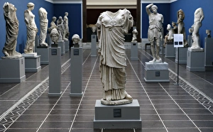
Ny Carlsberg Glyptotek. Copenhagen. Inside. Room dedicated to classical sculpture. Copenhagen. Denmark
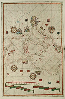
Portolan atlas by Joan Martines (1556-1590). WesternPortolan atlas of the world by Joan Martines (1556-1590). Messina, 1587. Western Mediterranean. National Library. Madrid. Spain
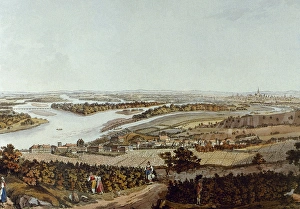
Austria. The city of Nussdorf and the Danube river. At the second plane, the city of Vienna (c. 1792). Colored engraving by Josef and Peter Schaffer (1780-1810)
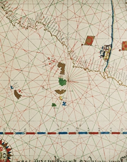
Portolan of Joan Martines (16th century). 1587. Map of the CPortolan of Spanish cartographer Joan Martines (16th century). Majorcal school. 1587. Map of the Canary Islands and the west coast of Africa. Messina, Sicily. National Library. Madrid. Spain
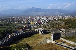
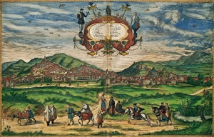
REPUBLICA OF ALBANIA. SHKODRA (SCUTARI). General view from Rozafa castle
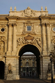
HUNGARY. BUDAPEST. Royal Palace. DoorHUNGARY. BUDAPEST. Door of the Royal Palace, built by Alajos HUSZMANN in the nineteenth century. It houses the National Gallery, among other cultural centers
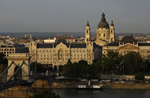
HUNGARY. BUDAPEST. Chain Bridge, Gresham Hotel and St. StepHUNGARY. BUDAPEST. View of Chain Bridge over the River Danube, the Gresham Hotel and St. Stephens Basilica
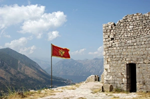
Flag of the Republic of Montenegro. Kotor
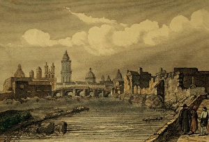
Peru. Lima. Founded by Spanish conquistador Francisco Pizarro, 1535. Engraving 1850
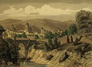
Ecuador. San Francisco de Quito. Engraving, 1850. Color
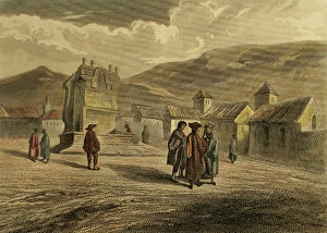
Colombia. Bogota. Founded by Gonzalo Jimenez de Quesada, 1538. Engraving, 1850. Color
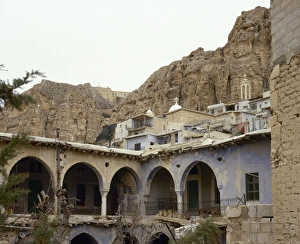
Syria. Maloula. Town built into the rugged mountainside. Village where Western Aramaic is still spoken. Near East. Photo before Syrian Civil War
Spain. Granada. Civitates Orbis Terrarum. 16th centurySpain. Granada in 1563. City panorama. Civitates Orbis Terrarum. By Georg Braun (1541-1622) and Franz Hogenberg (1536-1590)
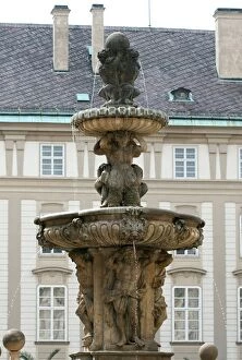
Czech Republic. Prague. Fountain of Kohl by Hieronymus KohlCzech Republic. Prague. Castle. Fountain of Kohl or Lions, by Hieronymus Kohl, 1686 (first courtyard). Castle complex (Hradcany)
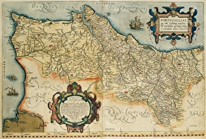
Map of Portugal. Theatrum Orbis Terrarum by Abraham Ortelius (1527-1598). First Edition. Antwerp, 1574. Library of Catalonia. Spain
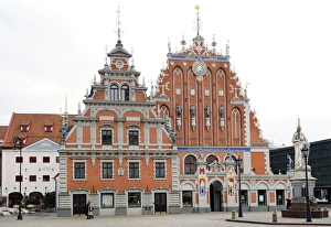
Latvia. Riga. House of the Blackheads (Melngalvju nams). Erected in 14th century for the Brotherhood of Blackheads, a guild for unmarried German merchants in Riga
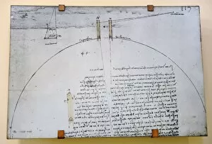
Circumference of the Earth. Leonardo da Vinci (1452-1519) deCircumference of the Earth. Eratosthenes (250 BC) calculated the circumference of the Earth by measuring noontime shadows at two localities of different latitude
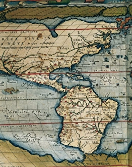
Theatrum Orbis Terrarum by Abraham Ortelius (1527-1598)Map of America. Theatrum Orbis Terrarum by Abraham Ortelius (1527-1598). First Edition. Antwerp, 1574
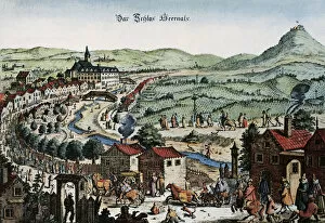
Austria. Vienna. Panorama. Engraving, late 17th centuryAustria. Vienna. Panorama of the city. Engraving, late 17th century, before being besieged by the Turks in 1683
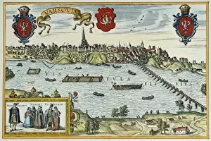
Poland. Warsaw. 16th century. EngravingPoland. Warsaw. 16th century. By Georg Braun (1541-1622) and Franz Hogenberg (1536-1590). Alte Europaische Stadtebilder. Civitates Orbis Terrarum
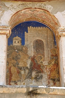
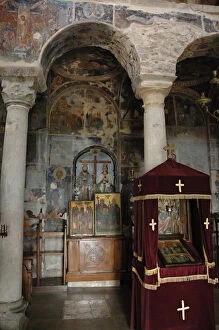
Greece. Mystras. Metropolitan Church of Saint Demetrius (Agios Dimitrios). Founded late 13th century. Painting murals. Scene life of st. Demetrius
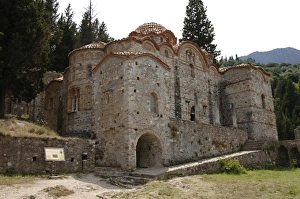
Greece. Mystras. Church of the Panayia Hodegetria, also knowGreece. Mystras. Holy Monastery of Vrontochion. Church of the Panayia Hodegetria, also known as Aphentiko. Founded in 1310. View
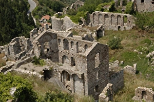
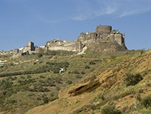
Greece. Mystras. The Palace of Despots. Dominates the Upper Town of Mystra. It is a great complex of buildings belonging to different times of construction. Peloponnese
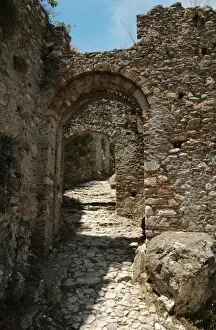
Greece. Mystras. Gate of Monemvasia. 13th Century. FortifiedGreece. Mystras. Gate of Monemvasia, also know as Sideroporta (Iron Gate). 13th Century. Fortified gate. Peloponnese
Greece. Mystras. The Monastery of Our Lady of Pandanassa (TheGreece. Mystras. The Monastery of Our Lady Panagia Pantanassa (Queen of all). A womens convent founded in the 15th century (1428 AD) by John Phrangopoulos
Syria. Baniyas. Margat castle, also known as Marqab from the Arabic Qalaat al-Marqab. It was a Crusader fortress and one of the major strongholds of the Knights Hospitaller. Built in 1062
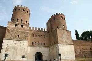
St. Sebastian Gate or Ancient Porta Appia. Rome. ItalyRoman Art. Porta S. Sebastiano (St. Sebastians Gate) or Ancient Porta Appia. I was built within Aurelians wall (271-275 AD.). It houses the Wall Museum (Museum della Mura). Rome. Italy. Europe
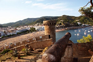
TOSSA DE MAR. Catalonia. SpainTOSSA DE MAR. Town located in the Costa Brava. Landscape coast. La Selva Region. Girona Province. Catalonia. Spain. Europe
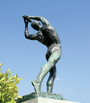
Statue of Discobolus in front the Panathenaic Stadium (Kallimarmaron). K. Dimitriad, 1927. Athens. Greece
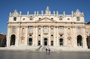
Basilica of Saint Peter (St Peters Basilica). VaticanoThe Papal Basilica of Saint Peter (St. Peters Basilica). Fac?ade. City of the Vatican. Europe
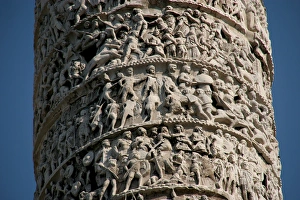
Roman Art. Column of Marcus Aurelius. Built in honour of romRoman Art. Column of Marcus Aurelius. Doric column, with a spiral relief. Built in honour of roman emperor Marcus Aurelius (180 AD.)
Greek Art. The Propylaea. Acropolis. Athens. Attica. CentraGreek Art. The Propylaea. In 437 BC Mnesicles started building the monument gates with columns of Pentelic marble. (437-432 BC). Acropolis. Athens. Attica. Central Greece. Europe
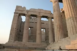
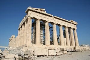
Greek Art. Parthenon (447-438 BC). Acropolis. Athens. AtticaGreek Art. Parthenon. Was built between 447-438 BC. in Doric style under leadership of Pericles. The building was designed by the architects Ictinos and Callicrates. Acropolis. Athens. Attica
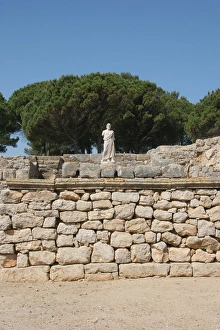
Emporium. Greek colonyGreek Art. Emporium (Ampurias). Greek colony founded by the greeks of Foci, 570 BC. Statue of Asclepius. God of medicin. Neapolis. Girona province. Catalonia. Spain. Europe
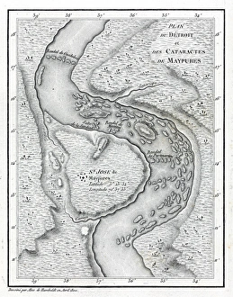
Cataracts of Maypures mapEngraving by Alexander Humboldt, April 1800. This map depicts an area of the Orinoco river in South America. Date: 1800
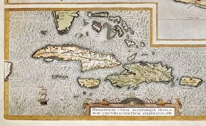
ORTELIUS, Abraham (1527-1598). Theatrum Orbis Terrarum. 1570. It is considered to be the first modern atlas. Map of the Caribbean Sea with the islands of Cuba, Cayman Islands
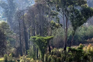
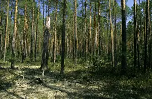
Nyanga Forest - Zimbabwe
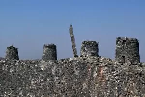
The King Palace Wall - Great Zimbabwe
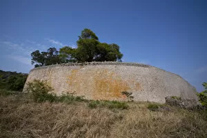
The Queen of Sheba Palace - Great Zimbabwe
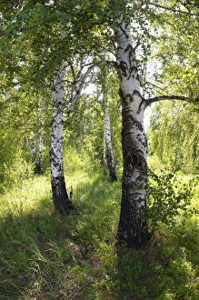
Russia - a compact woods kolok ( kolki for plural) consisting of birch only (Betula sp.). forest steppe near town of Chelyabinsk - Russian
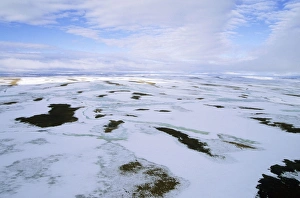
Snow melts in arctic tundra spring. Aerial view from a helicopter. landscape near Kara sea, Taimyr peninsula, North of Siberia, Russian Arctic. July
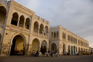
Massawa - Old town with local residents. Eritrea - Africa
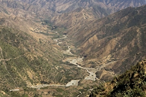
Valley - Seen from the old road from Asmara to Massawa, built by Italians during colonialism. Eritrea - Africa
Pine taiga - forest with forest floor covered in lichens; typical in the basin of river Bolshoi Ugan, near Ugut settlement; spring. Uganskii Nat. reserve, Siberia, Russia;
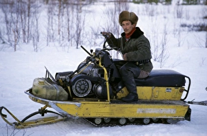
Selkup on snow-bike, North Siberia. Selkup hunter on his old snow-bike, near river Taz, North Tumen region, Russia, spring
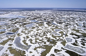
Semi-tundra aerial, North Siberia. Helicopter view over frozen lakes in semi-tundra near river Taz; early spring; North Tumen region, Russia
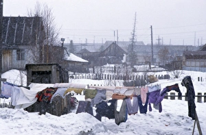
Clothes drying in snowfall, Siberia. A typical scene in Krasnoselkup settlement, yards and houses covered in snow, clothes normally dryed outside all year round, winter; North Tumen region
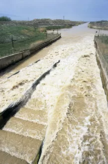
Karakum / Qaraqum / Kara Kum / Garagum Canal - water comes from water pump in sluices. goes along Kopet-Dag Mountain Range - Turkmenistan - Spring - April