mail_outline sales@mediastorehouse.com
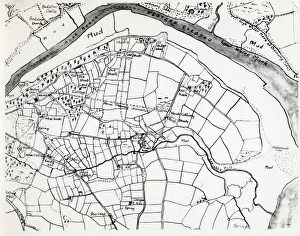
Sketch map of Hook, Pembrokeshire, South WalesA sketch map of the village of Hook, including the various mining shafts of the colliery, on the Western Cleddau near Haverfordwest, Pembrokeshire, South Wales
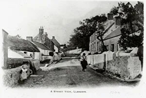
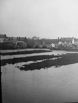
Llangwm village, near Haverfordwest, South WalesStreet scene in the picturesque village of Llangwm, near Haverfordwest, Pembrokeshire, Dyfed, South Wales. The village is located on the western bank of the Cleddau Estuary
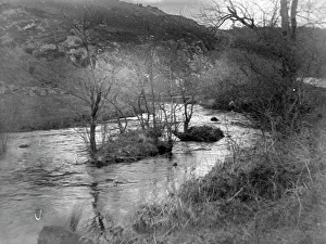
Treffgarne Gorge, Pembrokeshire, South WalesView of Treffgarne Gorge and River Cleddau at Nant Y Coy, Pembrokeshire, Dyfed, South Wales, before the Great Western Railway line was built
Oak woods, Pembrokeshire CoastA man walks along the waters edge of the Daugleddau Estuary through Oak Woods in the Pembrokeshire Coast National Park, South Wales
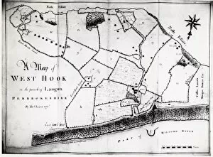
Colliery map of Hook, Pembrokeshire, South WalesA colliery map (by Thomas Lewis) of the village of Hook, described here as West Hook in the parish of Langwn (Llangwm), showing fields, trees and mining locations
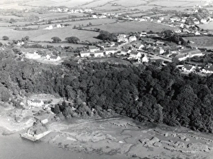
Aerial view of Hook, Pembrokeshire, South WalesAn aerial view of the coastal village of Hook, on the Western Cleddau, near Haverfordwest, Pembrokeshire, South Wales. The quay can be seen in the foreground -- it was constructed in the late 18th
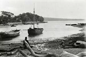
Boats off Llangwm, near Haverfordwest, South WalesA coal boat and a fishing vessel off the coast at Llangwm, near Haverfordwest, Pembrokeshire, Dyfed, South Wales. The village is located on the western bank of the Cleddau Estuary
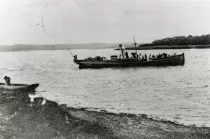
Boat off Llangwm, near Haverfordwest, South WalesA long passenger boat off the coast at Llangwm, near Haverfordwest, Pembrokeshire, Dyfed, South Wales. The village is located on the western bank of the Cleddau Estuary
View of the Old Bridge, Haverfordwest, South WalesDistant view of the Old Bridge (known as St Martins Bridge) and the barge park at Haverfordwest, Pembrokeshire, Dyfed, South Wales, crossing the River Cleddau
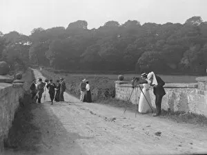
Photographic party, Slebech, Pembrokeshire, West WalesA photographic party on the bridge at Slebech, Pembrokeshire, West Wales. Blackpool Bridge, crossing the River Cleddau, is a Grade II listed, single span bridge
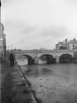
View of the New Bridge, Haverfordwest, South WalesView of the New Bridge (built in 1835) at Haverfordwest, Pembrokeshire, Dyfed, South Wales, crossing the River Cleddau