mail_outline sales@mediastorehouse.com
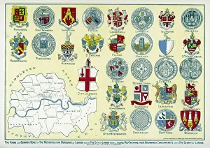
London arms and sealsThe Arms and Common Seals of the Metropolitan Boroughs of London and of the City of London, with a block map showing their boundaries
Middlesex Fire Brigade in the London Fire Brigade areaMutual assistance took place where a nearby fire brigade would attend a fire in the London Fire Brigade area, or vice-versa
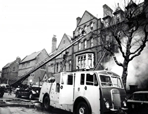
LCC-LFB Plumstead fire station, SE LondonSituated in Plumstead High Street and opened in 1906, Plumstead fire station was one of the LCC boundary fire stations bordering onto the Kent Fire Brigade until 1965
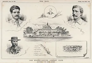
Warwickshire Cricket Club - 1888Sketches at the County Ground, Edgbaston, Birmingham - the home of Warwickshire CC. The main pavilion is shown in the centre
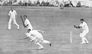
Denis Compton at HastingsDenis Compton turns a ball from spinner Jim Laker (out of picture) off his legs to score another boundary past the despairing reach of the short leg fielder as wicketkeeper Stewart Billy Griffith
National Childrens Home (NCH), Alverstoke - Aerial viewNational Childrens Home (NCH), Alverstoke, Hampshire. Aerial view showing the boundary of the homes site. Date: July 1939
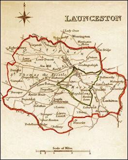
1832 Victorian Map of Launceston
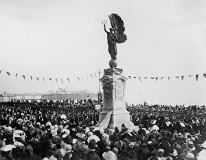
Edward VII Memorial unveiling at Brighton and HoveThe unveiling of a Memorial to the late King Edward VII on the boundary dividing the boroughs of Brighton and Hove. It was unveiled by the Lord Lieutenant of Sussex, the Duke of Norfolk
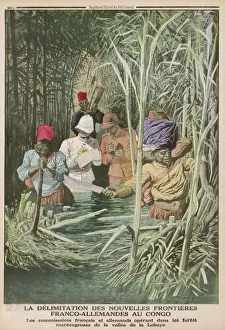
Africa / Exploration / CongoCONGO - French and German officials, determined to correctly map the boundary between their territories, make their way through the marshy Lobaye valley
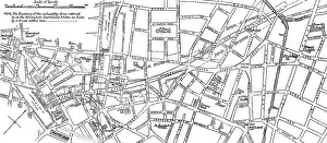
Sketch map of proposed improvements, BirminghamSketch map of a locality around Stafford Street in Birmingham with the proposed new street running through it. The boundary of the unhealthy area referred to in the Birmingham Improvement Scheme as
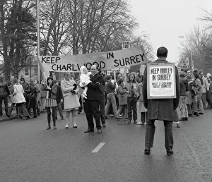
Demonstration to keep Horley and Charlwood in SurreyA group of people on a demonstration in the middle of a road, holding banners and placards, determined to keep Horley and Charlwood in Surrey
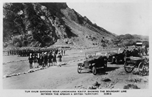
Events / Asia / AfghanistanTur Khum Gardens near Landikhana, showing the boundary line between Afghanistan and the North-West Frontier Province
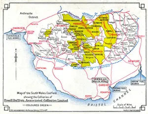
Map, South Wales coalfield. 1939
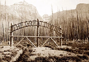
The Great Divide Boundary between BC and Alberta, CanadaThe Great Divide Boundary between BC and Alberta, Banff, Canada Date: early 1900s
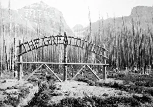
Great Divide boundary bewteen Alberta and British ColumbiaThe Great Divide boundary bewteen Alberta and British Columbia, early 1900s Date: early 1900s
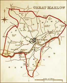
1832 Victorian Map of Great Marlow
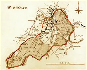
1832 Victorian Map of Windsor
1832 Victorian Map of Abingdon
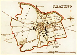
1832 Victorian Map of Reading
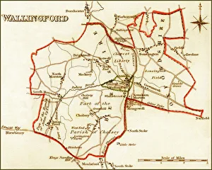
1832 Victorian Map of Wallingford
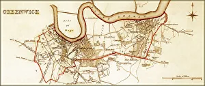
1832 Victorian Map of Greenwich
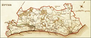
1832 Victorian Map of Hythe
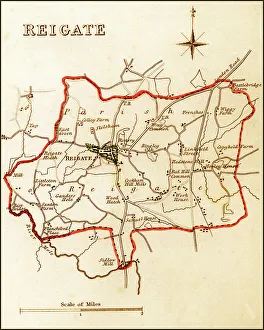
1832 Victorian Map of Reigate
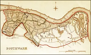
1832 Victorian Map of Southwark
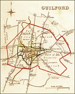
1832 Victorian Map of Guildford
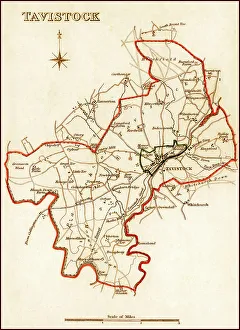
1832 Victorian Map of Tavistock
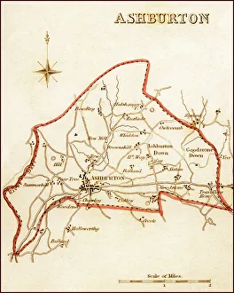
1832 Victorian Map of Ashburton
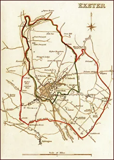
1832 Victorian Map of Exeter
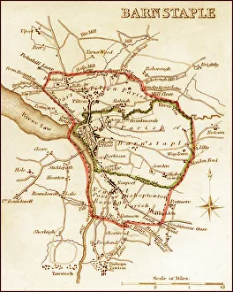
1832 Victorian Map of Barnstaple
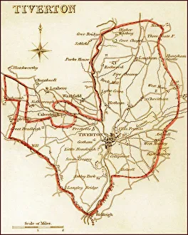
1832 Victorian Map of Tiverton
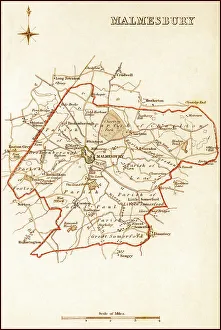
1832 Victorian Map of Malmesbury
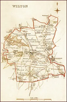
1832 Pre Victorian Map of Wilton near Salisbury
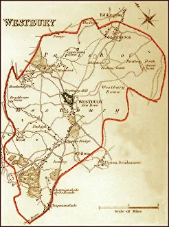
1832 Victorian Map of Westbury
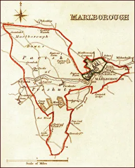
1832 Victorian Map of Marlborough
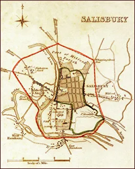
1832 Victorian Map of Salisbury
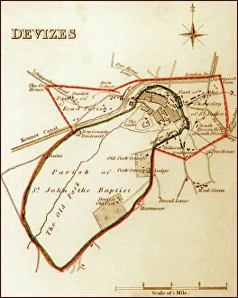
1832 Victorian Map of Devizes
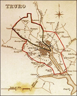
1832 Victorian Map of Truro
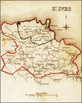
1832 Victorian Map of St. Ives
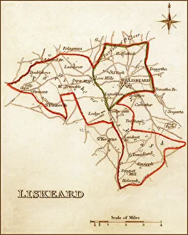
1832 Victorian Map of Liskeard
1832 Victorian Map of Penryn and Falmouth
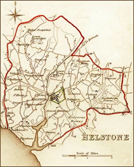
1832 Victorian Map of Helston
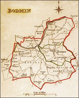
1832 Victorian Map of Bodmin
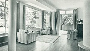
Modernist House, Moor Park, Living RoomA photograph of a living room to a modernist house in Moor Park, Rickmansworth, designed in 1937 by architects Colin Anderson Lucas, Amyas Douglas Connell and Basil Robert Ward
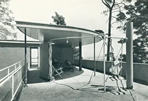
Modernist House, Moor Park, Roof TerraceA photograph of a roof terrace to a modernist house in Moor Park, Rickmansworth, designed in 1937 by architects Colin Anderson Lucas, Amyas Douglas Connell and Basil Robert Ward
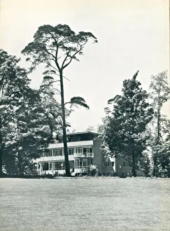
Modernist House, Moor Park, RickmansworthA photograph of a modernist house from across a green in Moor Park, Rickmansworth, designed in 1937 by architects Colin Anderson Lucas, Amyas Douglas Connell and Basil Robert Ward
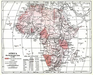
Map of Africa showing boundary lines in 1924 Date: 1924
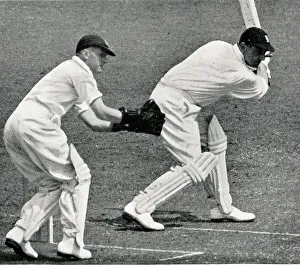
Wally Hammond hitting boundary off McCabe at LordsEngland cricketer Wally Hammond hitting a boundary off McCabe at Lords, 1938, B A Barnett keeping wicket Date: 1938
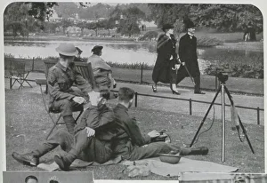
Neville and Anne Chamberlain in the parkPrime Minister Neville Chamberlain (1869-1940) with his wife Anne (1883-1967) taking a stroll in the park. The watching soldiers are signallers under instruction. Date: 1939