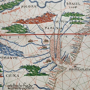
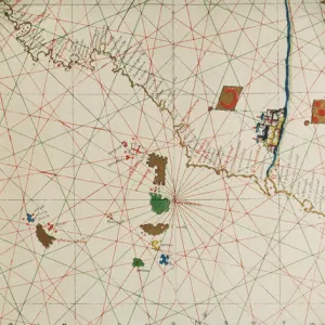
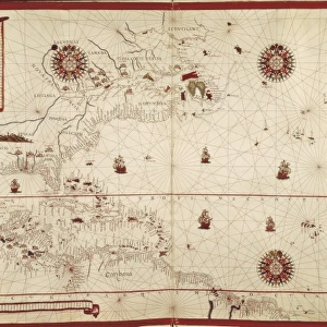
Portolan of Joan Martines (16th century). American west coas
. American west coas")
![]()
Wall Art and Photo Gifts from Mary Evans Picture Library
Portolan of Joan Martines (16th century). American west coas
Portolan of Spanish cartographer Joan Martines (16th century). Majorcan school. American west coast (Peru, Ecuador and Colombia). 1587 Messina, Sicily
Media ID 14353942
© Thaliastock / Mary Evans
1587 Americas Atlas Cartographer Cartography Coastline Colombia Compass Discovery Ecuador Geography Joan Majorcan Martines Messina Peru Portolan Sicily
MADE IN THE UK
Safe Shipping with 30 Day Money Back Guarantee
FREE PERSONALISATION*
We are proud to offer a range of customisation features including Personalised Captions, Color Filters and Picture Zoom Tools
SECURE PAYMENTS
We happily accept a wide range of payment options so you can pay for the things you need in the way that is most convenient for you
* Options may vary by product and licensing agreement. Zoomed Pictures can be adjusted in the Basket.