Home > Popular Themes > Maps and Charts
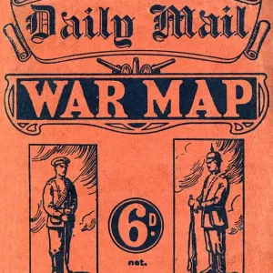
Fine Art Print : Daily Mail War Map, WW1


![]()
Fine Art Prints from Mary Evans Picture Library
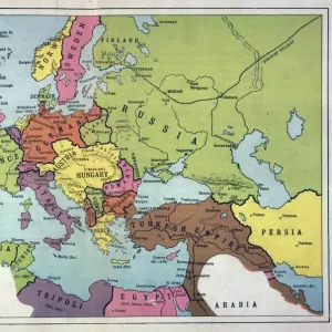
Daily Mail War Map, WW1
A fold out war map issued by the Daily Mail in the early weeks of the First World War. The map offers statistics regarding the manpower strength of each of the warring nations, as well as the number of battleships and food stores each had. While the Triple Entente of Britain, France and Russia could boast 9, 380, 000 men (of which Britain comprised just 380, 000), the Triple Alliance numbered 9, 500, 000. The map was intended to be marked with Philips flag pins in ten different colours so that civilians could chart the progress of the campaign. Date: 1914
Media ID 14185852
© Mary Evans Picture Library
Battleships Borders Conflict Countries Daily Entente Fold Mail Manpower Maps Nations Outbreak Progress Statistics Strength Triple Warring
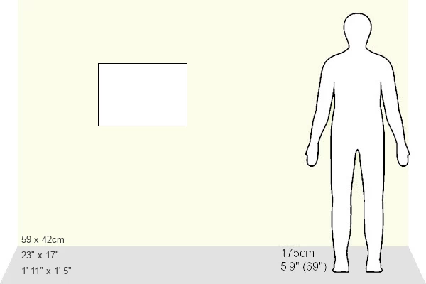
A2 (42x59cm) Fine Art Print
Our Fine Art Prints are printed on 100% acid free, PH neutral paper with archival properties. This printing method is used by museums and art collections to exhibit photographs and art reproductions. Hahnemühle certified studio for digital fine art printing. Printed on 308gsm Photo Rag Paper.
Our fine art prints are high-quality prints made using a paper called Photo Rag. This 100% cotton rag fibre paper is known for its exceptional image sharpness, rich colors, and high level of detail, making it a popular choice for professional photographers and artists. Photo rag paper is our clear recommendation for a fine art paper print. If you can afford to spend more on a higher quality paper, then Photo Rag is our clear recommendation for a fine art paper print.
Estimated Product Size is 59.4cm x 42cm (23.4" x 16.5")
These are individually made so all sizes are approximate
Artwork printed orientated as per the preview above, with landscape (horizontal) orientation to match the source image.
MADE IN THE UK
Safe Shipping with 30 Day Money Back Guarantee
FREE PERSONALISATION*
We are proud to offer a range of customisation features including Personalised Captions, Color Filters and Picture Zoom Tools
SECURE PAYMENTS
We happily accept a wide range of payment options so you can pay for the things you need in the way that is most convenient for you
* Options may vary by product and licensing agreement. Zoomed Pictures can be adjusted in the Cart.