Home > New Images July 2023
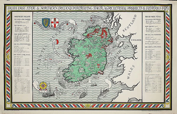
A Map Of Irish Free State And Northern Ireland
![]()
Wall Art and Photo Gifts from Mary Evans Picture Library
A Map Of Irish Free State And Northern Ireland
a, map, of, irish, free, state, and, northern, ireland, 1929, truly, outstanding, large, scale, empire, marketing, board, poster, designed, by, leslie, macdonald, max, gill, this, design, for, the, was, published, in, as, part, series, celebrating, produce, british, isles, its, dominions, namely, south, africa, canada, new, zealand, australia, they, were, intended, public, display, often, on, specially, erected, hoardings, today, these, extremely, scare, beautiful, posters, rarely, appear, market, example, came, from, estate, would, have, been, retained, reference, copy. artwork, publisher, , 13748184
Media ID 32254486
© Mary Evans Picture Library 2021
Beautiful Celebrating Copy Dominions Erected Estate Extremely Free Gill Hoardings Intended Isles Leslie Macdonald Marketing Outstanding Produce Publisher Rarely Reference Retained Scale Scare Specially Today Zealand
MADE IN THE UK
Safe Shipping with 30 Day Money Back Guarantee
FREE PERSONALISATION*
We are proud to offer a range of customisation features including Personalised Captions, Color Filters and Picture Zoom Tools
SECURE PAYMENTS
We happily accept a wide range of payment options so you can pay for the things you need in the way that is most convenient for you
* Options may vary by product and licensing agreement. Zoomed Pictures can be adjusted in the Basket.

