Home > New Images August 2021
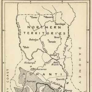
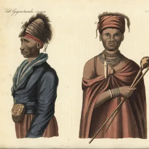
Map of Africa, 1820

![]()
Wall Art and Photo Gifts from Mary Evans Picture Library
Map of Africa, 1820
Map of Africa, 1820. Showing Morocco, Barbary and the Sahara in the north, Soudan and Guinea in the west, Khoikhoi (Hottentots) and Bantu (Caffres) in the south, and Abyssinia and Sennaar in the east
Media ID 23391590
© Florilegius
1820 Amusement Barbary Best Celebration Eyes Instruction Isaac Lead Makeup Moors Muslim Powder Scholar Tarry Taylor Tunis Tunisia
MADE IN THE UK
Safe Shipping with 30 Day Money Back Guarantee
FREE PERSONALISATION*
We are proud to offer a range of customisation features including Personalised Captions, Color Filters and Picture Zoom Tools
SECURE PAYMENTS
We happily accept a wide range of payment options so you can pay for the things you need in the way that is most convenient for you
* Options may vary by product and licensing agreement. Zoomed Pictures can be adjusted in the Basket.