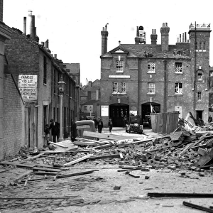
Map of the East Coast Bombardments, WW1

![]()
Wall Art and Photo Gifts from Mary Evans Picture Library
Map of the East Coast Bombardments, WW1
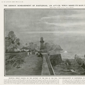
A map of the North East coast of Britain, showing Hartlepool, Whitby and Scarborough, the scene of shelling by German battle cruisers in December 1914. Annotations give information on the length of the bombardments, where was hit and how many deaths and fatalities were caused by an action which caused the death of 110 people, the majority of whom were civilians (including women and children). The event was seen as a ruthlessly barbaric act and spurred many more to join up. Date: 1914
Media ID 14158191
© Mary Evans Picture Library
Annotations Attack Bombardment Bombardments Hartlepool Maps Scarborough Shelling Towns Whitby
MADE IN THE UK
Safe Shipping with 30 Day Money Back Guarantee
FREE PERSONALISATION*
We are proud to offer a range of customisation features including Personalised Captions, Color Filters and Picture Zoom Tools
SECURE PAYMENTS
We happily accept a wide range of payment options so you can pay for the things you need in the way that is most convenient for you
* Options may vary by product and licensing agreement. Zoomed Pictures can be adjusted in the Basket.