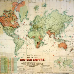
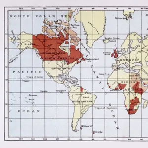
Map of British Empire showing international cable

![]()
Wall Art and Photo Gifts from Mary Evans Picture Library
Map of British Empire showing international cable
Map of the British Empire (coloured red), showing the All-British international cable going round the world, enabling telegraphic communication. Date: circa 1902
Media ID 14164147
© Mary Evans / Pharcide
Cable Commonwealth Communication Guiana Honduras Jack Patriotic Patriotism Technology Telegraph Telegraphic Zealand
MADE IN THE UK
Safe Shipping with 30 Day Money Back Guarantee
FREE PERSONALISATION*
We are proud to offer a range of customisation features including Personalised Captions, Color Filters and Picture Zoom Tools
SECURE PAYMENTS
We happily accept a wide range of payment options so you can pay for the things you need in the way that is most convenient for you
* Options may vary by product and licensing agreement. Zoomed Pictures can be adjusted in the Basket.