mail_outline sales@mediastorehouse.com
4,407 items
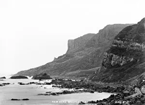
Fair Head, Ballycastle - a low view looking up to fair head from the sea. (Location: Northern Ireland: County Antrim: Ballycastle). Date: circa early 1900s
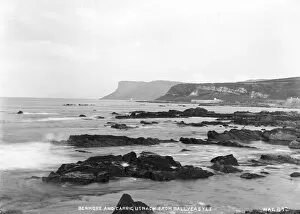
Benmore and Carrig Usnach from Ballycastle - a view across the rocks and sea to fair head in the distance. (Location: Northern Ireland: County Antrim: Ballycastle). Date: circa early 1900s
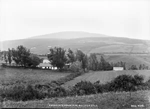
Knocklayd Mountain, Ballycastle - a view of the mountain with building in the middle foreground. (Location: Northern Ireland: County Antrim: Ballycastle). Date: circa early 1900s
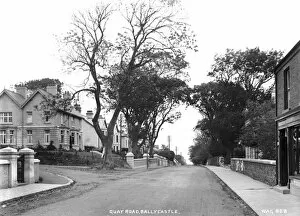
Quay Road, Ballycastle - a view of a residential street with large houses to the left. (Location: Northern Ireland: County Antrim: Ballycastle). Date: circa early 1900s
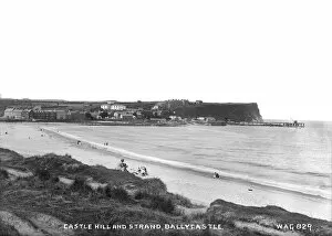
Castle Hill and Strand, Ballycastle - a view across the strand to castle hill in the distance, with people on the beach. (Location: Northern Ireland: County Antrim: Ballycastle)
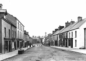
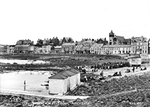
Main Street, Ballycastle - a street scene with shop fronts and people to the distance. (Location: Northern Ireland: County Antrim: Ballycastle). Date: circa early 1900s
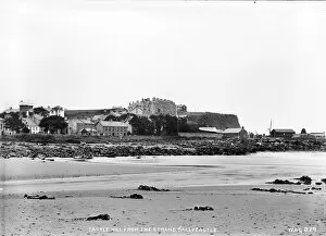
Castle Hill from the Strand, Ballycastle - a low view from the beach to castle hill. (Location: Northern Ireland: County Antrim: Ballycastle). Date: circa early 1900s
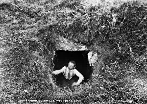
Souterrain, Bushmills, Wee Folks Cove - a view of an underground entrance with a boy at the mouth for scale. (Location: Northern Ireland: County Antrim: Bushmills). Date: circa early 1900s
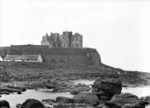
Portstewart Castle - a view across the rocks and sea to the castle above. (Location: Northern Ireland: County Londonderry: Portstewart). Date: circa early 1900s
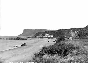
Fair Head from Ballycastle - a view along a beach strand towards fair head in the distance. On the strand there is a horse vehicle and to the right a motor car
Ladies Bathing Place and Beach, Portstewart - an elevated view of the beach with changing boxes and the promenade and buildings behind. There is a large crowd on the beach at a convention
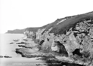
Cathedral Cliffs and Caves, Whiterocks, Portrush - a perspective view of eroded cliffs and caves. (Location: Northern Ireland: County Antrim: Portrush). Date: circa early 1900s
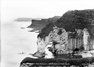
Wishing Arch and Dunluce, Whiterocks, Portrush - a high level view of an eroded cliff arch with a glimpse of Dunluce castle and a continuing rugged coastline
R. C. Chapel, RostrevorR.C. Chapel, Rostrevor - a front view of the chapel. (Location: Northern Ireland: County Down: Rostrevor). Date: circa early 1900s
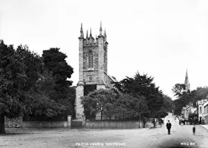
Parish Church, Rostrevor - a front view of the church with horse vehicles and people to the right. (Location: Northern Ireland: County Down: Rostrevor). Date: circa early 1900s
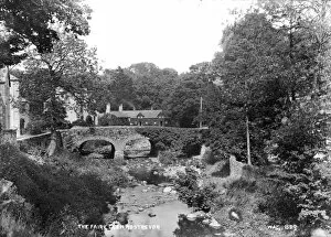
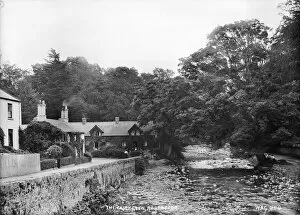
The Fairy Glen, Rostrevor - a view of a bridge over a river with buildings in the background. (Location: Northern Ireland: County Down: Rostrevor). Date: circa early 1900s
The Square, Rostrevor - a street scene with shop fronts and church, people and horse vehicles. (Location: Northern Ireland: County Down: Rostrevor). Date: circa early 1900s
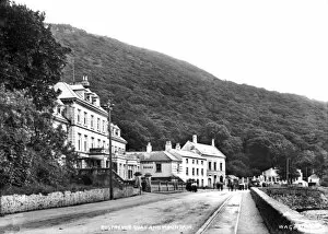
Rostrevor Quay and Mountain - a view along the promenade with buildings on the left and people and horse vehicles on the road in the distance. (Location: Northern Ireland: County Down: Rostrevor)
The Fairy Glen, Rostrevor - a view of buildings beside a river. (Location: Northern Ireland: County Down: Rostrevor). Date: circa early 1900s
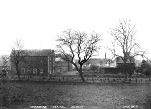
Masserene Hospital, Antrim - a view of the hospital buildings. (Location: Northern Ireland: County Antrim: Antrim). Date: circa early 1900s
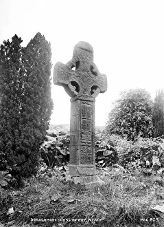
Donaghmore Cross, Newry, Western FaceDonaghmore Cross, Newry, W.Face - a view of a standing cross. (Location: Northern Ireland: County Down: Newry). Date: circa early 1900s
The Mount, Donaghmore, Newry - a view of an earthen mound. (Location: Northern Ireland: County Down: Newry). Date: circa early 1900s
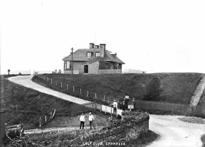
Golf Club, Carnalea - a front view of the clubhouse with golfers in the foreground. (Location: Northern Ireland: County Down: Bangor). Date: circa early 1900s
Bangor Rd. Presbyterian Church, Holywood - a front view of the church, much of the building hidden by vegetation. (Location: Northern Ireland: County Down: Holywood). Date: circa early 1900s
The Kissing Bridge, Holywood - a view of a wooden raised path, alongside a river, with five children on it. (Location: Northern Ireland: County Down: Holywood). Date: circa early 1900s
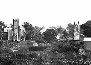
High Holywood and the Churches - a view over vegetation of two churches. (Location: Northern Ireland: County Down: Holywood). Date: circa early 1900s
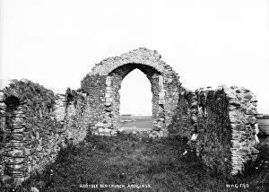
Ardtole Old Church, Ardglass - a view of a derelict church, arch and walls only remaining. (Location: Northern Ireland: County Down: Ardglass). Date: circa early 1900s
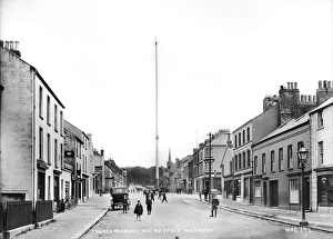
Church Road and the Maypole, Holywood - a street scene with shop fronts and children around the maypole and a motor car.. (Location: Northern Ireland: County Down: Holywood). Date: circa early 1900s
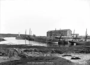
Pier and Lighthouse, Ardglass - a low level view of the pier with boats and barrels and the lighthouse to the left. (Location: Northern Ireland: County Down: Ardglass). Date: circa early 1900s
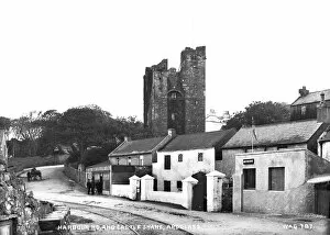
Harbour Rd. and Castle Shane, Ardglass - a street scene with shop front and people outside, horse vehicle and the castle in the background. (Location: Northern Ireland: County Down: Ardglass)
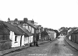
Kildare St. Ardglass - a street scene with children playing and motor vehicles in the distance. (Location: Northern Ireland: County Down: Ardglass). Date: circa early 1900s
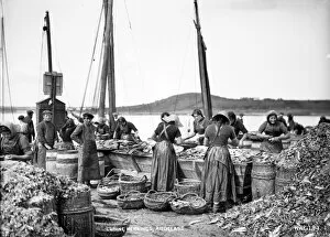
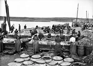
Curing Herrings, Ardglass - a closer in view than above showing workers cleaning fish. (Location: Northern Ireland: County Down: Ardglass). Date: circa early 1900s
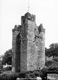
Castle Shane, Ardglass - a view of the castle. (Location: Northern Ireland: County Down: Ardglass). Date: circa early 1900s
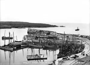
Ardglass Harbour from the Castle - a panoramic view of the harbour and pier with a lot of boats there. (Location: Northern Ireland: County Down: Ardglass). Date: circa early 1900s
The Harvest of the Sea, Ardglass - a view on the harbour pier of lots of workers sorting and cleaning fish. (Location: Northern Ireland: County Down: Ardglass). Date: circa early 1900s
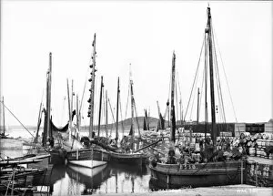
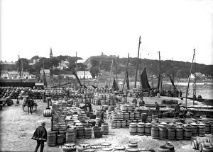
Herring Boats in Ardglass Harbour - a view of the boats at the harbour with loads of barrels on the pier. (Location: Northern Ireland: County Down: Ardglass). Date: circa early 1900s
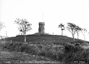
Bellas Tower and Earthen fort, ArdglassBellas Tower and Earthen Fort, Ardglass - a view of a tower on top of an earthen mound. (Location: Northern Ireland: County Down: Ardglass). Date: circa early 1900s
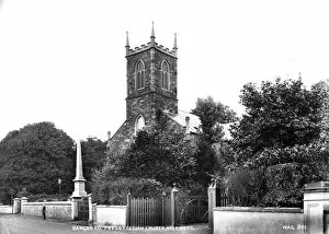
Parish Church, Ardglass - a side view of the church. (Location: Northern Ireland: County Down: Ardglass). Date: circa early 1900s
Ardglass in the Herring Season - an elevated view of the harbour pier with loads of barrels, fish for sale, horse vehicles, people and boats and the town in the background
Cliff Path and Smugglers Cave, Blackhead - a view of a cave and bridge on the cliff path with three men for scale. (Location: Northern Ireland: County Antrim: Whitehead). Date: circa early 1900s
Ardglass, Co Down - a street scene with the castle in the background and people posing for the camera. (Location: Northern Ireland: County Down: Ardglass). Date: circa early 1900s
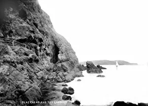
Blackhead and the Gobbins - a view showing the cliff path at blackhead. (Location: Northern Ireland: County Antrim: Whitehead). Date: circa early 1900s
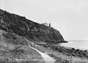
Blackhead and Lighthouse, Co Antrim - a low view of the cliff and lighthouse. (Location: Northern Ireland: County Antrim: Whitehead). Date: circa early 1900s
R. C. Chapel, WhiteheadR.C. Chapel, Whitehead - a side view of the chapel. (Location: Northern Ireland: County Antrim: Whitehead). Date: circa early 1900s
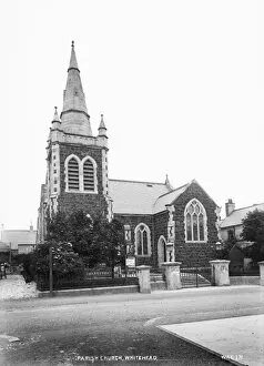
Parish Church, Whitehead - a front view from the road. (Location: Northern Ireland: County Antrim: Whitehead). Date: circa early 1900s
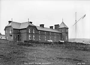
Coastguard Station, Whitehead - a side view of the building. (Location: Northern Ireland: County Antrim: Whitehead). Date: circa early 1900s
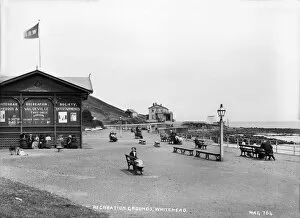
Recreation Grounds, Whitehead - view with a lot of people on benches and vaudeville hut on the left and other buildings and swings in the distance