mail_outline sales@mediastorehouse.com
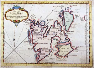
Map of Spitsbergen, NorwayMap of Spitsbergen, Svalbard, Norway Date: 1758
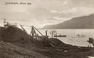
Spitsbergen, Norway - Adventfjorden (Advent Bay). Depicted here is the former mining camp of Longyearbyen (located on its southwestern shore)
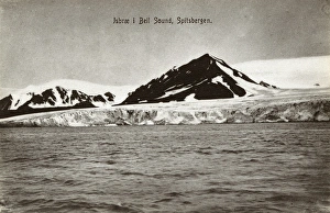
Spitsbergen, Norway - Bellsund (Bell Sound)Bellsund (Bell Sound) - a 20km long sound on the west coast of Spitsbergen, part of the Svalbard archipelago, Norway. Date: circa 1910s
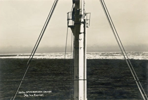
View from a cruise ship to an Ice BarierView from a cruise to an Ice Barier, Spitsbergen (Spitzbergen) circa 1930
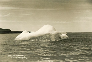
Iceberg in Kings Bay, Spitsbergen (Spitzbergen)Floating iceberg in Kings Bay, Spitsbergen (Spitzbergen), Norway. circa 1930
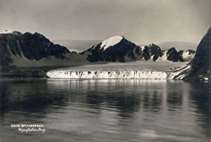
Glacier of Spitsbergen (Spitzbergen), Magdalen BayA Glacier of Spitzbergen (Spitsbergen) at Magdalen Bay. Spitsbergen is the largest and only permanently populated island of the Svalbard archipelago in northern Norway. circa 1930
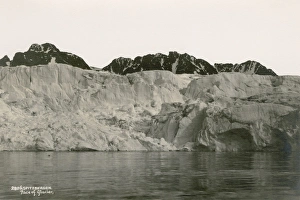
Face of glacier from Spitsbergen (Spitzbergen)Postcard showing a glacier from Spitsbergen (Spitzbergen). circa 1930
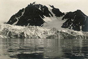
Spitsbergen (Spitzbergen), Magdalen BayPostcard showing Spitzbergen (Spitsbergen) at Magdalen Bay. Spitsbergen is the largest and only permanently populated island of the Svalbard archipelago in northern Norway. circa 1930