mail_outline sales@mediastorehouse.com
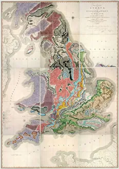
William Smith Geological Map
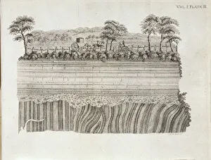
Geological unconformity on the river Jed. Plate 3 from Theory of the Earth (1795) Vol. 1, by James Hutton
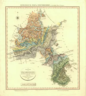
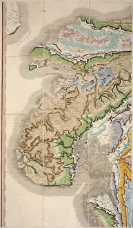
Geological Map of OxfordshireDelineation of Strata of Oxfordshire by William Smith
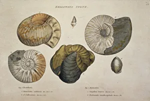
Kelloways Stone
William Smiths Geological MapFig. 6 from Delineation of Strata of England and Wales (1815) by William Smith
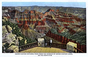
Grand Canyon National Park fr. Terrace of Grand Canyon LodgeGrand Canyon National Park from the Terrace of the Grand Canyon Lodge - North Rim. Date: circa 1930s
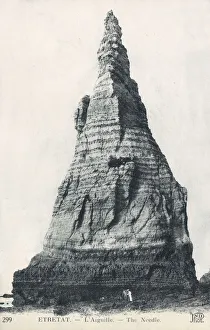
Etretat, France - L Aiguille ( The Needle )Etretat, Seine-Maritime department in the Normandy region of France - L Aiguille ( The Needle ) Date: circa 1907
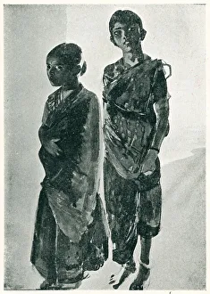
Two Brahmin GirlsA group portrait painting of two Brahmin girls, which means they belong to the highest caste society in Hinduism, a section of the social stratification system permitted to intellectuals and priests
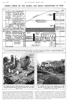
Archaeological excavations at Kish, Mespotamia, Iraq" Visible proof of the flood: the great discoveries at Kish" - a page from the Illustrated London News, featuring an article by Dr
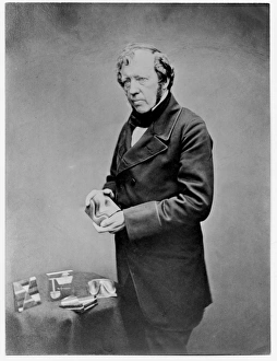
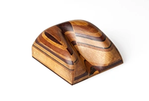
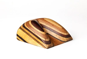
Thomas Sopwith (1803-1879) & geological modelsThomas Sopwith (1803 - 1879) was an eminent geologist and civil engineer who pioneered methods of representing geological features
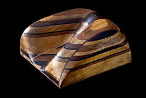
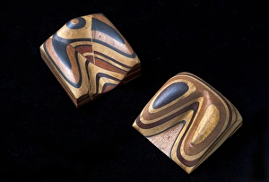
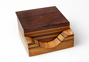
Sopwith Model XII: Denudation of mineral veinsThis model shows the influence of surface denudation and faulting on inclined strata, with increased complexity to the situation in Model VII
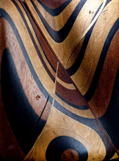
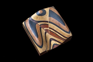
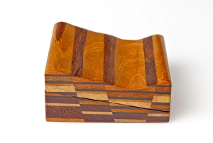
Sopwith Model VII: Surface denudation of veinsThis model shows the influence of surface denudation and faulting on otherwise flat, horizontal strata. The discontinuity between the beds as viewed at the surface can be seen
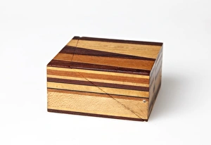
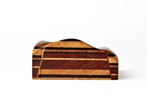
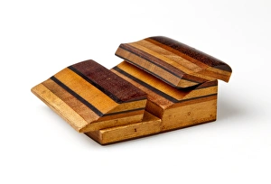
Sopwith Models: denudation & faultingModels showing the effect of denudation and faulting on how rock strata appear at the surface. Thomas Sopwith (1803 - 1879)
Sopwith Model II: Coal strata near NewcastleUnlike the models of generic situations this representation of coal strata was specific to a particular surveyed location in England showing several thin, and mostly hidden, coal seams
Sopwith Model VII: Denudation of mineral veinsThis model shows the influence of surface denudation and faulting on otherwise flat, horizontal strata. The discontinuity between the beds as viewed at the surface can be seen
Sopwith Model VI: Intersecting mineral veinsThis Model, rather than representing the strata as they would appear at the surface, shows how a seam of coal can be displaced in the subsurface by various modes of faulting
Sopwith Model XI: Vertical intersecting veinsThis model, when separated, shows the complex interface between faulted strata of rocks. Thomas Sopwith (1803 - 1879) was an eminent geologist
Sopwith Model XII: Mineral vein denudationThis model shows the influence of surface denudation and faulting on inclined strata, with increased complexity to the situation in Model VII
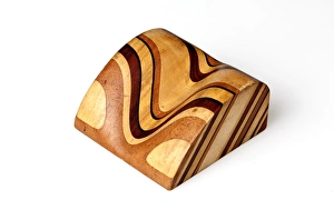
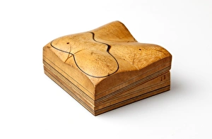
Sopwith Model VIII: Overcutting of strataThis model shows overcut strata: when the layers of rock are inclined at a gentler angle than the eroded slope, the resulting vee pattern points uphill
Sopwith Model VII: Surface denudationThis model shows the influence of surface denudation and faulting on otherwise flat, horizontal strata. The discontinuity between the beds as viewed at the surface can be seen
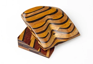
Sopwith Model X: Denuded basset of strataThis model shows undercut strata: when the layers of rock are inclined at a steeper angle than the eroded slope, the resulting vee pattern points downhill
Sopwith Model V: Dislocations of coal strataThis model shows that while very little coal may appear at ground level, coal seams (subject to faults and dislocations) can be found below the ground
Sopwith Model IV: Fallacious coal indicationsThis model depicts the scenario where from the surface an abundance of coal appears to exist, but there is actually very little quantity below
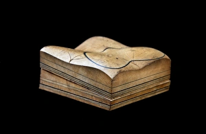
Sopwith Model III: Dislocation of strataThis model represents the side of a valley of denudation, with undisturbed horizontal beds of sedimentary rock when fully assembled
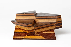
Sopwith Model I: Stratified rocks / denudationBlack lines in this model represent coal seams, between lighter shales and sandstones. When separated the lower section shows a gently inclined valley floor
Sopwith Model II: Coal strata nr NewcastleUnlike the models of generic situations this representation of coal strata was specific to a particular surveyed location in England showing several thin, and mostly hidden, coal seams
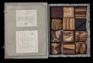
Cover of Thomas Sopwiths Geological Model SetThomas Sopwith (1803 - 1879) was an eminent geologist and civil engineer who pioneered methods of representing geological features
Thomas Sopwiths Geological Model SetThomas Sopwith (1803 - 1879) was an eminent geologist and civil engineer who pioneered methods of representing geological features
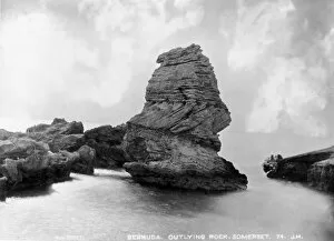
Outlying rocks, Bermuda 1873A photograph taken during the voyage of H.M.S. Challenger (1872-1876), funded by the British Government for scientific purposes
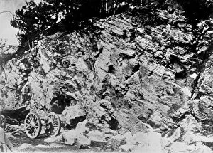
Rock structure, Burmuda 1873A photograph taken during the voyage of H.M.S. Challenger (1872-1876), funded by the British Government for scientific purposes
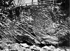
Peculiar stratifications just outside the dockyards, BermudaA photograph taken during the voyage of H.M.S. Challenger (1872-1876), funded by the British Government for scientific purposes
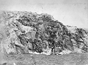
Rock formation, Bermuda 1873A photograph taken during the voyage of H.M.S. Challenger (1872-1876), funded by the British Government for scientific purposes
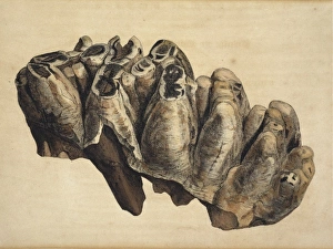
Fossil tooth of some extinct monstrous unknown animal from WPlate 1 from Strata Identified by Organized Fossils by William Smith (1816-1819) (Mastodon arvernensis Croizet & Jobert from Norwich Crag, Pleistocene)
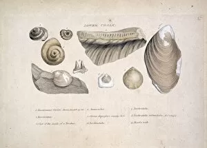
Lower Chalk
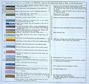
William Smiths geological tableFig 2 from Delineation of Strata of England and Wales (1815) by William Smith
Volcanic eruptionA flood basalt eruption. One of a series (including image numbers 185 to 190) showing various forms of volcanic eruption
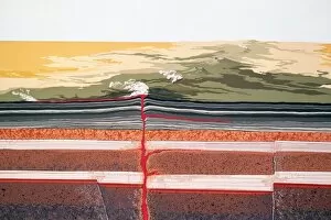
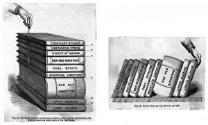
Stratification DiagramsTwo diagrams to explain stratification: the books represent the different stratas in a depth of about 5 miles; the hand indicates depth of the coal strata Date: 19th century