mail_outline sales@mediastorehouse.com
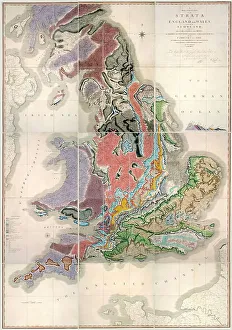
William Smith Geological Map
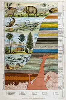
Geological Strata 19CA schematic representation of geology and palaeontology
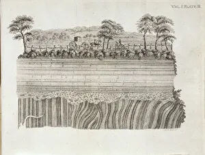
Geological unconformity on the river Jed. Plate 3 from Theory of the Earth (1795) Vol. 1, by James Hutton
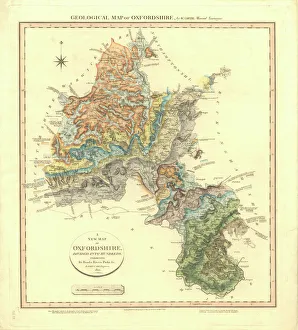
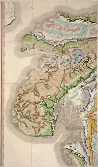
Geological Map of OxfordshireDelineation of Strata of Oxfordshire by William Smith
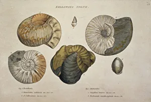
Kelloways Stone
William Smiths Geological MapFig. 6 from Delineation of Strata of England and Wales (1815) by William Smith
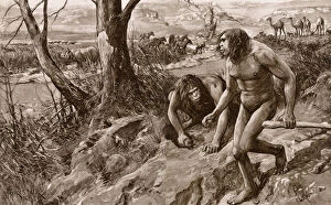
Earliest man tracked by tooth, discovery in Pliocene strataThe earliest man tracked by a tooth: an astounding discovery of human remains in Pliocene strata. An artists vision of Hesperopithecus (the ape-man of the western world) and contemporary animals
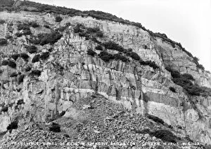
Watchet Cliff StrataThe curious cliff strata at Watchet, Somerset, England
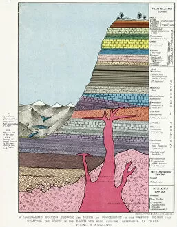
ROCK STRATA SECTIONSA diagrammatic section showing the order of succession of rock strata in the earths crust
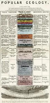
ROCK STRATA DIAGRAMA diagram giving a detailed explanation of rock strata groups, their uses and localities
CRUIKSHANK - SOCIETYAn Outline of Society in Our Own Times Date: 1846
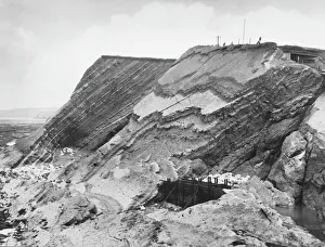
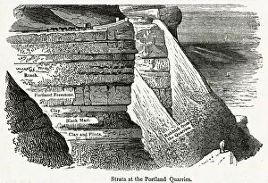
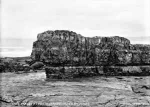
PORTLAND QUARRY: STRATAPORTLAND Diagram showing rock strata at the quarries Date: circa 1830s
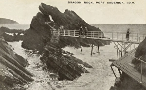
Dragon Rock - Port Soderick - Isle of Man. Date: circa 1910s
Cornish rock faceClose up of a Cornish rock face. circa 1946
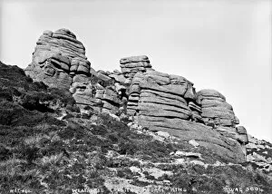
Weathered Granite, Mourne Mountains - a view of exposed Granite strata on a hillside (see WAG 583). (Location: Northern Ireland; County Down; Mournes). Date: circa early 1900s
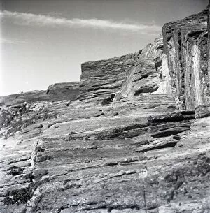
Lias Shales at Portrush Indurated By Dykes - a side view of an escarpment showing strata alignment. (Location: Northern Ireland; County Antrim; Portrush). Date: circa early 1900s
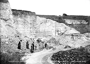
Magheralin, Moira, Boulder Clay Overlying Indurated Chalk - a ground level view of the rock strata with people in the foreground and horse and trap to the rear
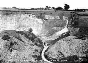
Chalk Capped By Boulder Clay, Magheralin Quarry, Moira - a view of the quarry and exposed rock strata. (Location: Northern Ireland; County Down; Moira). Date: circa early 1900s
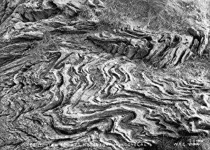
Contorted Schists, Rossapena, North West Donegal - a close in view of whirled rock strata. (Location: Republic of Ireland; County Donegal; Rosapenna). Date: circa early 1900s
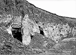
Indurated Chalk Capped By the Plateau Basalts, Whitewell Quarry, Belfast - a close in view of rock strata. (Location: Northern Ireland: County Antrim: Belfast). Date: circa early 1900s
Transverse Dykes Or Sills in Triassic Sandstone, Scrabo. Newtownards - a view of strata in an exposed section of hillside. (Location: Northern Ireland; County Down; Newtownards)
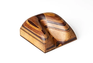
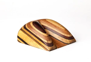
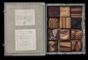
Thomas Sopwith (1803-1879) & geological modelsThomas Sopwith (1803 - 1879) was an eminent geologist and civil engineer who pioneered methods of representing geological features
Sopwith Model XII: Denudation of mineral veinsThis model shows the influence of surface denudation and faulting on inclined strata, with increased complexity to the situation in Model VII
Sopwith Model VII: Surface denudation of veinsThis model shows the influence of surface denudation and faulting on otherwise flat, horizontal strata. The discontinuity between the beds as viewed at the surface can be seen
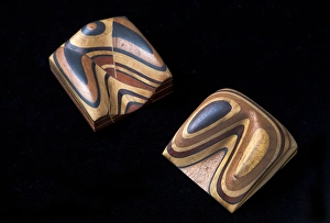
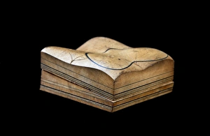
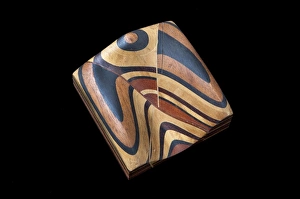
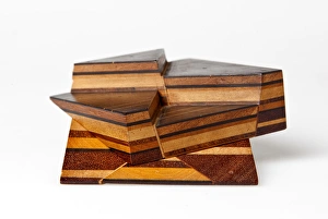
Sopwith Models: denudation & faultingModels showing the effect of denudation and faulting on how rock strata appear at the surface. Thomas Sopwith (1803 - 1879)
Sopwith Model II: Coal strata near NewcastleUnlike the models of generic situations this representation of coal strata was specific to a particular surveyed location in England showing several thin, and mostly hidden, coal seams
Sopwith Model VII: Denudation of mineral veinsThis model shows the influence of surface denudation and faulting on otherwise flat, horizontal strata. The discontinuity between the beds as viewed at the surface can be seen
Sopwith Model VI: Intersecting mineral veinsThis Model, rather than representing the strata as they would appear at the surface, shows how a seam of coal can be displaced in the subsurface by various modes of faulting
Sopwith Model XI: Vertical intersecting veinsThis model, when separated, shows the complex interface between faulted strata of rocks. Thomas Sopwith (1803 - 1879) was an eminent geologist
Sopwith Model XII: Mineral vein denudationThis model shows the influence of surface denudation and faulting on inclined strata, with increased complexity to the situation in Model VII
Sopwith Model VIII: Overcutting of strataThis model shows overcut strata: when the layers of rock are inclined at a gentler angle than the eroded slope, the resulting vee pattern points uphill
Sopwith Model VII: Surface denudationThis model shows the influence of surface denudation and faulting on otherwise flat, horizontal strata. The discontinuity between the beds as viewed at the surface can be seen
Sopwith Model X: Denuded basset of strataThis model shows undercut strata: when the layers of rock are inclined at a steeper angle than the eroded slope, the resulting vee pattern points downhill
Sopwith Model V: Dislocations of coal strataThis model shows that while very little coal may appear at ground level, coal seams (subject to faults and dislocations) can be found below the ground
Sopwith Model IV: Fallacious coal indicationsThis model depicts the scenario where from the surface an abundance of coal appears to exist, but there is actually very little quantity below
Sopwith Model III: Dislocation of strataThis model represents the side of a valley of denudation, with undisturbed horizontal beds of sedimentary rock when fully assembled
Sopwith Model I: Stratified rocks / denudationBlack lines in this model represent coal seams, between lighter shales and sandstones. When separated the lower section shows a gently inclined valley floor
Sopwith Model II: Coal strata nr NewcastleUnlike the models of generic situations this representation of coal strata was specific to a particular surveyed location in England showing several thin, and mostly hidden, coal seams
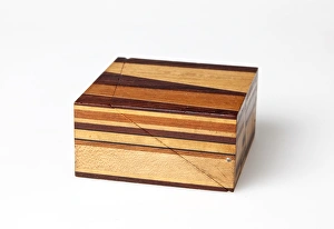
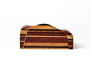
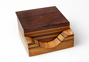
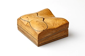
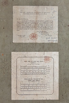
Cover of Thomas Sopwiths Geological Model SetThomas Sopwith (1803 - 1879) was an eminent geologist and civil engineer who pioneered methods of representing geological features
Thomas Sopwiths Geological Model SetThomas Sopwith (1803 - 1879) was an eminent geologist and civil engineer who pioneered methods of representing geological features
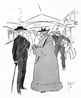
Elderly lady not overly generous with her tipping" Have you got change for a threepenny-piece, Adolphus? I want to give the porter a gratuity." The porter appears to already be expecting the impending disappointment! Date: 1894
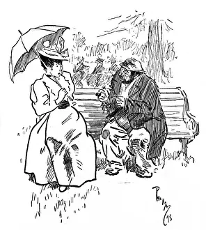
Tramp asks a horrified lady for a hairpin to clean his pipeA Tramp asks a horrified smart lady, seated on a park bench for a hairpin to clean his pipe! Weary Willy seating himself beside nervous Miss Jones) - Will yer lend me a nairpin, Lidy
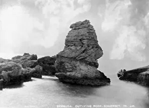
Outlying rocks, Bermuda 1873A photograph taken during the voyage of H.M.S. Challenger (1872-1876), funded by the British Government for scientific purposes
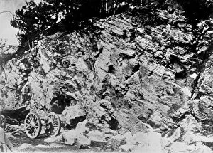
Rock structure, Burmuda 1873A photograph taken during the voyage of H.M.S. Challenger (1872-1876), funded by the British Government for scientific purposes