mail_outline sales@mediastorehouse.com
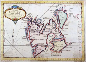
Map of Spitsbergen, NorwayMap of Spitsbergen, Svalbard, Norway Date: 1758
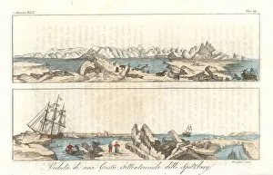
View of the north coast of Spitsbergen island, Norway, early 19th century. Handcoloured copperplate engraving by Bernieri from Giulio Ferrarios Ancient
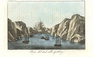
View of the South Bay of Spitsbergen island, NorwayView of sailing ships in the South Bay of Spitsbergen island, Norway. Handcoloured copperplate engraving by Bernieri from Giulio Ferrarios Ancient and Modern Costumes of all the Peoples of the World
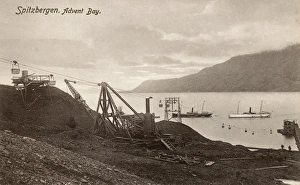
Spitsbergen, Norway - Adventfjorden (Advent Bay). Depicted here is the former mining camp of Longyearbyen (located on its southwestern shore)
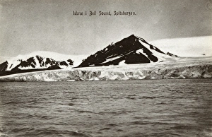
Spitsbergen, Norway - Bellsund (Bell Sound)Bellsund (Bell Sound) - a 20km long sound on the west coast of Spitsbergen, part of the Svalbard archipelago, Norway. Date: circa 1910s
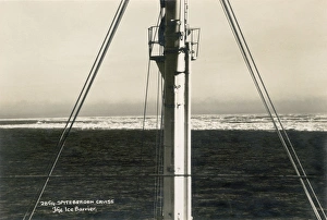
View from a cruise ship to an Ice BarierView from a cruise to an Ice Barier, Spitsbergen (Spitzbergen) circa 1930
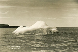
Iceberg in Kings Bay, Spitsbergen (Spitzbergen)Floating iceberg in Kings Bay, Spitsbergen (Spitzbergen), Norway. circa 1930
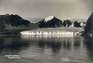
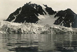
Glacier of Spitsbergen (Spitzbergen), Magdalen BayA Glacier of Spitzbergen (Spitsbergen) at Magdalen Bay. Spitsbergen is the largest and only permanently populated island of the Svalbard archipelago in northern Norway. circa 1930
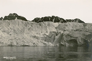
Face of glacier from Spitsbergen (Spitzbergen)Postcard showing a glacier from Spitsbergen (Spitzbergen). circa 1930
Spitsbergen (Spitzbergen), Magdalen BayPostcard showing Spitzbergen (Spitsbergen) at Magdalen Bay. Spitsbergen is the largest and only permanently populated island of the Svalbard archipelago in northern Norway. circa 1930
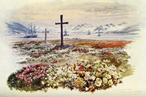
Norway / Kecherche BayKecherche Bay, Spitsbergen: graves of Norwegian whalers Date: 1909
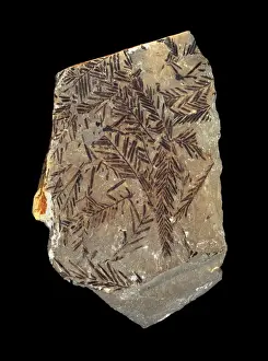
Metasequoia occidentalisEocene fossil leaves from Spitsbergen. Specimen held at the Natural History Museum, London
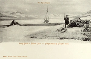
Trapping in Advent Bay, Spitsbergen, NorwayA trapper at work in Advent Bay, Spitsbergen, Norway Date: circa 1907
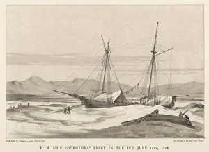
Franklin / Dorothea in IceLieutenant John Franklin on his first expedition: the Dorothea icebound not far from Spitsbergen. The expedition did bring back some valuable charts