mail_outline sales@mediastorehouse.com
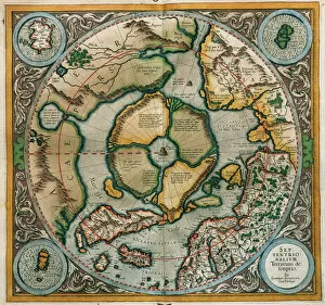
Septentrionalium Terrarum descriptio, 1595, by Gerardus MercGerardus Mercator (1512-1594). Flemish cartographer. Septentrionalium Terrarum descriptio. Map of the Arctic with the North Pole and surrounding lands within and outside the Arctic Circle, 1595
Mercator / World Map / 1587A map of the world by Gerhard Mercator
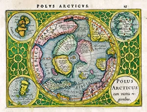
Arctic, North Pole
Gerhard Mercator - Cartographer
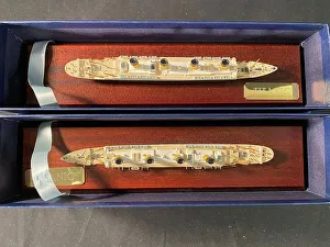
White Star Line, RMS Titanic - Mercator cast modelsWhite Star Line, RMS Titanic - boxed pair of modern Mercator cast models, on treen stands. 11.5 inches. Date: 20th century
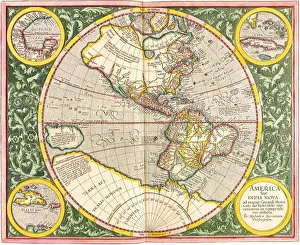
Map of the Americas1633 Date: 1633
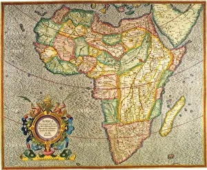
Map of Africa 1633 Date: 1633
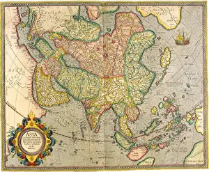
Map of Asia 1633 Date: 1633
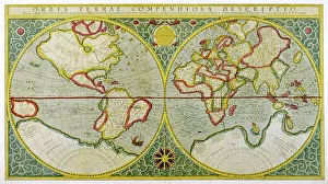
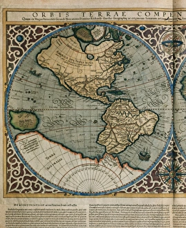
World Map by Rumold Mercator (1512-1594)Orbis Terrae Compendiosa Descriptio. World map, 1587. Detail of America. By Rumold Mercator (1545-1599)
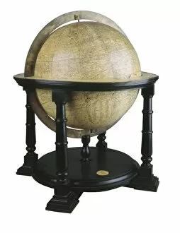
MERCATOR, Gerhard Kremer, called Gerardus (1512-1594). Earth Globe by Mercator. Dimensions: 64 x 55 cm. Diameter: 41 cm. BELGIUM. Sint-Nikls. Mercatormuseum
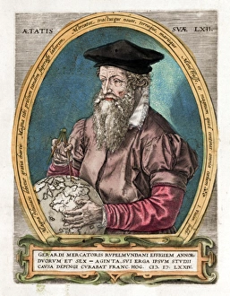
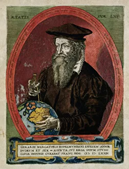
Gerardus MercatorGERARDUS MERCATOR Known also as Gerhard Kremer Flemish cartographer
Portrait of Mercator with globe and compassTitle page illustration from Theatrum Geographiae Veteris, an early large-scale world Atlas by Pertius Bertius, printed in Amsterdam 1618-19 showing the great cartographer Mercator Date: 1618
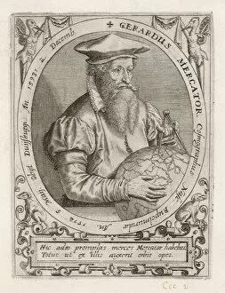
Gerardus Mercator (1512-1594). EngravingGerardus Mercator (1512-1594). Flemish cartographer. Engraving, 1595
Martin P4M-1 Mercator
Martin XP4M-1 Mercator
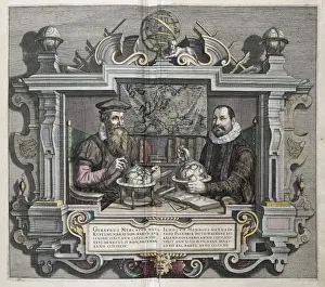
The geographers and cartographers Gerardus Mercator (left) and Jodocus Hondius. Etching. BELGIUM. Sint-Nikls. Mercatormuseum