mail_outline sales@mediastorehouse.com
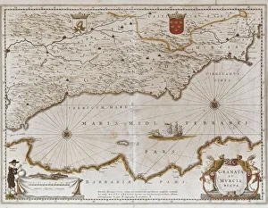
Map of the kingdoms of Granada and Murcia (Granata et Murcia regna) by W. Blaeu. Decorated with the Arms of both States, the figure of a surveyor and a naval combat. Published in Amsterdam, 1635
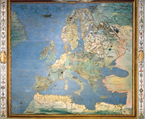
ITALY. Caprarola. Villa Farnese. Map of Europe. 1574 painting by Giovanni Antonio da Varese Vanosino. Stanza del Mappamondo (Geographic room or Room of the World Map). Renaissance art. Cinquecento
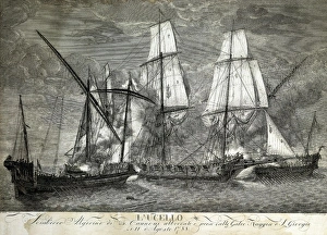
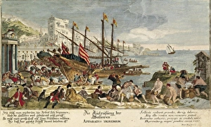
Capture of the Algerian corsair xebec L Uccello by the Genoese galleys Taggia and San Giorgio on August 11, 1788 near San Remo. Engraving. ITALY. LIGURIA. Genoa. Pegli. Navy Museum
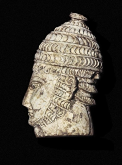
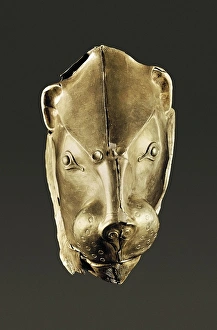
Warrior head. Mycenaean artIvory Head of a Warrior. 13th c. BC. Mycenaean art. Sculpture on ivory. GREECE. ATTICA. Athens. National Museum of Archaeology. Proc: GREECE. PELOPONNESE. ARCADIA. Mycenae
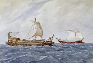
Roman shipsMONLEON Y TORRES, Rafael (1835-1900). History of the navigation: Ships of the Ancient Rome. Military bireme and trade ship. Watercolour. SPAIN. MADRID (AUTONOMOUS COMMUNITY). Madrid. Navy Museum
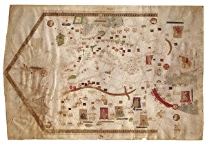
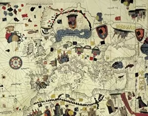
Portolan chart of the Mediterranean sea (1439) of Gabriel de Vallseca. It belonged to Amerigo Vespucci. SPAIN. Barcelona. Barcelona Maritime Museum
Gold Rython. 16th C. BC. Object found in the Fourth Tomb of A-level Tombs. Mycenaean art. Jewelry. GREECE. ATTICA. Athens. National Museum of Archaeology. Proc: GREECE. PELOPONNESE. ARCADIA. Mycenae
Apparatus triremium Procurement of food and water in galleys. 18th c. Copper engraving by Martin Engelbrecht (1684-1756) after drawing of Jacques Rigaud (1680-1754). Early Modern Era. Engraving
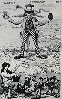
Il Colosso di Rodi. Allegory of the British Empire as the Colossus of Rhodes monitoring and controlling the passage of the Bosphorus
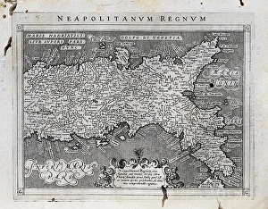
Map of the Kingdom of Naples. 1597-1568. Illustration from the work Geografia, cio鬠 Descrittione universale de la terra, edited in Venice by Giovanni Battista and Giorgio Galignani. SPAIN
COSA, Juan de la (1460-1510). Cartographer. Nautical chart. 1500. Detail. SPAIN. Madrid. Navy Museum