mail_outline sales@mediastorehouse.com
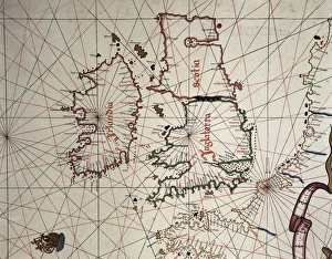
Spanish map of England, Scotland and IrelandA Spanish map of England, Scotland and Ireland and the coast of northern France from the time of the Anglo Spanish War. Joan Martines (1556-1591). Date: 1587
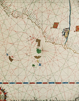
Portolan of Joan Martines (16th century). 1587. Map of the CPortolan of Spanish cartographer Joan Martines (16th century). Majorcal school. 1587. Map of the Canary Islands and the west coast of Africa. Messina, Sicily. National Library. Madrid. Spain
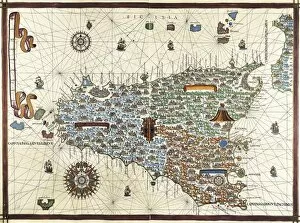
Chart by Joan Martines. Island of Sicily (1591). Miniature Painting
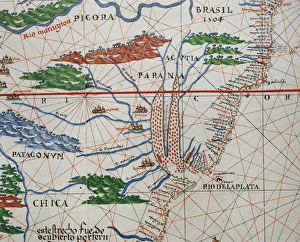
Portolan atlas by Joan Martines (1556-1590). Detail SouthPortolan atlas of the world by Joan Martines (1556-1590). Messina, 1587. Detail of South America. Atlantic Coast. National Library. Madrid. Spain
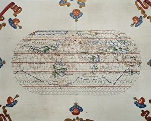
Portolan atlas by Joan Martines (1556-1590). MessinaPortolan atlas of the world by Joan Martines (1556-1590). Messina, 1587. National Library. Madrid. Spain
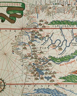
Portolan of Joan Martines (16th century). American west coasPortolan of Spanish cartographer Joan Martines (16th century). Majorcan school. American west coast (Peru, Ecuador and Colombia). 1587 Messina, Sicily
Seventy Seven Park Lance by Walter HackettPromotional postcard for Seventy Seven Park Lane by Walter Hackett. First produced St. Martins Theatre, 25th October 1928. Well-dressed couples arrive at the prestigious London address of the title
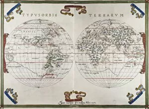
World map by Joan Martines (1591). Miniature Painting
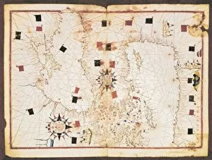
Portolan chart, 16th c. Map of the Eastern Mediterranean Sea and the Black sea. (Anonymous, it is believed to be made by Joan Martines or by his workshop). Renaissance art. Miniature Painting. SPAIN