mail_outline sales@mediastorehouse.com
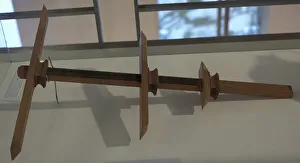
Ballestilla. 16th centuryBallestilla (Jacob's staff). Navigational instrument used to calculate the height of the sun and other celestial bodies over the horizon for use in nautical navigation. 16th century
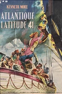
RMS Titanic - poster, French version of A Night to RememberRMS Titanic: poster for French version of film A Night to Remember (Atlantique Latitude 41) by J Fourastre, 45 x 60 inches. Date: 1958
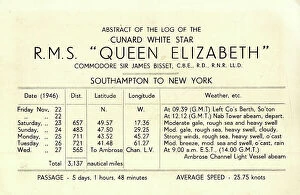
Abstract of Cunard White Star Log, RMS Queen ElizabethAbstract of the Log of Cunard White Star RMS Queen Elizabeth, November 1946 - Southampton to New York. Date: 1946
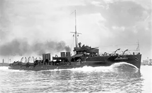
HMS Usk - a Yarrow-type River-Class destroyerRoyal Navy - HMS Usk, a Yarrow-type River-Class destroyer ordered under the 1901 - 1902 Naval Estimates and named after the River Usk in Wales flowing through Newport
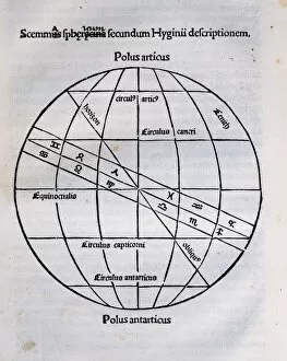
Earths Sphere according the author. Engraving in Poeticon Astronomicon, by Gaius Julius Hyginus (ca.64 BC-17 AD). Edited in Venice, 1485. Incunable
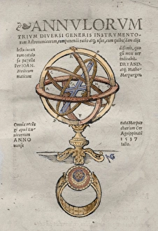
Annulorum by Johann Dryander. Colored engravingJohann Dryander (1500-1560). German anatomist and astronomer. Annulorum. Title cover, 1537. Colored engraving
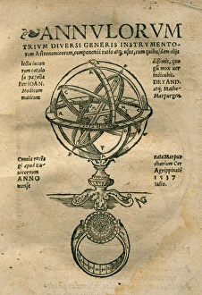
Annulorum by Johann DryanderJohann Dryander (1500-1560). German anatomist and astronomer. Annulorum. Title cover, 1537
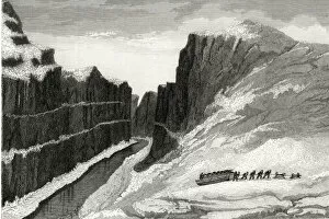
Ross / Saumarez RiverJohn Rosss arctic expedition: The Saumarez River which never freezes in Latitude 70 degrees north and Longitude 92 degrees west. Date: 1829 - 33
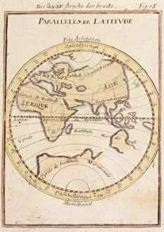
Parallels of LatitudeParallels of latitude, including the Equator Date: circa 1690
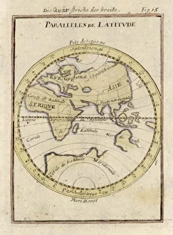
Lines of Latitude 1683Showing Africa, Europe, Asia, part of Australia, the two hemispheres, the equator and the lines of Latitude. With Dutch text and listed as plate no.15 (?)