mail_outline sales@mediastorehouse.com
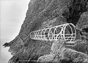
70ft Oval Girder Bridge, Gobbins, Islandmagee - with people on structure. (Location: Northern Ireland: County Antrim: Islandmagee). Date: circa early 1900s
Gobbins cliff pathThe Gobbins cliff path in Islandmagee, County Antrim, Northern Ireland : a thrilling point of the walk as a steel bridge extends over the sea
The Gobbins, Islandmagee, Antrim, Ireland
The Gobbins, Islandmagee, ireland - early 1900s
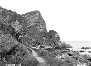
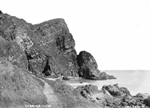
Gobbins Head - a close in view of the Headland taken from the Cliff path. (Location: Northern Ireland; County Antrim; Gobbins). Date: circa early 1900s
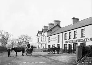
The Lough Road, Ballycarry - a view of the Gobbins Hotel and shop fronts with two horse vehicles, one with people and bicycles. (Location: Northern Ireland: County Antrim; Ballycarry td.)
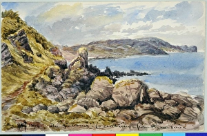
The Gobbins, Co. Antrim, from Pigeon Cove (1874). Moore, James 1819 - 1883. Date: 1874
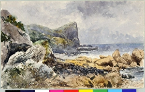
The Gobbins, Co. Antrim (1870). Moore, James 1819 - 1883. Date: 1870
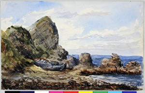
The Gobbins, Islandmagee (1865). Moore, James 1819 - 1883. Date: 1865
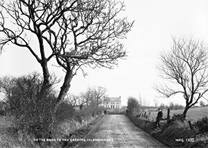
On the Road to the Gobbins, Islandmagee - a view of a country road with a house in the distance, (and horse) and a man to the right. (Location: Northern Ireland: County Antrim: Islandmagee)
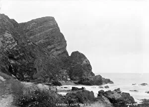
Gobbins Cliff Head - a scenic view of the cliff head taken from the shore. (Location: Northern Ireland: County Antrim: Islandmagee). Date: circa early 1900s
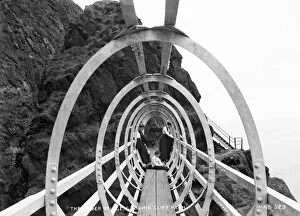
Tubular Bridge, Gobbins Cliff Path, Whitehead - a view of the tubular bridge on the cliff path walk. (Location: Northern Ireland: County Antrim: Whitehead). Date: circa early 1900s
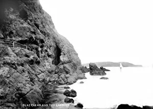
Blackhead and the Gobbins - a view showing the cliff path at blackhead. (Location: Northern Ireland: County Antrim: Whitehead). Date: circa early 1900s
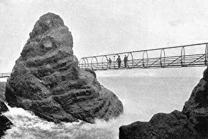
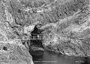
The Gobbins Swinging Bridge - a view of a bridge spanning the entrance to a large cave with people on the bridge and rocks. (Location: Northern Ireland: County Antrim: Islandmagee)
Entrance Tunnel to Gobbins Cliff Path - a view of the entrance tunnel to the Gobbins with a young boy for scale. (Location: Northern Ireland: County Antrim: Islandmagee). Date: circa early 1900s
The Gobbins Bridge - a perspective view of the cliff path and tubular bridge with a man on the bridge for scale. (Location: Northern Ireland: County Antrim: Islandmagee). Date: circa early 1900s
The Girder Bridge, Gobbins Cliff Path - a perspective view along the girder bridge with people on the bridge. (Location: Northern Ireland: County Antrim: Islandmagee). Date: circa early 1900s
Gobbins Cliff Head, Islandmagee - a view of a cliff and people on the cliff path. (Location: Northern Ireland: County Antrim: Islandmagee). Date: circa early 1900s
The Gobbins Cliffs, Islandmagee - same view as above but with people in the foreground. (Location: Northern Ireland: County Antrim: Islandmagee). Date: circa early 1900s
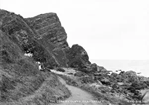
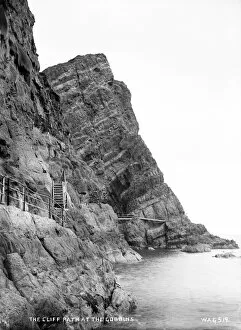
Cliff Path at the Gobbins - a view of the Gobbins cliffs and the path going around it. (Location: Northern Ireland: County Antrim: Islandmagee). Date: circa early 1900s
The Sandy Cave, Gobbins Cliff Path - a view of a group of people outside an entrance to a cave. (Location: Northern Ireland: County Antrim: Islandmagee). Date: circa early 1900s
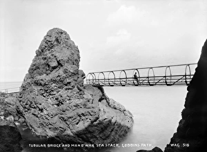
Tubular Bridge and Man O War Sea Stack, Gobbins Path - a view of a man on the middle of a tubular bridge spanning a sharp drop to the sea. (Location: Northern Ireland: County Antrim: Islandmagee)
Hillsport and the Gobbins - a coastal view. (Location: Northern Ireland: County Antrim: Islandmagee). Date: circa early 1900s
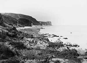
The Gobbins Path from the South - a coastal view. (Location: Northern Ireland: County Antrim: Islandmagee). Date: circa early 1900s
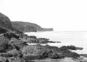
The Gobbins from South - a view along the shore showing the cliffs. (Location: Northern Ireland; County Antrim; Gobbins). Date: circa early 1900s
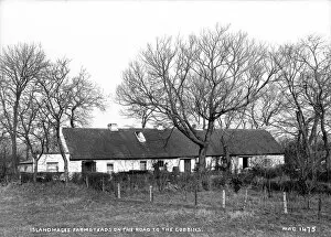
Islandmagee Farmsteads on the Road to the Gobbins - a view of a long thatched cottage. (Location: Northern Ireland: County Antrim: Islandmagee). Date: circa early 1900s