mail_outline sales@mediastorehouse.com
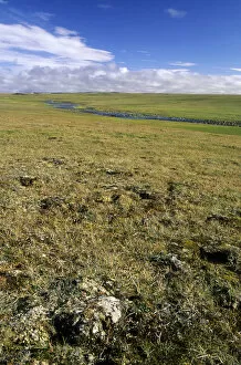
Arctic tundra, a typical landscape near Dikson. Russian Arctic. A typical habitat of Siberian Lemming. August
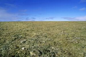
Arctic tundra landscape. plain near Dikson, Russian Arctic. A typical habitat of Siberian Lemming. Summer, August
Oldoinyo Lengai from lake Natron, Tanzania, Africa
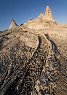
Lava - The top of Oldoynio Lengai Volcano / The Mountain of God. Tanzania - Africa
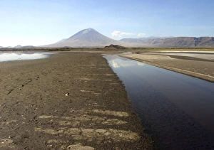
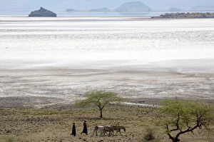
View of Oldoynio Lengai Volcano / The Mountain of God. from Lake Natron - Tanzania - Africa
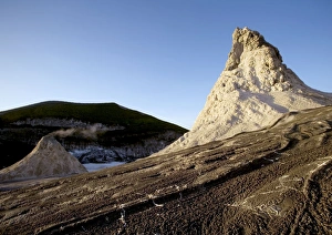
The top of Oldoynio Lengai Volcano / The Mountain of God. Tanzania - Africa
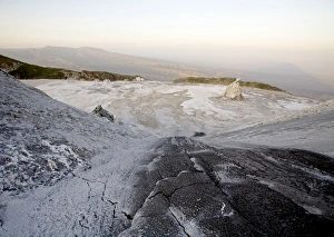
View from the top of Oldoynio Lengai Volcano / The Mountain of God. Tanzania - Africa
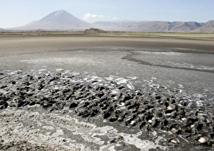
Msai moving with donkeys near lake Natron. Tanzania - Africa
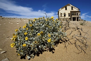
Old Mining Town near Luderitz called Ghost Town. Namibia - Africa
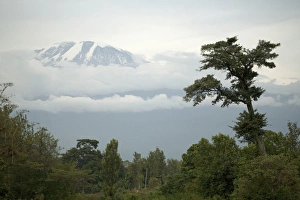
Mount Kilimanjaro - Snow melting on summit. Tanzania - Africa
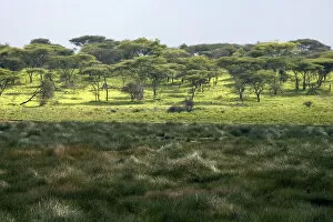
Small marsh at Ndutu. part of Ngorongoro conservation area - Tanzania - Africa
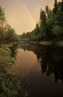
Rainbow after evening rain over river Negustyah (typical Siberian river). tributary of river Bolshoi Ugan, near Ugut settlement; Uganskii Nat. reserve, Siberia, Russia; spring
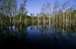
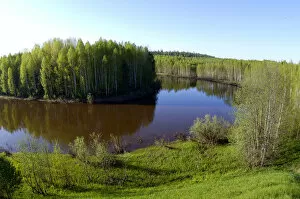
River Ugutka flooded valley in spring, typical scene. tributary of Bolshoi Ugan river, near Ugut settlement; Uganskii Nat. reserve, Siberia, Russia; spring
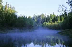
Morning mist over river Negustyah, a tributary of river Bolshoi Ugan. Spring. near Ugut settlement; Uganskii Nat. reserve, Siberia, Russia
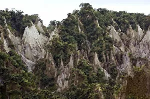
Wind and rain erosion of mountains of ash - lahar - formed from fallen ash of volcano Pinatubo, erupted in 1992. Mount Pinatubo in Luzon, Philippines
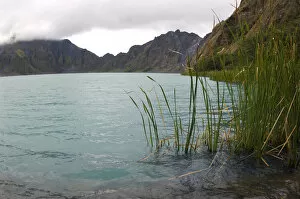
A lake, formed in a crater of volcano Pinatubo (the water level gradually rises over the years), erupted in 1992. The blue colour of water is due to a high salinity
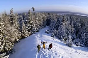
A typical view over coniferous taiga-forest and North Ural Mountains. near Vsevolodo-Blagodatskoye village; Russians on a snow-walk; midwinter, December. (All the land is state owned)
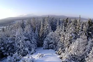
Russia; midwinter, December. The view is towards Denezhkin Kamen State Nature Reserve. Taiga-forest and a view to Denezhkin Kamen mountain (1492m)
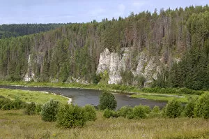
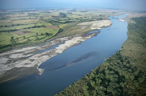
Limestone rocks along river Chusovaya - the symbol of conquest of Siberia, the only river that flows from Asia to Europe cutting through the Ural Mountains
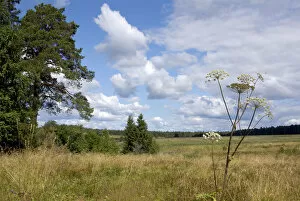
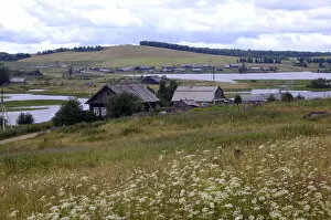
A typical scenery in Ural Mountains, near Ekaterinburg, Russia. A meadow that used to be a large village Shanya of Russian Shismatic Ordodox Old Believers church; village abandoned in 1940s due to
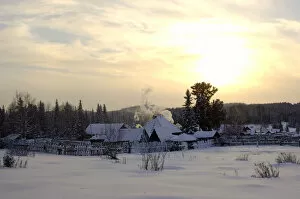
Russian village at midwinter sunset. a typical scene in North Ural Mountains; outskirts of the Vsevolodo-Blagodatskoye village, surrounded by coniferous forest; Russia, december
Deciduous forest in river Sakmara valley (a tributary of river Ural) in South Ural Mountains, just before the river enters the steppes (Dryomys nitedula )
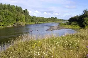
River Lalya valley, a typical Siberian river;. near Staraya Lalya settlement in Ural Mountains; summer
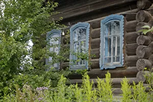
Russia - A traditional front of an early 19th century wooden house in village Karaul, which used to be a customs check-point settlement on a famous Babinovs road from European Russia to Siberia in
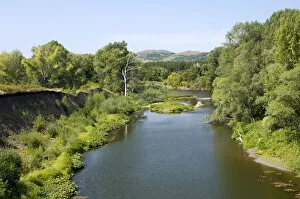
River Syilva / Sylva passing through Syilva / Sylva village, one of oldest Russian settlements in Siberia (now in a state of desolation). Ural Mountains, near Ekaterinburg, Russia; late summer
River Tura in North Ural Mountains - a typical large Siberian river with brown waters (coloured by pit) in spring. Near Verhoturye town, Siberia, Russia
Nepal - Terai. Chitwan National Park, River Rapti marks park boundry
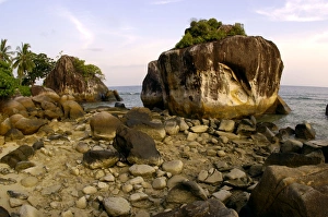
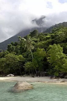
Volcanic boulders on a beach of Tioman Island. 30 km east off peninsula Malaysia in South China Sea; evening in June
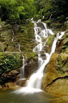
An upper part of Mukut Waterfalls, surrounded by rainforest; near Mukut village on Tioman Island, . 30 km east off peninsula Malaysia in South China Sea; June
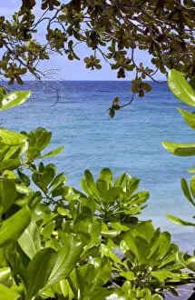
Sea at Tioman Island at high tide -seen through vegetation on a beach. 30 km east off peninsula Malaysia in South China Sea; June
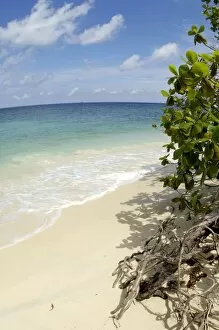
Sand beach of volcanic Tioman Island and sea at high tide - shadows of leaves and branches. 30 km east off peninsula Malaysia in South China Sea; a scene near small Bagus Place Retreat resort
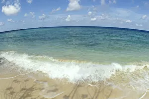
Sand beach of volcanic Tioman Island and sea at high tide. 30 km east off peninsula Malaysia in South China Sea; a scene near small Bagus Place Retreat resort; June
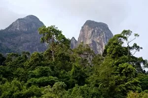
Rainforest on the slopes of Twin Peaks. Bukit Batu Sirau and Bukit Semukut peaks, of volcanic Tioman Island, 30 km east off peninsula Malaysia in South China Sea; evening in June
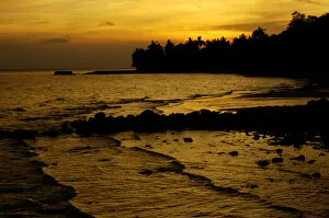
Sunset over a beach and rainforest on slopes of volcanic Tioman Island. 30 km east off peninsula Malaysia in South China Sea; a scene near small Bagus Place Retreat resort; June
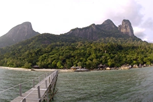
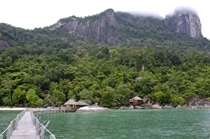
Rainforest, volcanic Twin Peaks - Bukit Batu Sirau and Bukit Semukut peaks, and the Gunung Kajang peak on the left, a jetty and a wooden cabins of the Bagus Place Retreat
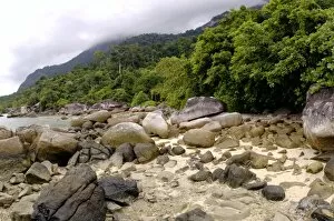
Boulders on sand beach and rainforest on slopes of volcanic Tioman Island. 30 km east off peninsula Malaysia in South China Sea. near small Bagus Place Retreat resort; June
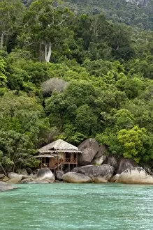
Rainforest and a wooden cabin of the Bagus Place Retreat - a small private resort. on the shore of volcanic Tioman Island (at high tide), 30 km east off peninsula Malaysia in South China Sea; June
Rainforest, a jetty and a wooden cabins of the Bagus Place Retreat - a small private resort, . on the shore of volcanic Tioman Island, 30 km east off peninsula Malaysia in South China Sea; June
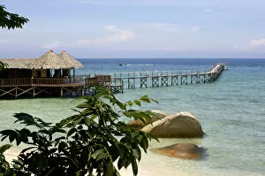
Sand beach, a bar and a jetty of the small Bagus Place Retreat resort on Tioman Island. 30 km east off peninsula Malaysia in South China Sea; June
Sand beach and rainforest on slopes of volcanic Tioman Island. 30 km east off peninsula Malaysia in South China Sea; a scene near small Bagus Place Retreat resort; June
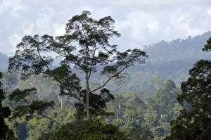
Primary rainforest on hill-slopes in river Danum conservation area. Sabah, Borneo, Malaysia; June
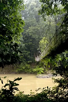
Sky Walk / Trail bridge / Suspension Bridge / canopy walkway - over river Danum in a rainy day. primary rainforest of river Danum Conservation Area, Sabah, Borneo, Malaysia; June
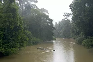
River Danum in the rain. primary rainforest near Borneo Rainforest Lodge, Sabah, Borneo, Malaysia; June
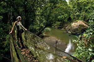
A visitor, accompanied by a quide, on a Sky Walk / Trail bridge / Suspension Bridge / canopy walkway over a small stream, surrounded by primary rainforest
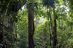
Rainforest and huge limestone rocks are typical in Sabang National Park. Palawan, Philippines - February
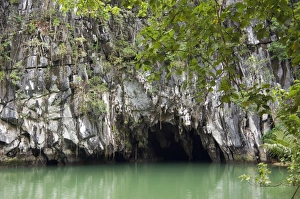
Entry to a cave that features a limestone karst mountain landscape with an 8.2 km. navigable underground river. 50 kilometers north of the city of Puerto Princesa, Palawan, Philippines. February
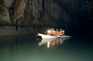
A group of tourists on a boat with a guide - inside the cave that features a limestone karst mountain landscape with an 8.2 km. navigable underground river
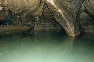
Limestone formations in the cave, that features a limestone karst mountain landscape with an 8.2 km. navigable underground river, supposedly the longest navigable underground river in the world