mail_outline sales@mediastorehouse.com
Antrim Coast Road at Glenarm - a view of the Coast road and the cliffs above. (Location: Northern Ireland; County Antrim; Glenarm). Date: circa early 1900s
Cliffs at Glenarm, Co. Antrim - a view of the Coast road and the cliffs beside it. (Location: Northern Ireland; County Antrim; Glenarm). Date: circa early 1900s
Causeway Cliffs at Port-Moon, Co. Antrim - a sea level view of the cliffs at Port-moon. (Location: Northern Ireland; County Antrim; Giants Causeway). Date: circa early 1900s
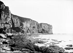
Larriban Cliffs, North Antrim - a sea level view of rocks and the cliffs in the distance. (Location: Northern Ireland; County Antrim; Carrick-a-Rede). Date: circa early 1900s
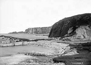
Larriban Cliffs and Carrick-A-Rede - a sea level view of rocks and the cliffs in the distance. (Location: Northern Ireland; County Antrim; Carrick-a-Rede). Date: circa early 1900s
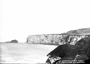
Larriban Cliffs from Coastguard Stn - a high level view of cliffs in the distance. (Location: Northern Ireland; County Antrim; Carrick-a-Rede). Date: circa early 1900s
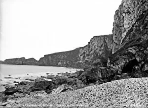
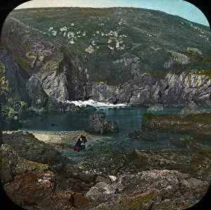
Larriban Cliffs and Ballintoy Harbour - a sea level view of rocks and the cliffs in the distance. (Location: Northern Ireland; County Antrim; Ballintoy). Date: circa early 1900s
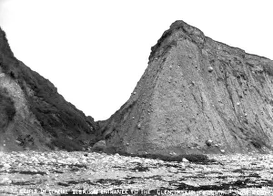
Cliffs of Glacial Debris at Entrance to the Glen, Kilkeel, Co. Down - a picture of rock debris and valley with two women there. (Location: Northern Ireland; County Down; Kilkeel)
Balscadden Bay, Co Dublin - a low view over a bay to cliffs. (Location: Republic of Ireland; County Dublin; Dublin). Date: circa early 1900s
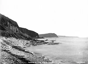
Antrim Cliffs from Larne - a sea level view along a rugged coastline. (Location: Northern Ireland; County Antrim; Larne). Date: circa early 1900s
Devils Bridge, Cliffs of Malen, Co. Donegal - a view of an unusual rock bridge formation. (Location: Republic of Ireland; County Donegal; Malin). Date: circa early 1900s
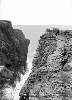
Hells Hole, Cliffs of Malen, Co. Donegal - a view of very steep cliffs and gap between. (Location: Republic of Ireland; County Donegal; Malin). Date: circa early 1900s
Skeildon Stack, Cliffs of Malen, Co. Donegal - an elevated view of a sea stack. (Location: Republic of Ireland; County Donegal; Malin). Date: circa early 1900s
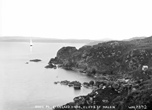
Doon Pt, Glengadd Head, Cliffs of Malen - an elevated view of a Headland and sea. (Location: Republic of Ireland; County Donegal; Malin). Date: circa early 1900s
Antrim Coast at Larne - a low view along the coast and cliffs. (Location: Northern Ireland; County Antrim; Larne). Date: circa early 1900s
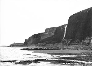
Downhill Cliffs - a low sea level view of the beach and cliffs. (Location: Northern Ireland; County Londonderry; Downhill td.). Date: circa early 1900s
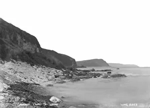
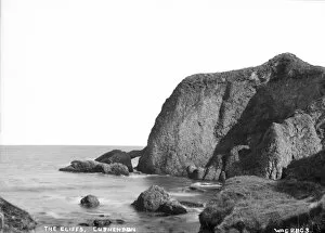
The Cliffs, Cushendun - a view of the rugged coastline. (Location: Northern Ireland; County Antrim; Cushendun). Date: circa early 1900s
The Cliff, Castlerock - a view of a rugged coastline and cliffs. (Location: Northern Ireland; County Londonderry; Castlerock). Date: circa early 1900s
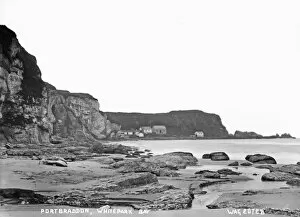
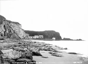
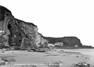
Portbraddon from Whitepark Bay - a low level view along the cliffs to Portbraddon. (Location: Northern Ireland; County Antrim; Portbraddon). Date: circa early 1900s
Portbraddon and Whitepark Bay, Co. Antrim - a low level view along the cliffs to Portbraddon. (Location: Northern Ireland; County Antrim; Portbraddon). Date: circa early 1900s
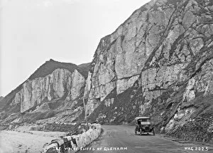
The White Cliffs of Glenarm - a view of the white cliffs on the coast road at Glenarm, with a motor car on the road. (Location: Northern Ireland; County Antrim; Glenarm). Date: circa early 1900s
On the Antrim Coast Road - a view of the coast road and cliffs on the left and people sitting on the sea wall on the right. (Location: Northern Ireland; County Antrim). Date: circa early 1900s
Cliffs and Arch, Cushendun - a view along the shoreline with a man for scale. (Location: Northern Ireland: County Antrim: Cushendun). Date: circa early 1900s
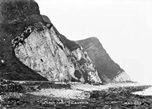
Garron Point, Co. Antrim - a view of the rugged cliffs and coast road at garron point, taken at sea level. (Location: Northern Ireland: County Antrim: Garron). Date: circa early 1900s
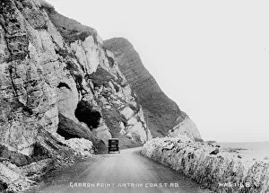
Garron Point, Antrim Coast Road - a view of the Antrim coast road with steep cliffs and a car on the road. (Location: Northern Ireland: County Antrim: Garron). Date: circa early 1900s
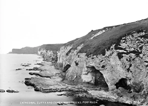
Cathedral Cliffs and Caves, Whiterocks, Portrush - a perspective view of eroded cliffs and caves. (Location: Northern Ireland: County Antrim: Portrush). Date: circa early 1900s
Glencar, Co Sligo - a scenic view along cliffs and lake. (Location: Republic of Ireland: County Sligo: Glencar). Date: circa early 1900s
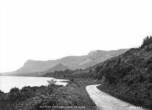
Glencar Lakes and Cliffs, Co Sligo - a scenic view along cliffs and lake with pathway to the right. (Location: Republic of Ireland: County Sligo: Glencar). Date: circa early 1900s
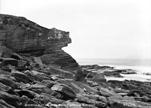
Undercut Cliff and Boulder Beach, West End, Bundoran - a view of cliffs and boulders. (Location: Republic of Ireland: County Donegal: Bundoran). Date: circa early 1900s
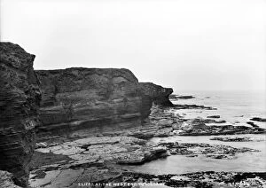
Cliffs at the West End, Bundoran - a view of cliffs. (Location: Republic of Ireland: County Donegal: Bundoran). Date: circa early 1900s
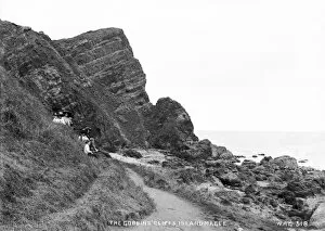
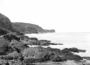
The Gobbins Cliffs, Islandmagee - same view as above but with people in the foreground. (Location: Northern Ireland: County Antrim: Islandmagee). Date: circa early 1900s
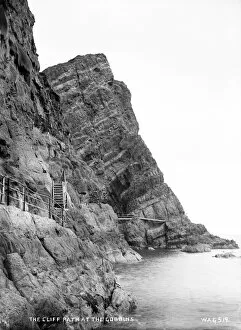
Cliff Path at the Gobbins - a view of the Gobbins cliffs and the path going around it. (Location: Northern Ireland: County Antrim: Islandmagee). Date: circa early 1900s
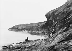
Brides Head from the Glen Strand, Wicklow - a view along cliffs with a man in the foreground for scale. (Location: Republic of Ireland: County Wicklow: Brides Head). Date: circa early 1900s
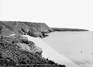
Silver Strand from the Cliffs, Wicklow - a panoramic and elevated view of the beach, with some people on it. (Location: Republic of Ireland: County Wicklow: Wicklow). Date: circa early 1900s
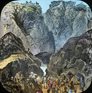
Mahdist War - Sudan Campaign - First coloumn at Gakdul Wells - Men and camels at lake among cliffs. Part of Box 244 Boswell Collection - Sudan War. Date: 1881 - 1889
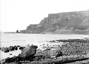
Port Noffer, Giants Causeway - a panoramic view of eroded cliffs taken from the beach. (Location: Northern Ireland: County Antrim: Bushmills). Date: circa early 1900s
The Channel Islands - Le Moye Point - Cliffs looking out to sea. Part of Box 234 Boswell Collection - The Channel Islands Date: circa 1900
The Channel Islands - Bay and Rocks - Pools, rocks, cliffs. Part of Box 234 Boswell Collection - The Channel Islands Date: circa 1900
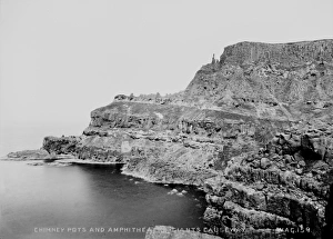
Chimney Pots and Amphitheatre, Giants Causeway - a view across water to eroded cliffs. (Location: Northern Ireland: County Antrim: Bushmills). Date: circa early 1900s
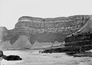
Port Na Spania, Giants Causeway - a low view across to very high cliffs. (Location: Northern Ireland: County Antrim: Bushmills). Date: circa early 1900s
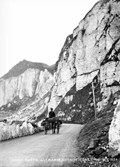
Chalk Cliffs, Glenarm, Antrim Coast Road - roadside cliffs with horse vehicle. (Location: Northern Ireland: County Antrim: Glenarm). Date: circa early 1900s
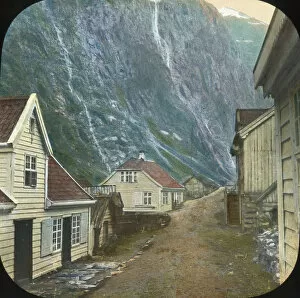
Western Norway - Sognefjord - Wooden buildings, road, high cliffs. Part of Box 185 Boswell Collection - Western Norway. Date: circa 1900
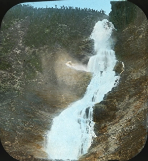
Western Norway - The Gjellfos - Waterfall dropping down between wooded cliffs. Part of Box 185 Boswell Collection - Western Norway. Date: circa 1900
Portbraddon and the White Cliffs of Whitepark Bay - a low level view showing the cliffs and Portbraddon in the distance. (Location: Northern Ireland; County Antrim; Portbraddon)
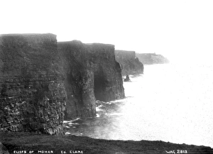
Cliffs of Moher, Co. Clare - a classical view of the famous cliffs, slightly misty. (Location: Republic of Ireland: County Clare: Moher). Date: circa early 1900s
The Gobbins from South - a view along the shore showing the cliffs. (Location: Northern Ireland; County Antrim; Gobbins). Date: circa early 1900s
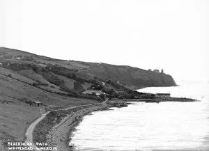
Blackhead Path, Whitehead - an elevated view of the path and cliffs at Blackhead. (Location: Northern Ireland; County Antrim; Whitehead). Date: circa early 1900s
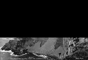
The Causeway Cliffs from the Chimney Pots - an elevated view looking down on the cliffs below. (Location: Northern Ireland: County Antrim: Bushmills). Date: circa early 1900s